193.84.74.8 - IP Lookup: Free IP Address Lookup, Postal Code Lookup, IP Location Lookup, IP ASN, Public IP
Country:
Region:
City:
Location:
Time Zone:
Postal Code:
IP information under different IP Channel
ip-api
Country
Region
City
ASN
Time Zone
ISP
Blacklist
Proxy
Latitude
Longitude
Postal
Route
Luminati
Country
Region
an
City
almunecar
ASN
Time Zone
Europe/Madrid
ISP
Radiocable Ingenieros S.l.
Latitude
Longitude
Postal
IPinfo
Country
Region
City
ASN
Time Zone
ISP
Blacklist
Proxy
Latitude
Longitude
Postal
Route
IP2Location
193.84.74.8Country
Region
andalucia
City
almunecar
Time Zone
Europe/Madrid
ISP
Language
User-Agent
Latitude
Longitude
Postal
db-ip
Country
Region
City
ASN
Time Zone
ISP
Blacklist
Proxy
Latitude
Longitude
Postal
Route
ipdata
Country
Region
City
ASN
Time Zone
ISP
Blacklist
Proxy
Latitude
Longitude
Postal
Route
Popular places and events near this IP address

Sexi (Phoenician colony)
Phoenician colony
Distance: Approx. 660 meters
Latitude and longitude: 36.73333333,-3.68333333
Sexi (Punic: 𐤑𐤊𐤑, ṢKṢ), also known as Ex, was a Phoenician colony at the present-day site of Almuñécar on southeastern Spain's Mediterranean coast. The Roman name for the place was Sexi Firmum Iulium. Alternative transcriptions of the Phoenician name of the city in Latin include Secks, Seks, Sex, Eks, Seksi and Sexsi.

Molvízar
Municipality in Andalusia, Spain
Distance: Approx. 9783 meters
Latitude and longitude: 36.78333333,-3.6
Molvízar is a small town and municipality located in the province of Granada, in Spain. Between 1905 and 2005, the population has ranged between 1500 and 3500 inhabitants. It is located in the foothills of the mountains of southern Spain, approximately five kilometres from the Costa Tropical coast.
Salobreña
Municipality in Andalucía, Spain
Distance: Approx. 9364 meters
Latitude and longitude: 36.74666667,-3.58694444
Salobreña (pronounced [saloˈβɾeɲa], < Phoenician Salambina Salawbiniya) is a town on the Costa Tropical in Granada, Spain. It claims a history stretching back 6,000 years. There are two main parts of Salobreña; The first is The Old Town which sits atop a rocky prominence and is a cluster of whitewashed houses and steep narrow streets leading up to a tenth-century Moorish castle, called 'Castillo de Salobreña' and it is one of its main tourist attractions.

Almuñécar
Municipality in Andalusia, Spain
Distance: Approx. 660 meters
Latitude and longitude: 36.73333333,-3.68333333
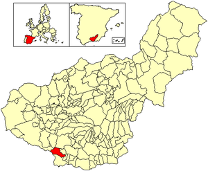
Almuñécar (Spanish pronunciation: [almuˈɲekaɾ]) is a Spanish city and municipality located in the southwestern part of the comarca of the Costa Granadina, in the province of Granada. It is located on the shores of the Mediterranean sea and borders the Granadin municipalities of Otívar, Jete, Ítrabo and Salobreña, and with the Malagueño municipality of Nerja. The Verde river runs through its territory.

Otívar
Village in Granada, Spain
Distance: Approx. 9237 meters
Latitude and longitude: 36.81666667,-3.68333333
Otívar is a municipality located at 267.80 metres above sea level in the Province of Granada, Spain. According to the 2004 census (INE), the village has a population of 1,113 inhabitants. Agriculture is Otívar's predominant economic activity (mainly tropical fruit) however, due to the dramatic scenery of the surrounding mountains, a number of northern Europeans have discovered its charms and either take rural holidays here, or in a few cases have settled here and integrated with the local population.

Jete, Granada
City in Granada, Spain
Distance: Approx. 7244 meters
Latitude and longitude: 36.7964,-3.66806
Jete is a municipality located in the province of Granada, Spain. According to the 2004 census (INE), the city has a population of 768 inhabitants.

Costa Granadina
Comarca in Andalusia, Spain
Distance: Approx. 8287 meters
Latitude and longitude: 36.75,-3.6
Costa Granadina (Spanish: [ˈkosta ɡɾanaˈðina]; "Granadan Coast") is a comarca in southern Spain, corresponding to the Mediterranean coastline of the province of Granada. It is also but less frequently called the Costa Tropical or Costa de Granada. It is crossed by the N-340 coastal highway that runs southwest–northeast along Spain's Mediterranean coast, to the border with France.

Ítrabo
Place in Andalusia, Spain
Distance: Approx. 8962 meters
Latitude and longitude: 36.8,-3.63333333
Ítrabo is a municipality in the province of Granada, Spain. As of 2010 Itrabo had a population of 1,152 inhabitants.

Castillo de Salobreña
Fortification in Granada, Spain
Distance: Approx. 9097 meters
Latitude and longitude: 36.74361111,-3.58944444
Castillo de Salobreña is located in Salobreña, in the province of Granada, Spain. The existence of a known fortification in Salobreña dates from the 10th century. The current structure which was built during the Nasrid dynasty.
Castle of San Miguel, Almuñécar
Castle in Granada, Spain
Distance: Approx. 377 meters
Latitude and longitude: 36.730833,-3.6925
Castillo de San Miguel is a castle located in Almuñécar, in the province of Granada, Spain. It is bounded by the remains of the original city walls. The castle sits on a small hill, which is difficult to access.

La Herradura
Seaside resort in Granada Province, Spain
Distance: Approx. 4201 meters
Latitude and longitude: 36.73472222,-3.73777778
La Herradura is a seaside resort on Spain's Costa Tropical, part of the borough of Almuñécar, in the province of Granada, Andalucía. It is on Granada's south-western coast, 70 kilometres east of Málaga.
Weather in this IP's area
clear sky
13 Celsius
12 Celsius
13 Celsius
13 Celsius
1018 hPa
67 %
1018 hPa
1002 hPa
10000 meters
6 m/s
7.45 m/s
331 degree
1 %

