193.84.74.242 - IP Lookup: Free IP Address Lookup, Postal Code Lookup, IP Location Lookup, IP ASN, Public IP
Country:
Region:
City:
Location:
Time Zone:
Postal Code:
ISP:
ASN:
language:
User-Agent:
Proxy IP:
Blacklist:
IP information under different IP Channel
ip-api
Country
Region
City
ASN
Time Zone
ISP
Blacklist
Proxy
Latitude
Longitude
Postal
Route
db-ip
Country
Region
City
ASN
Time Zone
ISP
Blacklist
Proxy
Latitude
Longitude
Postal
Route
IPinfo
Country
Region
City
ASN
Time Zone
ISP
Blacklist
Proxy
Latitude
Longitude
Postal
Route
IP2Location
193.84.74.242Country
Region
andalucia
City
motril
Time Zone
Europe/Madrid
ISP
Language
User-Agent
Latitude
Longitude
Postal
ipdata
Country
Region
City
ASN
Time Zone
ISP
Blacklist
Proxy
Latitude
Longitude
Postal
Route
Popular places and events near this IP address

Motril
Municipality in Andalusia, Spain
Distance: Approx. 128 meters
Latitude and longitude: 36.75,-3.51666667
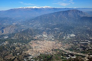
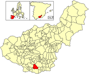
Motril (Spanish pronunciation: [moˈtɾil]) is a town and municipality of Spain belonging to the province of Granada, in the autonomous community of Andalusia. The main settlement is located a few kilometers inland, separated from the Port of Motril by the Guadalfeo delta. Motril is the second most populated municipality in the province, with 60,368 inhabitants as of 2016.

Molvízar
Municipality in Andalusia, Spain
Distance: Approx. 8181 meters
Latitude and longitude: 36.78333333,-3.6
Molvízar is a small town and municipality located in the province of Granada, in Spain. Between 1905 and 2005, the population has ranged between 1500 and 3500 inhabitants. It is located in the foothills of the mountains of southern Spain, approximately five kilometres from the Costa Tropical coast.
Salobreña
Municipality in Andalucía, Spain
Distance: Approx. 6184 meters
Latitude and longitude: 36.74666667,-3.58694444
Salobreña (pronounced [saloˈβɾeɲa], < Phoenician Salambina Salawbiniya) is a town on the Costa Tropical in Granada, Spain. It claims a history stretching back 6,000 years. There are two main parts of Salobreña; The first is The Old Town which sits atop a rocky prominence and is a cluster of whitewashed houses and steep narrow streets leading up to a tenth-century Moorish castle, called 'Castillo de Salobreña' and it is one of its main tourist attractions.

Estadio Escribano Castilla
Multi-purpose stadium, in Motril, Spain
Distance: Approx. 612 meters
Latitude and longitude: 36.75444167,-3.51277778
Estadio Municipal Escribano Castilla de Motril is a multi-purpose stadium in Motril, Spain, with a capacity of 4,400 people. It is used mostly for football matches, and is the home ground of CF Motril. On 24 November, 2011, a qualifying match for the UEFA Women's Euro 2013 between Spain and Germany was held in the stadium.

Vélez de Benaudalla
City in Granada, Spain
Distance: Approx. 9199 meters
Latitude and longitude: 36.83333333,-3.51666667
Vélez de Benaudalla is a municipality in the province of Granada, Spain. According to the 2008 census (INE), the city has a population of 2,980 inhabitants. The municipality includes the hamlet of La Gorgoracha, about 5 km (3.1 mi) south of the municipal center, towards the town of Motril.

Costa Granadina
Comarca in Andalusia, Spain
Distance: Approx. 7332 meters
Latitude and longitude: 36.75,-3.6
Costa Granadina (Spanish: [ˈkosta ɡɾanaˈðina]; "Granadan Coast") is a comarca in southern Spain, corresponding to the Mediterranean coastline of the province of Granada. It is also but less frequently called the Costa Tropical or Costa de Granada. It is crossed by the N-340 coastal highway that runs southwest–northeast along Spain's Mediterranean coast, to the border with France.

Castillo de Salobreña
Fortification in Granada, Spain
Distance: Approx. 6439 meters
Latitude and longitude: 36.74361111,-3.58944444
Castillo de Salobreña is located in Salobreña, in the province of Granada, Spain. The existence of a known fortification in Salobreña dates from the 10th century. The current structure which was built during the Nasrid dynasty.
Torrenueva Costa
Municipality in Andalusia, Spain
Distance: Approx. 6137 meters
Latitude and longitude: 36.7019,-3.4858
Torrenueva Costa is a newly-created (2018) Spanish Municipality in the province of Granada and in the autonomous community Andalucía. It is located in the central part of the region of the Granada coast, and was formerly part of the municipality of Motril, from which it was constitutionally separated on 2 October 2018. Beside this locality are found the centres of El Varadero, La Chucha and Carchuna.
Port of Motril
Spanish port located at Motril (Granada)
Distance: Approx. 3660 meters
Latitude and longitude: 36.71833333,-3.525
The Port of Motril–Granada or simply, the port of Motril, is a passenger and cargo port in Motril, Spain. It is one of the Puertos de Interés General del Estado ("ports of General Interest of the State").

Maruja García Beach
Beach in Andalusia, Spain
Distance: Approx. 4370 meters
Latitude and longitude: 36.71333333,-3.50277778
Maruja García beach, commonly called Playa Maruja, is located in the Spanish municipalities of Motril and Torrenueva Costa, in the province of Granada, autonomous community of Andalusia. With a width of about 15 meters, it is a dark sand beach that runs along 300 m of coastline between the Port of Motril and Torrenueva Costa. It is located between Playa del Cañón and Playa de La Chincheta.
Weather in this IP's area
overcast clouds
20 Celsius
19 Celsius
20 Celsius
20 Celsius
1015 hPa
44 %
1015 hPa
987 hPa
10000 meters
2.27 m/s
2.28 m/s
347 degree
100 %

