193.84.69.74 - IP Lookup: Free IP Address Lookup, Postal Code Lookup, IP Location Lookup, IP ASN, Public IP
Country:
Region:
City:
Location:
Time Zone:
Postal Code:
ISP:
ASN:
language:
User-Agent:
Proxy IP:
Blacklist:
IP information under different IP Channel
ip-api
Country
Region
City
ASN
Time Zone
ISP
Blacklist
Proxy
Latitude
Longitude
Postal
Route
db-ip
Country
Region
City
ASN
Time Zone
ISP
Blacklist
Proxy
Latitude
Longitude
Postal
Route
IPinfo
Country
Region
City
ASN
Time Zone
ISP
Blacklist
Proxy
Latitude
Longitude
Postal
Route
IP2Location
193.84.69.74Country
Region
olt
City
caracal
Time Zone
Europe/Bucharest
ISP
Language
User-Agent
Latitude
Longitude
Postal
ipdata
Country
Region
City
ASN
Time Zone
ISP
Blacklist
Proxy
Latitude
Longitude
Postal
Route
Popular places and events near this IP address

Caracal, Romania
Municipality in Olt, Romania
Distance: Approx. 518 meters
Latitude and longitude: 44.1125,24.34722222
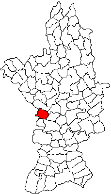
Caracal (Romanian pronunciation: [kaˈrakal] ) is a city in Olt County, Romania, situated in the historic region of Oltenia, on the plains between the lower reaches of the Jiu and Olt rivers. The region's plains are well known for their agricultural specialty in cultivating grains and over the centuries, Caracal has been the trading center for the region's agricultural output. Caracal has a population of 27,403 and is the second largest city in the region.

Dobrosloveni
Commune in Olt, Romania
Distance: Approx. 7536 meters
Latitude and longitude: 44.18333333,24.36666667
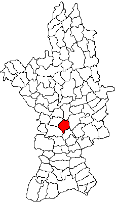
Dobrosloveni is a commune in Olt County, Oltenia, Romania. It is composed of five villages: Dobrosloveni, Frăsinetu, Potopinu, Reșca and Reșcuța. According to the 2002 census, it had a population of 3,909, of which 99% were ethnic Romanians.
Potopin
River in Olt County, Romania
Distance: Approx. 7500 meters
Latitude and longitude: 44.1726,24.4024
The Potopin is a left tributary of the river Teslui in Romania. It flows into the Teslui in Reșcuța. Its length is 23 km (14 mi) and its basin size is 43 km2 (17 sq mi).
Frăsinet (river)
River in Olt County, Romania
Distance: Approx. 5937 meters
Latitude and longitude: 44.1699,24.3552
The Frăsinet is a right tributary of the river Teslui in Romania. It flows into the Teslui in Dobrosloveni. Its length is 24 km (15 mi) and its basin size is 72 km2 (28 sq mi).
Teslui (river)
River in Olt, Romania
Distance: Approx. 9469 meters
Latitude and longitude: 44.1402,24.4639
The Teslui is a right tributary of the river Olt in Romania. It discharges into the Olt in Fărcașele. Its length is 110 km (68 mi) and its basin size is 569 km2 (220 sq mi).

Cezieni
Commune in Olt, Romania
Distance: Approx. 9966 meters
Latitude and longitude: 44.18333333,24.26666667
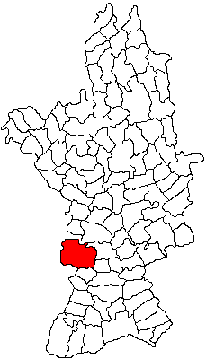
Cezieni is a commune in Olt County, Oltenia, Romania. It is composed of three villages: Bondrea, Cezieni and Corlătești.

Deveselu
Commune in Olt, Romania
Distance: Approx. 7889 meters
Latitude and longitude: 44.05,24.38333333
Deveselu (Romanian pronunciation: [deveˈselu]) is a commune in Olt County, Oltenia, Romania. It is composed of two villages, Comanca and Deveselu.

Redea
Commune in Olt, Romania
Distance: Approx. 6856 meters
Latitude and longitude: 44.06666667,24.3
Redea is a commune in Olt County, Oltenia, Romania. It is composed of three villages: Redea, Redișoara and Valea Soarelui.

Fărcașele
Commune in Olt, Romania
Distance: Approx. 7856 meters
Latitude and longitude: 44.1473,24.4386
Fărcașele is a commune in Olt County, Oltenia, Romania. It is composed of four villages: Fărcașele, Fărcașu de Jos, Ghimpați and Hotărani.

Drăghiceni
Commune in Olt, Romania
Distance: Approx. 8202 meters
Latitude and longitude: 44.13333333,24.25
Drăghiceni is a commune in Olt County, Oltenia, Romania. It is composed of three villages: Drăghiceni, Grozăvești, and Liiceni.

Ioniță Asan National College
Romanian College from Caracal
Distance: Approx. 329 meters
Latitude and longitude: 44.1174,24.354
Ioniță Asan National College (Romanian: Colegiul Național Ioniță Asan) is a high school located at 39 Nicolae Titulescu Boulevard, Caracal, Romania. For some years, the citizens of Caracal had demanded a gymnasium in their town, and, with the approval of Education Minister Titu Maiorescu, one opened in the autumn of 1888. It was dedicated to Ivan Asen I of Bulgaria.

Deveselu Military Base
Romanian NATO base
Distance: Approx. 6605 meters
Latitude and longitude: 44.07866667,24.41341667
The 99th Military Base Deveselu (Baza Militară 99 Deveselu), or the Deveselu Military Base, is a Romanian NATO base hosting the United States Navy Aegis Ashore Ballistic Missile Defense System. The base consists of three military units: The Romanian 99th Military Base, which hosts two American bases: the Naval Support Facility Deveselu and the Aegis Ashore Defense System Romania. Located in Deveselu commune, Olt County, the base has an area of 900 ha (2,200 acres); of those, 170 ha (420 acres) are used by the U.S. forces.
Weather in this IP's area
overcast clouds
9 Celsius
8 Celsius
9 Celsius
9 Celsius
1018 hPa
66 %
1018 hPa
1005 hPa
10000 meters
1.85 m/s
1.86 m/s
80 degree
100 %