Country:
Region:
City:
Latitude and Longitude:
Time Zone:
Postal Code:
IP information under different IP Channel
ip-api
Country
Region
City
ASN
Time Zone
ISP
Blacklist
Proxy
Latitude
Longitude
Postal
Route
Luminati
Country
Region
zh
City
zurich
ASN
Time Zone
Europe/Zurich
ISP
Migros-Genossenschafts-Bund
Latitude
Longitude
Postal
IPinfo
Country
Region
City
ASN
Time Zone
ISP
Blacklist
Proxy
Latitude
Longitude
Postal
Route
db-ip
Country
Region
City
ASN
Time Zone
ISP
Blacklist
Proxy
Latitude
Longitude
Postal
Route
ipdata
Country
Region
City
ASN
Time Zone
ISP
Blacklist
Proxy
Latitude
Longitude
Postal
Route
Popular places and events near this IP address

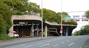
Milchbuck Tunnel
Tunnel in Zurich, Switzerland
Distance: Approx. 407 meters
Latitude and longitude: 47.3853,8.5369
The Milchbuck Tunnel is a motor road tunnel in Switzerland, and forms part of the A1L motorway from Zürich Schwamendingen to Zürich Letten, where the tunnel's southern portal lies on Wasserwerkstrasse, which leads into central Zürich. Constructed in 1978, the tunnel is 1,910 metres (6,270 ft) in length. A proposed second tunnel bore (to create two separate tunnels for two directions of traffic) was turned down.

Sihl
River in Switzerland
Distance: Approx. 604 meters
Latitude and longitude: 47.3826,8.5382
The Sihl is a Swiss river that rises near the Druesberg mountain in the canton of Schwyz, and eventually flows into the Limmat in the centre of the city of Zürich, after crossing the Zürich–Winterthur railway at Zürich HB. It has a length of 73 km (45 mi), including the Sihlsee reservoir, through which the river flows. Water is abstracted from the river at the Sihlsee, leading to decreased downstream water flows and a consequent reduction in water quality. The river flows through, or along the border of, the cantons of Schwyz, Zürich and Zug.

Museum of Design, Zurich
Museum in Zurich (Switzerland)
Distance: Approx. 480 meters
Latitude and longitude: 47.382798,8.536366
The Museum of Design, Zürich (German: Museum für Gestaltung Zürich) is a museum for industrial design, visual communication, architecture, and craft in Zurich, Switzerland.

Gewerbeschule (Zürich)
Quarter in the fifth district of Zürich, Switzerland
Distance: Approx. 104 meters
Latitude and longitude: 47.38467778,8.53174444
Gewerbeschule is a quarter in the district 5 in Zürich. The district Gewerbeschule (upper district 5, there are located several Business schools) formed the formerly separate municipality of Aussersihl, which was incorporated into Zürich in 1893. The separation into the current districts 3, 4 and 5 dates to 1913.
Zurich District
District in Switzerland
Distance: Approx. 287 meters
Latitude and longitude: 47.38333333,8.53333333
Zurich District is a district (German: Bezirk) of the Swiss canton of Zurich in Switzerland.

A.V. Turicia
Swiss student association
Distance: Approx. 536 meters
Latitude and longitude: 47.38527778,8.53861111
AV Turicia is a color-bearing student society in Zürich. It was founded in 1860. It is a section of the Swiss Student Association and a member of the "Federation of Student Komment Societies" (also known as "Block").
Institute for Mathematical Research
Distance: Approx. 223 meters
Latitude and longitude: 47.3863169,8.5287591
The Institute for Mathematical Research (Forschungsinstitut für Mathematik, FIM) is a mathematical research institution located at ETH Zurich and founded in 1964 by Beno Eckmann. Its main goals are to promote and facilitate the exchange between ETH Zurich and international leading mathematicians. The Institute offers a platform on which contacts of lasting values between faculty members of the Department of Mathematics of ETH, graduate students, members of the Swiss mathematical community at large and international researchers can be established.

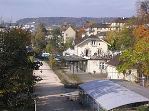
Zurich Letten railway station
Former rail station in Zurich, Switzerland
Distance: Approx. 228 meters
Latitude and longitude: 47.387164,8.533475
Zurich Letten (German: Bahnhof Zürich Letten) is a former railway station in the Swiss city of Zurich. It is situated on the old route of the Lake Zurich right bank railway (Rechtsufrige Zürichseebahn) from Zürich HB to Rapperswil via Tiefenbrunnen. Radical changes to the local railway geography in conjunction with the opening of the Zurich S-Bahn system led to the closure of the station in 1989, but the station building still exists, and the trackbed and viaducts are used as a pedestrian path/cycling route.
Autonomous School Zurich
Distance: Approx. 215 meters
Latitude and longitude: 47.384742,8.534069
Autonomous School Zurich (ASZ, Autonome Schule Zürich in German) is a grassroot project in Switzerland. This school is run by immigrants as well as Swiss locals. Since 2009 the association "Bildung für Alle" provides education for all under the shelter of the Autonomous School Zurich.

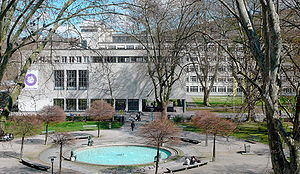
Zurich University of the Arts
Art school in Zürich, Switzerland
Distance: Approx. 437 meters
Latitude and longitude: 47.38277778,8.53555556
Zurich University of the Arts (ZHdK, German: Zürcher Hochschule der Künste) has approximately 2,500 students, which makes it the largest arts university in Switzerland. The university was established in 2007, following the merger between Zurich's School of Art and Design (HGKZ) and the School of Music, Drama, and Dance (HMT). ZHdK is one of four universities affiliated with Zürcher Fachhochschule.

Letten Tunnel
Former railway tunnel in Zurich
Distance: Approx. 584 meters
Latitude and longitude: 47.3838,8.5388
The Letten Tunnel (German: Lettentunnel) was a railway tunnel in the Swiss city of Zurich. It formed part of the old route of the Lake Zurich right bank railway (Rechtsufrige Zürichseebahn) from Zürich Hauptbahnhof railway station to Rapperswil station. Radical changes to the local railway geography led to the tunnel being disused in 1989, tracks removed by 2002, and finally filled in from 2002-2004 due to its poor condition.
Swissmill Tower
Tall grain silo in Zürich, Switzerland
Distance: Approx. 559 meters
Latitude and longitude: 47.389628,8.527086
The Swissmill Tower, also known as Kornhaus, is the tallest operating grain elevator in the world. Standing at 118 metres (387 ft), it is the second-tallest building in the Swiss city of Zürich.
Weather in this IP's area
overcast clouds
8 Celsius
8 Celsius
7 Celsius
9 Celsius
1024 hPa
92 %
1024 hPa
974 hPa
5000 meters
1.03 m/s
100 %
07:21:51
16:57:41
