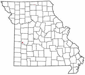
Country:
 USA
USARegion:
City:
Latitude and Longitude:
Time Zone:
Postal Code:
IP information under different IP Channel
ip-api
Country
Region
City
ASN
Time Zone
ISP
Blacklist
Proxy
Latitude
Longitude
Postal
Route
IPinfo
Country
Region
City
ASN
Time Zone
ISP
Blacklist
Proxy
Latitude
Longitude
Postal
Route
MaxMind
Country
Region
City
ASN
Time Zone
ISP
Blacklist
Proxy
Latitude
Longitude
Postal
Route
Luminati
Country
 CH
CHASN
Time Zone
Europe/Zurich
ISP
green.ch AG
Latitude
Longitude
Postal
db-ip
Country
Region
City
ASN
Time Zone
ISP
Blacklist
Proxy
Latitude
Longitude
Postal
Route
ipdata
Country
Region
City
ASN
Time Zone
ISP
Blacklist
Proxy
Latitude
Longitude
Postal
Route
Popular places and events near this IP address

Rockville, Missouri
City in Missouri, United States
Distance: Approx. 4524 meters
Latitude and longitude: 38.07055556,-94.08027778
Rockville is a city in Bates County, Missouri, and is part of the Kansas City metropolitan area within the United States. The population was 135 at the 2020 census.

Schell City, Missouri
City in Missouri, United States
Distance: Approx. 2685 meters
Latitude and longitude: 38.01916667,-94.11666667
Schell City is a city in northeast Vernon County, Missouri, United States. The population was 249 at the 2010 census.
Taberville, Missouri
Unincorporated community in the American state of Missouri
Distance: Approx. 8690 meters
Latitude and longitude: 38.00833333,-93.99472222
Taberville is an unincorporated community in southwestern St. Clair County, Missouri, United States. It is located approximately sixteen miles west of Osceola, situated on the north side of the Osage River.

Rockville Township, Bates County, Missouri
Township in Missouri, United States
Distance: Approx. 4698 meters
Latitude and longitude: 38.07277778,-94.08777778
Rockville Township is one of twenty-four townships in Bates County, Missouri, and is part of the Kansas City metropolitan area within the USA. As of the 2000 census, its population was 271. Rockville Township was established in 1872, taking its name from Rockville, Missouri.
Bacon Township, Vernon County, Missouri
Inactive township in the U.S. state of Missouri
Distance: Approx. 5329 meters
Latitude and longitude: 37.98861111,-94.11888889
Bacon Township is a township in Vernon County, in the U.S. state of Missouri. Bacon Township was erected in 1856, taking its name from James Bacon, a pioneer citizen.
Prairie City, Missouri
Unincorporated community in Missouri, U.S.
Distance: Approx. 9187 meters
Latitude and longitude: 38.07892,-94.17467
Prairie City is an unincorporated community in southeast Bates County, in the U.S. state of Missouri. The community is approximately 11.5 miles east of Rich Hill via Missouri routes B and D. The Harry S Truman Reservoir is adjacent to the south.
Panther Creek (Osage River tributary)
Stream in the American state of Missouri
Distance: Approx. 2269 meters
Latitude and longitude: 38.04805556,-94.10305556
Panther Creek is a stream in Bates and Henry counties of west central Missouri. It is a tributary of Osage River. The stream headwaters are located at 38°13′22″N 94°03′06″W and the confluence with the Osage is at 38°02′53″N 94°06′11″W. Panther Creek was named for the animal.
Shaw Branch (Osage River tributary)
Stream in the American state of Missouri
Distance: Approx. 6639 meters
Latitude and longitude: 38.057253,-94.157446
Shaw Branch is a stream in Bates County in the U.S. state of Missouri. It is a tributary of the Osage River. Shaw Branch has the name of William Shaw, an early settler.
Fair Haven, Missouri
Unincorporated community in Missouri, U.S.
Distance: Approx. 9499 meters
Latitude and longitude: 37.97638889,-94.17333333
Fair Haven is an unincorporated community in Vernon County, in the U.S. state of Missouri.
Ladies Branch
Stream in the American state of Missouri
Distance: Approx. 9191 meters
Latitude and longitude: 38.034754,-94.194391
Ladies Branch is a stream in Vernon County in the U.S. state of Missouri. It is a tributary of the Osage River. Ladies Branch, historically called Lady Branch, has the name of Wilton Lady, a pioneer citizen.
McKenzie Creek (Osage River tributary)
Stream in the American state of Missouri
Distance: Approx. 5297 meters
Latitude and longitude: 38.056697,-94.140223
McKenzie Creek is a stream in Vernon County in the U.S. state of Missouri. It is a tributary of Osage River. Historically called "McKenzie's Branch," the creek is named after Nelson G. McKenzie, an early settler of the area.
Miller Branch
Stream in Vernon County, Missouri
Distance: Approx. 516 meters
Latitude and longitude: 38.0351625,-94.0886677
Miller Branch is a stream in Vernon County in the U.S. state of Missouri. It is a tributary of the Osage River. Miller Branch has the name of a pioneer citizen.
Weather in this IP's area
clear sky
8 Celsius
5 Celsius
8 Celsius
11 Celsius
1027 hPa
49 %
1027 hPa
1000 hPa
10000 meters
4.99 m/s
10.07 m/s
171 degree
07:28:11
18:34:17