Country:
 Switzerland
Region:
City:
Latitude and Longitude:
Time Zone:
Postal Code:
IP information under different IP Channel
ip-api
Country
Region
City
ASN
Time Zone
ISP
Blacklist
Proxy
Latitude
Longitude
Postal
Route
IPinfo
Country
Region
City
ASN
Time Zone
ISP
Blacklist
Proxy
Latitude
Longitude
Postal
Route
MaxMind
Country
Region
City
ASN
Time Zone
ISP
Blacklist
Proxy
Latitude
Longitude
Postal
Route
Luminati
Country
CHASN
Time Zone
Europe/Zurich
ISP
green.ch AG
Latitude
Longitude
Postal
db-ip
Country
Region
City
ASN
Time Zone
ISP
Blacklist
Proxy
Latitude
Longitude
Postal
Route
ipdata
Country
Region
City
ASN
Time Zone
ISP
Blacklist
Proxy
Latitude
Longitude
Postal
Route
Popular places and events near this IP address
Aarau District
District in Switzerland
Distance: Approx. 3050 meters
Latitude and longitude: 47.38333333,8.03333333
Aarau District is a district in the Swiss Canton of Aargau with administrative capital Aarau encompasses the agglomeration of Aarau south of the Juras.

Stadion Brügglifeld
Distance: Approx. 2824 meters
Latitude and longitude: 47.38333333,8.06
Stadion Brügglifeld is a multi-purpose stadium in Aarau, Switzerland. It is primarily used for football matches and is the home stadium of FC Aarau. The current capacity is 9,249 seats, which include 1499 covered seats.
Muhen
Municipality in Aargau, Switzerland
Distance: Approx. 2825 meters
Latitude and longitude: 47.33333333,8.05
Muhen is a municipality in the district of Aarau of the canton of Aargau in Switzerland.

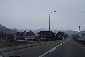
Oberentfelden
Municipality in Aargau, Switzerland
Distance: Approx. 890 meters
Latitude and longitude: 47.36666667,8.05
Oberentfelden is a municipality in the district of Aarau of the canton of Aargau in Switzerland.

Suhr, Aargau
Municipality in Aargau, Switzerland
Distance: Approx. 2590 meters
Latitude and longitude: 47.36666667,8.08333333
Suhr is a municipality in the district of Aarau of the canton of Aargau in Switzerland.
Unterentfelden
Municipality in Aargau, Switzerland
Distance: Approx. 1604 meters
Latitude and longitude: 47.36666667,8.03333333
Unterentfelden is a municipality in the district of Aarau of the Canton of Aargau in Switzerland.

Eppenberg-Wöschnau
Municipality in Solothurn, Switzerland
Distance: Approx. 3050 meters
Latitude and longitude: 47.38333333,8.03333333
Eppenberg-Wöschnau is a municipality in the district of Olten in the canton of Solothurn in Switzerland.

Aarau WSB railway station
Railway station in Switzerland
Distance: Approx. 3595 meters
Latitude and longitude: 47.39097222,8.05269444
Aarau WSB railway station (German: Bahnhof Aarau WSB) is a railway station in the municipality of Aarau, the capital city of the Swiss canton of Aargau. It is the principal intermediate point on the 1,000 mm (3 ft 3+3⁄8 in) gauge Schöftland–Aarau–Menziken line of Aargau Verkehr. The station is the main point of transfer to the Swiss Federal Railways (SBB) lines, and is situated across Hintere Bahnhofstrasse from the south side of the SBB station.

Suhr railway station
Railway station in Switzerland
Distance: Approx. 2758 meters
Latitude and longitude: 47.37162806,8.08227111
Suhr railway station (German: Bahnhof Suhr) is a railway station in the municipality of Suhr, in the Swiss canton of Aargau. It is located at the intersection of the standard gauge Zofingen–Wettingen line of Swiss Federal Railways (SBB) and the 1,000 mm (3 ft 3+3⁄8 in) gauge Schöftland–Aarau–Menziken line of Aargau Verkehr.

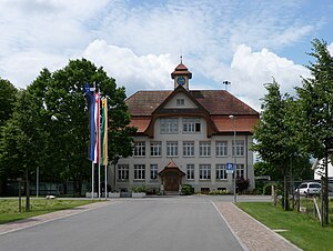
Oberentfelden railway station
Railway station in Switzerland
Distance: Approx. 320 meters
Latitude and longitude: 47.35648056,8.04836944
Oberentfelden railway station (German: Bahnhof Oberentfelden) is a railway station in the municipality of Oberentfelden, in the Swiss canton of Aargau. It is an intermediate stop on the standard gauge Zofingen–Wettingen line of Swiss Federal Railways. The station is located some 180 metres (590 ft) from Oberentfelden Engelplatz on the 1,000 mm (3 ft 3+3⁄8 in) gauge Aarau–Schöftland line of Aargau Verkehr.

Kölliken railway station
Railway station in Switzerland
Distance: Approx. 3021 meters
Latitude and longitude: 47.33728806,8.02644194
Kölliken railway station (German: Bahnhof Kölliken) is a railway station in the municipality of Kölliken, in the Swiss canton of Aargau. It is an intermediate stop on the standard gauge Zofingen–Wettingen line of Swiss Federal Railways.

Aargauer Kunsthaus
Swiss art museum and natural history museum
Distance: Approx. 3622 meters
Latitude and longitude: 47.390965,8.044816
The Aargauer Kunsthaus (English: Aargau Art House) is a Swiss art museum founded in 1959, and located in Aarau. The museum collection includes Swiss art from the 18th century to the present day; and Naturama, a natural history collection.
Weather in this IP's area
overcast clouds
18 Celsius
18 Celsius
17 Celsius
19 Celsius
1014 hPa
94 %
1014 hPa
966 hPa
10000 meters
0.89 m/s
1.79 m/s
281 degree
95 %
06:56:26
19:54:42