Country:
Region:
City:
Latitude and Longitude:
Time Zone:
Postal Code:
IP information under different IP Channel
ip-api
Country
Region
City
ASN
Time Zone
ISP
Blacklist
Proxy
Latitude
Longitude
Postal
Route
Luminati
Country
ASN
Time Zone
Europe/Zurich
ISP
green.ch AG
Latitude
Longitude
Postal
IPinfo
Country
Region
City
ASN
Time Zone
ISP
Blacklist
Proxy
Latitude
Longitude
Postal
Route
db-ip
Country
Region
City
ASN
Time Zone
ISP
Blacklist
Proxy
Latitude
Longitude
Postal
Route
ipdata
Country
Region
City
ASN
Time Zone
ISP
Blacklist
Proxy
Latitude
Longitude
Postal
Route
Popular places and events near this IP address

Habsburg, Switzerland
Municipality in Aargau, Switzerland
Distance: Approx. 3056 meters
Latitude and longitude: 47.46666667,8.18333333
Habsburg (High Alemannic: Hapschberg) is a municipality in the district of Brugg in canton of Aargau in Switzerland. It lies about three kilometres southwest of the town of Brugg, the capital of the district of Brugg. Habsburg is named after Habsburg Castle, built around 1020–1030 for Count Radbot of the nearby county of Klettgau in the Duchy of Swabia, which Habsburg was also a part of at the time.
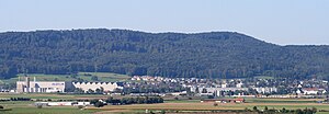
Birr, Aargau
Municipality in Aargau, Switzerland
Distance: Approx. 1664 meters
Latitude and longitude: 47.43333333,8.2
Birr is a municipality in the Swiss canton of Aargau and the capital of Brugg (district). The village lies halfway between Lenzburg and Brugg. Birr has grown with its neighbour Lupfig into a conurbation.

Habsburg Castle
Castle in Aargau, Switzerland
Distance: Approx. 2881 meters
Latitude and longitude: 47.46273889,8.18103889
Habsburg Castle (German: Schloss Habsburg, pronounced [ˌʃlɔs ˈhaːpsbʊʁk] ) is a medieval fortress located in what is now Habsburg, Switzerland, in the canton of Aargau, near the Aar River. At the time of its construction, the location was part of the Duchy of Swabia. Habsburg Castle is the original seat of the House of Habsburg, which became one of the leading imperial and royal dynasties in Europe.
Battle of Vindonissa
Battle between Roman and Alemanni forces (298/302)
Distance: Approx. 2300 meters
Latitude and longitude: 47.46666694,8.21666694
The Battle of Vindonissa was fought in 298 or 302 between the Imperial Roman army, led by Emperor Constantius Chlorus, and the Alemanni. The Romans won the battle, fought in Vindonissa, strengthening Rome's defenses along the Rhine.

Hausen AG
Municipality in Aargau, Switzerland
Distance: Approx. 2300 meters
Latitude and longitude: 47.46666667,8.21666667
Hausen (prior to 2003: Hausen bei Brugg) is a municipality in the district of Brugg in canton of Aargau in Switzerland.
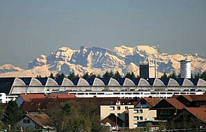
Lupfig
Municipality in Aargau, Switzerland
Distance: Approx. 902 meters
Latitude and longitude: 47.45,8.2
Lupfig is a municipality in the district of Brugg in canton of Aargau in Switzerland. On 1 January 2018 the former municipality of Scherz merged into the municipality of Lupfig.
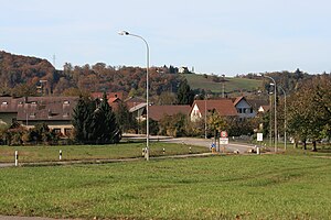
Mülligen
Municipality in Aargau, Switzerland
Distance: Approx. 2826 meters
Latitude and longitude: 47.46666667,8.23333333
Mülligen is a municipality in the district of Brugg in canton of Aargau in Switzerland.

Scherz
Former municipality in Aargau, Switzerland
Distance: Approx. 2101 meters
Latitude and longitude: 47.45,8.18333333
Scherz is a former municipality in the district of Brugg in canton of Aargau in Switzerland. On 1 January 2018 the former municipality of Scherz merged into the municipality of Lupfig.
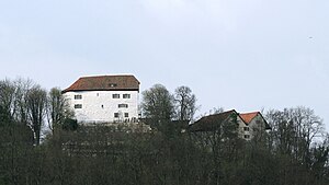
Brunegg Castle
Distance: Approx. 2713 meters
Latitude and longitude: 47.42216111,8.21448889
Brunegg castle (German: Schloss Brunegg) is a castle in the municipality of Brunegg in the canton of Aargau in Switzerland. The castle was built on a hill at the edge of the Jura mountains in the 13th century. This castle was probably built, together with Wildegg castle in nearby Wildegg, as part of the Habsburg border defenses.

Birr railway station
Railway station in Switzerland
Distance: Approx. 1286 meters
Latitude and longitude: 47.43584,8.21764889
Birr railway station (German: Bahnhof Birr) is a railway station in the municipality of Birr, in the Swiss canton of Aargau. It is an intermediate stop on the standard gauge Brugg–Hendschiken line of Swiss Federal Railways.
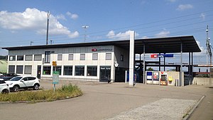
Lupfig railway station
Railway station in Switzerland
Distance: Approx. 348 meters
Latitude and longitude: 47.44519444,8.215
Lupfig railway station (German: Bahnhof Lupfig) is a railway station in the municipality of Lupfig, in the Swiss canton of Aargau. It is an intermediate stop on the standard gauge Brugg–Hendschiken line of Swiss Federal Railways. The station was built in 1994 and replaced Birrfeld railway station, 300 m away.

Schinznach Bad railway station
Railway station in Switzerland
Distance: Approx. 3134 meters
Latitude and longitude: 47.45222222,8.17
Schinznach Bad railway station (German: Bahnhof Schinznach Bad) is a railway station in the municipality of Schinznach-Bad, in the Swiss canton of Aargau. It is an intermediate stop on the standard gauge Baden–Aarau line of Swiss Federal Railways.
Weather in this IP's area
broken clouds
12 Celsius
12 Celsius
10 Celsius
14 Celsius
1027 hPa
98 %
1027 hPa
980 hPa
10000 meters
1.18 m/s
1.51 m/s
68 degree
63 %
07:14:10
17:07:12