Country:
Region:
City:
Latitude and Longitude:
Time Zone:
Postal Code:
IP information under different IP Channel
ip-api
Country
Region
City
ASN
Time Zone
ISP
Blacklist
Proxy
Latitude
Longitude
Postal
Route
Luminati
Country
Region
12
City
zagorze
ASN
Time Zone
Europe/Warsaw
ISP
Bajtnet Spolka Z Ograniczona Odpowiedzialnoscia
Latitude
Longitude
Postal
IPinfo
Country
Region
City
ASN
Time Zone
ISP
Blacklist
Proxy
Latitude
Longitude
Postal
Route
db-ip
Country
Region
City
ASN
Time Zone
ISP
Blacklist
Proxy
Latitude
Longitude
Postal
Route
ipdata
Country
Region
City
ASN
Time Zone
ISP
Blacklist
Proxy
Latitude
Longitude
Postal
Route
Popular places and events near this IP address
Battle of Grotniki
Final battle of the Hussite Wars
Distance: Approx. 638 meters
Latitude and longitude: 50.30277778,20.81055556
The Battle of Grotniki took place either on 4 or 6 May 1439 in the vicinity of Grotniki Duże, a village near Nowy Korczyn, currently in Świętokrzyskie Voivodeship. The battle was fought between the Hussite confederates under Spytko III of Melsztyn against the royal forces of King Władysław III of Poland under Hińcza of Rogów and de facto regent bishop Zbigniew Oleśnicki. The defeat of the non-Catholic forces marked the end of militant Hussite movement in Poland and the beginning of a complete consolidation of power in the Polish Kingdom, led by bishop Zbigniew.

Nida (river)
River in Poland
Distance: Approx. 3230 meters
Latitude and longitude: 50.29666667,20.85472222
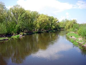
The Nida pronounced [ˈɲida] is a river in central Poland, a left tributary of the Vistula river, into which it flows near Nowy Korczyn). The Nida has a length of 154 kilometres and a basin area of 3,844 km2. This includes the protected area called Nida Landscape Park.

Nowy Korczyn
Town in Świętokrzyskie Voivodeship, Poland
Distance: Approx. 232 meters
Latitude and longitude: 50.29916667,20.80888889
Nowy Korczyn [ˈnɔvɨ ˈkɔrt͡ʂɨn] is a small town in Busko County, Świętokrzyskie Voivodeship, in south-central Poland. It is the seat of the gmina (administrative district) called Gmina Nowy Korczyn. It lies in Lesser Poland, approximately 20 kilometres (12 mi) south of Busko-Zdrój and 67 km (42 mi) south of the regional capital Kielce.
Gmina Nowy Korczyn
Gmina in Świętokrzyskie Voivodeship, Poland
Distance: Approx. 232 meters
Latitude and longitude: 50.29916667,20.80888889
Gmina Nowy Korczyn is a rural gmina (administrative district) in Busko County, Świętokrzyskie Voivodeship, in south-central Poland. Its seat is the village of Nowy Korczyn, which lies approximately 20 kilometres (12 mi) south of Busko-Zdrój and 67 km (42 mi) south of the regional capital Kielce. The gmina covers an area of 117.31 square kilometres (45.3 sq mi), and as of 2006 its total population is 6,381.

Borusowa
Village in Lesser Poland Voivodeship, Poland
Distance: Approx. 1669 meters
Latitude and longitude: 50.28333333,20.8
Borusowa [bɔruˈsɔva] is a village in the administrative district of Gmina Gręboszów, within Dąbrowa County, Lesser Poland Voivodeship, in southern Poland. It lies approximately 19 kilometres (12 mi) north-west of Dąbrowa Tarnowska and 67 km (42 mi) east of the regional capital Kraków. The Borusowa Ferry, a cable ferry, crosses the River Vistula between Borusowa and Nowy Korczyn.
Grotniki Duże
Village in Świętokrzyskie Voivodeship, Poland
Distance: Approx. 638 meters
Latitude and longitude: 50.30277778,20.81055556
Grotniki Duże [ɡrɔtˈniki ˈduʐɛ] is a village in the administrative district of Gmina Nowy Korczyn, within Busko County, Świętokrzyskie Voivodeship, in south-central Poland. It lies approximately 1 kilometre (1 mi) north of Nowy Korczyn, 20 km (12 mi) south of Busko-Zdrój, and 66 km (41 mi) south of the regional capital Kielce.
Grotniki Małe
Village in Świętokrzyskie Voivodeship, Poland
Distance: Approx. 2603 meters
Latitude and longitude: 50.31222222,20.83722222
Grotniki Małe [ɡrɔtˈniki ˈmawɛ] is a village in the administrative district of Gmina Nowy Korczyn, within Busko County, Świętokrzyskie Voivodeship, in south-central Poland. It lies approximately 3 kilometres (2 mi) north-east of Nowy Korczyn, 20 km (12 mi) south-east of Busko-Zdrój, and 66 km (41 mi) south of the regional capital Kielce.
Harmoniny
Village in Świętokrzyskie Voivodeship, Poland
Distance: Approx. 2768 meters
Latitude and longitude: 50.31666667,20.83333333
Harmoniny [xarmɔˈninɨ] is a village in the administrative district of Gmina Nowy Korczyn, within Busko County, Świętokrzyskie Voivodeship, in south-central Poland. It lies approximately 3 kilometres (2 mi) north-east of Nowy Korczyn, 19 km (12 mi) south-east of Busko-Zdrój, and 65 km (40 mi) south of the regional capital Kielce.
Łęka, Świętokrzyskie Voivodeship
Village in Świętokrzyskie Voivodeship, Poland
Distance: Approx. 1551 meters
Latitude and longitude: 50.28916667,20.82722222
Łęka [ˈwɛnka] is a village in the administrative district of Gmina Nowy Korczyn, within Busko County, Świętokrzyskie Voivodeship, in south-central Poland. It lies approximately 2 kilometres (1 mi) south-east of Nowy Korczyn, 22 km (14 mi) south of Busko-Zdrój, and 68 km (42 mi) south of the regional capital Kielce.
Podraje
Village in Świętokrzyskie Voivodeship, Poland
Distance: Approx. 2349 meters
Latitude and longitude: 50.29083333,20.84083333
Podraje [pɔˈdrajɛ] is a village in the administrative district of Gmina Nowy Korczyn, within Busko County, Świętokrzyskie Voivodeship, in south-central Poland. It lies approximately 3 kilometres (2 mi) east of Nowy Korczyn, 22 km (14 mi) south-east of Busko-Zdrój, and 68 km (42 mi) south of the regional capital Kielce.
Podzamcze, Busko County
Village in Świętokrzyskie Voivodeship, Poland
Distance: Approx. 1174 meters
Latitude and longitude: 50.29527778,20.82555556
Podzamcze [pɔˈd͡zamt͡ʂɛ] is a village in the administrative district of Gmina Nowy Korczyn, within Busko County, Świętokrzyskie Voivodeship, in south-central Poland. It lies approximately 2 kilometres (1 mi) east of Nowy Korczyn, 21 km (13 mi) south of Busko-Zdrój, and 67 km (42 mi) south of the regional capital Kielce.
Winiary Dolne
Village in Świętokrzyskie Voivodeship, Poland
Distance: Approx. 1874 meters
Latitude and longitude: 50.3,20.78333333
Winiary Dolne [viˈɲarɨ ˈdɔlnɛ] is a village in the administrative district of Gmina Nowy Korczyn, within Busko County, Świętokrzyskie Voivodeship, in south-central Poland. It lies approximately 2 kilometres (1 mi) west of Nowy Korczyn, 20 km (12 mi) south of Busko-Zdrój, and 66 km (41 mi) south of the regional capital Kielce.
Weather in this IP's area
clear sky
3 Celsius
-0 Celsius
2 Celsius
3 Celsius
1034 hPa
92 %
1034 hPa
1012 hPa
10000 meters
3.17 m/s
7.46 m/s
77 degree
2 %
06:41:03
16:00:15