193.58.239.20 - IP Lookup: Free IP Address Lookup, Postal Code Lookup, IP Location Lookup, IP ASN, Public IP
Country:
Region:
City:
Location:
Time Zone:
Postal Code:
ISP:
ASN:
language:
User-Agent:
Proxy IP:
Blacklist:
IP information under different IP Channel
ip-api
Country
Region
City
ASN
Time Zone
ISP
Blacklist
Proxy
Latitude
Longitude
Postal
Route
db-ip
Country
Region
City
ASN
Time Zone
ISP
Blacklist
Proxy
Latitude
Longitude
Postal
Route
IPinfo
Country
Region
City
ASN
Time Zone
ISP
Blacklist
Proxy
Latitude
Longitude
Postal
Route
IP2Location
193.58.239.20Country
Region
brandenburg
City
neuheim
Time Zone
Europe/Berlin
ISP
Language
User-Agent
Latitude
Longitude
Postal
ipdata
Country
Region
City
ASN
Time Zone
ISP
Blacklist
Proxy
Latitude
Longitude
Postal
Route
Popular places and events near this IP address

Jüterbog
Town in Brandenburg, Germany
Distance: Approx. 3204 meters
Latitude and longitude: 51.99333333,13.07277778
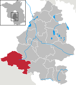
Jüterbog (German pronunciation: [ˈjyːtɐˌbɔk] ) is a historic town in north-eastern Germany, in the Teltow-Fläming district of Brandenburg. It is on the Nuthe river at the northern slope of the Fläming hill range, about 65 km (40 mi) southwest of Berlin.
Dennewitz
Distance: Approx. 7221 meters
Latitude and longitude: 51.96666667,13
Dennewitz is a village of Germany, in the federal state and old Prussian province of Brandenburg, near Jüterbog, 40 km. S.W. from Berlin. It is part of the municipality of Niedergörsdorf, Teltow-Fläming district.

Battle of Jüterbog
1644 battle of the Thirty Years' War
Distance: Approx. 3208 meters
Latitude and longitude: 51.9933,13.0728
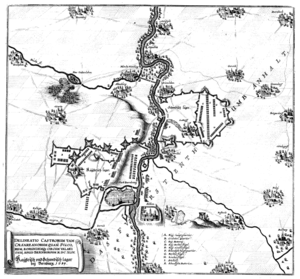
The Battle of Jüterbog was fought in Jüterbog on 3 December 1644 between Sweden and the Holy Roman Empire, resulting in a Swedish victory. The cavalry of the main Imperial army tried to break out of its blockade by the Swedish in Magdeburg but was caught and mostly shattered by the Swedes.

Zinna Abbey
Former monastery in Jüterbog
Distance: Approx. 2892 meters
Latitude and longitude: 52.01666667,13.1
Zinna Abbey (German: Kloster Zinna) is a former Cistercian monastery, the site of which is now occupied by a village also called Kloster Zinna, today part of Jüterbog in Brandenburg, Germany, about 60 km (37 mi) south of Berlin. The village was established by Frederick II of Prussia as a village for weavers.

Niedergörsdorf
Municipality in Brandenburg, Germany
Distance: Approx. 5768 meters
Latitude and longitude: 51.98333333,13
Niedergörsdorf is a municipality in the Teltow-Fläming district of Brandenburg, Germany.
Pechüle
Village in Brandenburg, Germany
Distance: Approx. 9470 meters
Latitude and longitude: 52.07491667,12.9517
Pechüle is an old village in Brandenburg, Germany, part of the village of Bardenitz, which itself belongs since 2003 to the administrative district of the town of Treuenbrietzen. Pechüle was first mentioned in writing in the year 1225 as Pechule. A property of the Zinna Abbey, it passed to the possessions of the Archbishop of Magdeburg when the abbey was dissolved in 1554.

Jüterbog Airfield
Airport in Jüterbog, Germany
Distance: Approx. 5765 meters
Latitude and longitude: 51.9964,12.984
Jüterbog Airfield (also known as Altes Lager airfield) was a military air base located west of the town of Jüterbog, in Brandenburg, Germany. Nowadays paragliders and hang gliders start from Altes Lager.
Forst Zinna rail disaster
Distance: Approx. 5572 meters
Latitude and longitude: 52.0601,13.1085
The Forst Zinna rail disaster occurred 19 January 1988 in Forst Zinna, East Germany. It was the result of a collision between a Soviet T-64A tank and an express train on the Berlin–Halle railway, in an area often used by the Soviet military for tank training. Six people were killed, and 33 were injured.

Jüterbog station
Railway station in Jüterbog, Germany
Distance: Approx. 2589 meters
Latitude and longitude: 51.99757,13.05442
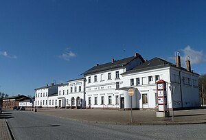
Jüterbog station is a station in the town of Jüterbog in the German state of Brandenburg. It was opened in 1841, which makes it one of the oldest railway stations in Brandenburg. The Jüterbog–Röderau railway has branched off the Berlin–Halle railway (Anhalterbahn) at the station since 1848.
Altes Lager station
Railway station in Altes Lager
Distance: Approx. 4541 meters
Latitude and longitude: 52.01588,12.99248
Altes Lager station is a railway station in the municipality of Altes Lager, located in the Teltow-Fläming district in Brandenburg, Germany.

St. Nikolai church (Jüterbog)
Church in Jüterbog, Germany
Distance: Approx. 3758 meters
Latitude and longitude: 51.991135,13.084778
The St. Nikolai church is the largest medieval church in Jüterbog, Brandenburg, Germany. The nave is a Brick Gothic hall church construction with field stone dual towers that dominate the cityscape.
Weather in this IP's area
clear sky
1 Celsius
-2 Celsius
1 Celsius
1 Celsius
1028 hPa
78 %
1028 hPa
1018 hPa
10000 meters
3.08 m/s
6.02 m/s
110 degree