Country:
 France
Region:
City:
Latitude and Longitude:
Time Zone:
Postal Code:
IP information under different IP Channel
ip-api
Country
Region
City
ASN
Time Zone
ISP
Blacklist
Proxy
Latitude
Longitude
Postal
Route
IPinfo
Country
Region
City
ASN
Time Zone
ISP
Blacklist
Proxy
Latitude
Longitude
Postal
Route
MaxMind
Country
Region
City
ASN
Time Zone
ISP
Blacklist
Proxy
Latitude
Longitude
Postal
Route
Luminati
Country
FRRegion
ara
City
romagnat
ASN
Time Zone
Europe/Paris
ISP
Atelier Olivier Charnay Telecom SAS
Latitude
Longitude
Postal
db-ip
Country
Region
City
ASN
Time Zone
ISP
Blacklist
Proxy
Latitude
Longitude
Postal
Route
ipdata
Country
Region
City
ASN
Time Zone
ISP
Blacklist
Proxy
Latitude
Longitude
Postal
Route
Popular places and events near this IP address

Gergovie plateau
Distance: Approx. 1796 meters
Latitude and longitude: 45.72027778,3.11805556
The Gergovie plateau is a plateau of the Massif Central located 10 km to the south of Clermont-Ferrand, Puy-de-Dôme, Auvergne, France and is named after the nearby village of Gergovie. It is the site of the Battle of Gergovia between Vercingetorix and Julius Caesar in 52 BC. It was listed as a site of outstanding historical interest in 2018.

Aubière
Commune in Auvergne-Rhône-Alpes, France
Distance: Approx. 2257 meters
Latitude and longitude: 45.7517,3.1117
Aubière (French pronunciation: [objɛʁ]; Auvergnat: Aubèira) is a commune located in the department of Puy-de-Dôme in the Auvergne-Rhône-Alpes region in southeast France. As of 2017 its population was 10,061. The town is home to the Cézeaux campus of the University of Clermont Auvergne, a substantial number of sports teams, and a large commercial area.

Beaumont, Puy-de-Dôme
Commune in Auvergne-Rhône-Alpes, France
Distance: Approx. 2689 meters
Latitude and longitude: 45.7525,3.0836
Beaumont (Auvergnat: Biaumont) is a commune in the Puy-de-Dôme department in Auvergne-Rhône-Alpes in central France. The commune lies to the south of the dormant volcano, the Puy-de-Dôme (10 km from the commune and the city) which is clearly visible, including the telecommunication antennas that sit on its top.
Ceyrat
Commune in Auvergne-Rhône-Alpes, France
Distance: Approx. 3026 meters
Latitude and longitude: 45.7336,3.0639
Ceyrat (French pronunciation: [sɛʁa]; Auvergnat: Ceirat) is a commune in the Puy-de-Dôme department in Auvergne-Rhône-Alpes in central France.

Pérignat-lès-Sarliève
Commune in Auvergne-Rhône-Alpes, France
Distance: Approx. 2935 meters
Latitude and longitude: 45.737,3.14
Pérignat-lès-Sarliève (French pronunciation: [peʁiɲa lɛ saʁljɛv]; Auvergnat: Pairinhac de Sarlèiva) is a commune in the Puy-de-Dôme department in Auvergne in central France.

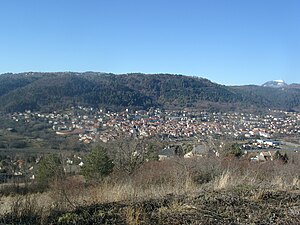
Romagnat
Commune in Auvergne-Rhône-Alpes, France
Distance: Approx. 302 meters
Latitude and longitude: 45.73,3.101
Romagnat (French pronunciation: [ʁɔmaɲa]; Auvergnat: Romanhat) is a commune in the Puy-de-Dôme department in Auvergne in central France.

Château d'Opme
11th-century castle converted to a château in Romagnat, France
Distance: Approx. 2955 meters
Latitude and longitude: 45.7074,3.09
The Château d'Opme (pronounced 'ome') is an 11th-century castle, later converted to an elegant château, located in the commune of Romagnat, in the département of Puy-de-Dôme, in the Auvergne region of France, nine kilometers south of Clermont-Ferrand. Both the château and garden are classified as Historic Monuments by the French Ministry of Culture: the gardens are classified as a jardin remarquable (Remarkable Gardens of France) .

SIGMA Clermont
Distance: Approx. 2922 meters
Latitude and longitude: 45.7577,3.1128
SIGMA Clermont is a French graduate engineering school and is a public institution under the authority of the French Ministry of Higher Education, Research and Innovation. It is located in Aubière, Clermont-Ferrand metropolitan area, France. It was created on 01.01.2016 following the merger of the French Institute for Advanced Mechanics (IFMA) and the National Graduate School of Chemistry (ENSCCF).
Canton of Aubière
Distance: Approx. 2038 meters
Latitude and longitude: 45.75,3.11
The canton of Aubière is an administrative division of the Puy-de-Dôme department, central France. Its borders were not modified at the French canton reorganisation which came into effect in March 2015. Its seat is in Aubière.
Canton of Beaumont
Distance: Approx. 2641 meters
Latitude and longitude: 45.75,3.08
The canton of Beaumont is an administrative division of the Puy-de-Dôme department, central France. Its borders were not modified at the French canton reorganisation which came into effect in March 2015. Its seat is in Beaumont.

Gergovie Monument
Stone monument in Puy-de-Dôme, France
Distance: Approx. 2262 meters
Latitude and longitude: 45.721,3.1269
The Gergovie Monument (French: monument de Gergovie) or Memorial to Vercingetorix (French: monument commémoratif à Vercingétorix) is a monument by the Clermontois architect Jean Teillard built in 1900 on the eastern edge of the Gergovie plateau, a few kilometers south of Clermont-Ferrand in the French departement of Puy-de-Dôme in Auvergne. It commemorates Vercingetorix's victory over Julius Caesar on this site in 52 BC. The monument was registered as a French Monument historique in March 2018 (the oppidum was registered in 2013) and in November of the same year, the monument was classified, included in a much larger classification of a major part of the Gergovie plateau.

2008 World Masters Athletics Indoor Championships
International athletics championship event
Distance: Approx. 2750 meters
Latitude and longitude: 45.757,3.106
2008 World Masters Athletics Indoor Championships is the third in a series of World Masters Athletics Indoor Championships (also called World Masters Athletics Championships Indoor, or WMACi). This third edition took place in Clermont-Ferrand, France, from 17 to 22 March 2008. The main venue was Jean-Pellez Stadium, which has a banked indoor track where the turns are raised to neutralize the centrifugal force of athletes running the curves.
Weather in this IP's area
clear sky
11 Celsius
11 Celsius
11 Celsius
11 Celsius
1012 hPa
94 %
1012 hPa
959 hPa
10000 meters
1.03 m/s
08:08:18
18:56:43