Country:
 Belgium
Region:
City:
Latitude and Longitude:
Time Zone:
Postal Code:
IP information under different IP Channel
ip-api
Country
Region
City
ASN
Time Zone
ISP
Blacklist
Proxy
Latitude
Longitude
Postal
Route
IPinfo
Country
Region
City
ASN
Time Zone
ISP
Blacklist
Proxy
Latitude
Longitude
Postal
Route
MaxMind
Country
Region
City
ASN
Time Zone
ISP
Blacklist
Proxy
Latitude
Longitude
Postal
Route
Luminati
Country
BEASN
Time Zone
Europe/Brussels
ISP
BELNET
Latitude
Longitude
Postal
db-ip
Country
Region
City
ASN
Time Zone
ISP
Blacklist
Proxy
Latitude
Longitude
Postal
Route
ipdata
Country
Region
City
ASN
Time Zone
ISP
Blacklist
Proxy
Latitude
Longitude
Postal
Route
Popular places and events near this IP address
Blegny
Municipality in French Community, Belgium
Distance: Approx. 5044 meters
Latitude and longitude: 50.66666667,5.73333333
Blegny (French pronunciation: [bleɲi], before 2001: Blégny; Walloon: Blegné) is a municipality of Wallonia located in the Province of Liège, Belgium. On January 1, 2006, Blegny had a total population of 12,799. The total area is 26.07 km2 which gives a population density of 491 inhabitants per km2.
Herstal
Municipality in Wallonia, Belgium
Distance: Approx. 2890 meters
Latitude and longitude: 50.66666667,5.63333333
Herstal (French pronunciation: [ɛʁstal] ; Walloon: Hesta), formerly known as Heristal, or Héristal, is a city and municipality of Wallonia located in the province of Liège, Belgium. It lies along the Meuse river. Herstal is included in the "Greater Liège" agglomeration, which counts about 600,000 inhabitants.
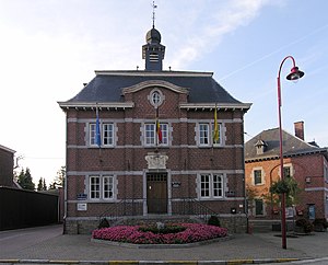
Oupeye
Municipality in French Community, Belgium
Distance: Approx. 2286 meters
Latitude and longitude: 50.7,5.65
Oupeye (French pronunciation: [upɛj]; Walloon: Oûpêye) is a municipality of Wallonia located in the province of Liège, Belgium. On January 1, 2006, Oupeye had a total population of 23,581. The total area is 36.11 km2 which gives a population density of 653 inhabitants per km2.

Piedboeuf Brewery
Belgian brewery
Distance: Approx. 4722 meters
Latitude and longitude: 50.64861111,5.62527778
Piedboeuf Brewery (French: Brasserie Piedbœuf, French pronunciation: [bʁasʁi pjedbœf]) is a brewery in Jupille-sur-Meuse, Belgium. It is owned by Anheuser–Busch InBev. The main brand is Jupiler, the best selling beer in Belgium.

Fort de Barchon
19th-20th century defence for Liège, Belgium
Distance: Approx. 2047 meters
Latitude and longitude: 50.67277778,5.69108333
The Fort de Barchon (French pronunciation: [fɔʁ də baʁʃɔ̃]) is one of twelve forts built around Liège, Belgium, in the late 19th century. The overall Fortified Position of Liège was a constituent part of the country's National Redoubt. Fort de Barchon was built between 1881 and 1884 according to the plans of General Henri Alexis Brialmont.

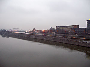
Pont-barrage de Monsin
Bridge in Liège, Belgium
Distance: Approx. 4190 meters
Latitude and longitude: 50.65194444,5.63083333
The Pont-barrage de Monsin ("bridge-dam or bridge-weir" of Monsin), across the Meuse at Liège, Belgium, was inaugurated for the 1930 Liège International Exposition. The new structure permitted the replacement of several locks and stabilized the course of the Meuse. It incorporates a hydro-electric plant.

Pont de Wandre
Bridge in Liège, Belgium
Distance: Approx. 1837 meters
Latitude and longitude: 50.674072,5.643495
The Pont de Wandre is a single-pier cable-stayed bridge carrying the N667 road across the Albert Canal and the river Meuse between Liège (on the east side) and Herstal (on the west side), both in Belgium.
Fort de Pontisse
19th-20th century defence for Liège, Belgium
Distance: Approx. 2162 meters
Latitude and longitude: 50.69280556,5.64047222
The Fort de Pontisse (French pronunciation: [fɔʁ də pɔ̃tis]) is one of twelve forts built around Liège, Belgium, in the late 19th century. The overall Fortified Position of Liège was a constituent part of the country's National Redoubt. Fort de Pontisse was built between 1881 and 1884 according to the plans of General Henri Alexis Brialmont.

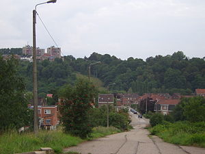
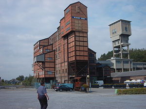
Coal mine of Hasard de Cheratte
Mine in Visé
Distance: Approx. 328 meters
Latitude and longitude: 50.68083333,5.67027778
The Coal mine of Hasard de Cheratte (or Cheratte 10) was the main colliery of the Société anonyme des Charbonnages du Hasard, and had four shafts. It is located in Cheratte, a section of the Belgian town of Visé in Liège province in Wallonia. The first shaft was dug in 1850 to extract dice coal and closed for the first time in 1877 following an accident.
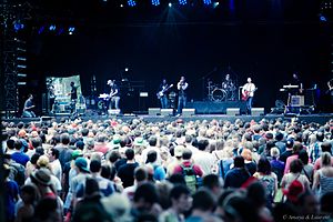
Les Ardentes
Annual rock festival in Liège, Belgium
Distance: Approx. 5074 meters
Latitude and longitude: 50.6531,5.6108
Les Ardentes (French pronunciation: [lezaʁdɑ̃t]) or Ardentes are a Belgian multi-day electro-rock music festival which yearly takes place in Liège, in early July. The last edition of the event took place in the district of Rocourt. Les Ardentes is organised ever since 2006, with Fabrice Lamproie and Gaëtan Servais as founders.
Blegny-Mine
Distance: Approx. 3732 meters
Latitude and longitude: 50.6889,5.718
Blegny-Mine was a coal mine in Trembleur, near Liège, in Belgium which today is preserved as an industrial heritage site and show mine. The museum features on the European Route of Industrial Heritage and is one of the four historical mines in Wallonia listed by UNESCO as a World Heritage Site in 2012. Mining at the site was begun by the monks of Val-Dieu Abbey in the 16th century.

Wandre
Sub-municipality of Liège in French Community, Belgium
Distance: Approx. 2071 meters
Latitude and longitude: 50.66666667,5.65
Wandre (French pronunciation: [wɑ̃dʁ]; Walloon: Wande) is a sub-municipality of the city of Liège located in the province of Liège, Wallonia, Belgium. It was a separate municipality until 1977. On 1 January 1977, it was merged into Liège.
Weather in this IP's area
moderate rain
14 Celsius
13 Celsius
13 Celsius
15 Celsius
1003 hPa
87 %
1003 hPa
996 hPa
10000 meters
7.2 m/s
180 degree
40 %
07:45:50
19:04:38