193.5.120.98 - IP Lookup: Free IP Address Lookup, Postal Code Lookup, IP Location Lookup, IP ASN, Public IP
Country:
Region:
City:
Location:
Time Zone:
Postal Code:
ISP:
ASN:
language:
User-Agent:
Proxy IP:
Blacklist:
IP information under different IP Channel
ip-api
Country
Region
City
ASN
Time Zone
ISP
Blacklist
Proxy
Latitude
Longitude
Postal
Route
db-ip
Country
Region
City
ASN
Time Zone
ISP
Blacklist
Proxy
Latitude
Longitude
Postal
Route
IPinfo
Country
Region
City
ASN
Time Zone
ISP
Blacklist
Proxy
Latitude
Longitude
Postal
Route
IP2Location
193.5.120.98Country
Region
veneto
City
due carrare
Time Zone
Europe/Rome
ISP
Language
User-Agent
Latitude
Longitude
Postal
ipdata
Country
Region
City
ASN
Time Zone
ISP
Blacklist
Proxy
Latitude
Longitude
Postal
Route
Popular places and events near this IP address

Castello del Catajo
Palace in Battaglia Terme, Italy
Distance: Approx. 2344 meters
Latitude and longitude: 45.29611111,11.78888889
Castello del Catajo is a patrician rural palace near the town of Battaglia Terme, province of Padua, north-eastern Italy built in 1573.

Albignasego
Comune in Veneto, Italy
Distance: Approx. 7423 meters
Latitude and longitude: 45.35,11.86666667
Albignasego is a comune (municipality) in the Province of Padua in the Italian region Veneto, located about 35 kilometres (22 mi) west of Venice and about 7 kilometres (4.3 mi) south of Padua. As of 06/03/2021, it has a population of 26.006 inhabitants and an area of 21.0 square kilometres (8.1 sq mi). The municipality of Albignasego contains the main village and frazioni (hamlets) Carpanedo, Lion, Mandriola, S. Agostino, S. Giacomo.
Cartura
Comune in Veneto, Italy
Distance: Approx. 4040 meters
Latitude and longitude: 45.26916667,11.85777778
Cartura is a comune (municipality) in the Province of Padua in the Italian region Veneto, located about 40 kilometres (25 mi) southwest of Venice and about 15 kilometres (9 mi) south of Padua. As of 31 December 2004, it had a population of 4,268 and an area of 16.2 square kilometres (6.3 sq mi). The municipality of Cartura contains the frazioni (subdivisions, mainly villages and hamlets) Cagnola and Gorgo.
Galzignano Terme
Comune in Veneto, Italy
Distance: Approx. 6712 meters
Latitude and longitude: 45.3,11.73333333
Galzignano Terme (Venetian: Galsignán) is a comune (municipality) in the Province of Padua in the Italian region Veneto, located about 50 kilometres (31 mi) southwest of Venice and about 15 kilometres (9 mi) southwest of Padua.
Gazzo, Veneto
Comune in Veneto, Italy
Distance: Approx. 5189 meters
Latitude and longitude: 45.28333333,11.88333333
Gazzo is a comune (municipality) in the Province of Padua in the Italian region Veneto, located about 50 kilometres (31 mi) northwest of Venice and about 25 kilometres (16 mi) northwest of Padua. As of 31 August 2017, it had a population of 4,302 and an area of 22.7 square kilometres (8.8 sq mi). The municipality of Gazzo contains the frazioni (subdivisions, mainly villages and hamlets) Grossa, Gaianigo, Grantortino, and Villalta.

Maserà di Padova
Comune in Veneto, Italy
Distance: Approx. 4632 meters
Latitude and longitude: 45.31666667,11.86666667
Maserà di Padova is a comune (municipality) in the Province of Padua in the Italian region of Veneto, located about 40 kilometres (25 mi) southwest of Venice and about 11 kilometres (7 mi) south of Padua. As of 1 January 2023, it had a population of 9,126 and an area of 17.58 square kilometres (6.79 sq mi). Maserà di Padova borders the following municipalities: Abano Terme, Albignasego, Cartura, Casalserugo, Due Carrare.

Montegrotto Terme
Comune in Veneto, Italy
Distance: Approx. 5301 meters
Latitude and longitude: 45.33333333,11.78333333
Montegrotto Terme (Venetian: Montegròto) is a comune (municipality) in the Province of Padua in the Italian region Veneto, located about 45 kilometres (28 mi) west of Venice and about 11 kilometres (7 mi) southwest of Padua. Montegrotto Terme is a spa resort, part of the Terme Euganee spas. The Euganean Hills (Colli Euganei) are located nearby.

Pernumia
Comune in Veneto, Italy
Distance: Approx. 3985 meters
Latitude and longitude: 45.26666667,11.78333333
Pernumia is a comune (municipality) in the Province of Padua in the Italian region Veneto, located about 45 kilometres (28 mi) southwest of Venice and about 20 kilometres (12 mi) southwest of Padua. As of 31 December 2004, it had a population of 3,756 and an area of 13.2 square kilometres (5.1 sq mi). Pernumia borders the following municipalities: Battaglia Terme, Cartura, Due Carrare, Monselice, San Pietro Viminario.

San Pietro Viminario
Comune in Veneto, Italy
Distance: Approx. 4744 meters
Latitude and longitude: 45.25,11.81666667
San Pietro Viminario is a comune (municipality) in the Province of Padua in the Italian region Veneto, located about 45 kilometres (28 mi) southwest of Venice and about 20 kilometres (12 mi) south of Padua. As of 31 December 2004, it had a population of 2,680 and an area of 13.3 square kilometres (5.1 sq mi). San Pietro Viminario borders the following municipalities: Cartura, Conselve, Monselice, Pernumia, Tribano.
Monte Ceva
Mountain in Italy
Distance: Approx. 2953 meters
Latitude and longitude: 45.29027778,11.78083333
Monte Ceva is a hill of the Veneto, Italy with a prominence of 196m/643ft. It has an elevation of 225 metres (738 ft).
Monte Ricco
Mountain in Italy
Distance: Approx. 7325 meters
Latitude and longitude: 45.25416667,11.7425
Monte Ricco is a mountain of the Veneto region of Italy. It has an elevation of 330 metres.

Ex Oratorio del Montirone
Church in Veneto, Italy
Distance: Approx. 7327 meters
Latitude and longitude: 45.351908,11.777813
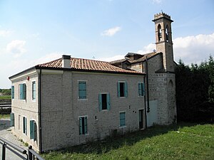
The former Oratorio del Montirone is a small chapel dating back to the 18th century, deconsecrated since the 1950s. It is located in Abano Terme (Padua) in via Pietro d'Abano 51, in front of the Montirone hill and park, from which it takes its name. It is also known as the former Oratorio del Cerato (from the name of the architect who designed it) or former Oratorio di San Giovanni (from the titular saint).
Weather in this IP's area
mist
10 Celsius
10 Celsius
9 Celsius
11 Celsius
1025 hPa
91 %
1025 hPa
1023 hPa
1300 meters
0.89 m/s
1.79 m/s
64 degree
75 %

