Country:
Region:
City:
Latitude and Longitude:
Time Zone:
Postal Code:
IP information under different IP Channel
ip-api
Country
Region
City
ASN
Time Zone
ISP
Blacklist
Proxy
Latitude
Longitude
Postal
Route
Luminati
Country
ASN
Time Zone
Indian/Mahe
ISP
velia.net Internetdienste GmbH
Latitude
Longitude
Postal
IPinfo
Country
Region
City
ASN
Time Zone
ISP
Blacklist
Proxy
Latitude
Longitude
Postal
Route
db-ip
Country
Region
City
ASN
Time Zone
ISP
Blacklist
Proxy
Latitude
Longitude
Postal
Route
ipdata
Country
Region
City
ASN
Time Zone
ISP
Blacklist
Proxy
Latitude
Longitude
Postal
Route
Popular places and events near this IP address

European Court of Human Rights
Supranational court established by the Council of Europe
Distance: Approx. 909 meters
Latitude and longitude: 48.59666667,7.77416667
The European Court of Human Rights (ECtHR), also known as the Strasbourg Court, is an international court of the Council of Europe which interprets the European Convention on Human Rights (ECHR). The court hears applications alleging that a contracting state has breached one or more of the human rights enumerated in the convention or its optional protocols to which a member state is a party. The court is based in Strasbourg, France.
Rhénus Sport
Distance: Approx. 1397 meters
Latitude and longitude: 48.600278,7.764722
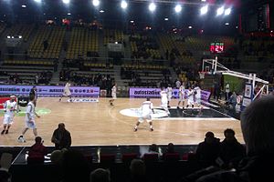
Rhénus Sport (originally Hall Rhénus, also known as Rhénus Sport Arena and Arena de la SIG) is a multi-purpose arena located in Strasbourg, France. The seating capacity is 6,200 for basketball games.
Palace of Europe
Former seat of the European Parliament
Distance: Approx. 1155 meters
Latitude and longitude: 48.595,7.77194444
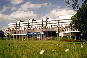
The Palace of Europe (French: Palais de l'Europe) is a building located in Strasbourg, France, that has served as the seat of the Council of Europe since 1977 when it replaced the "House of Europe". Between 1977 and 1999 it was also the Strasbourg seat of the European Parliament.

Seat of the European Parliament in Strasbourg
Meeting place for the EU legislative body
Distance: Approx. 1197 meters
Latitude and longitude: 48.597401,7.768825
The city of Strasbourg in France is the official seat of the European Parliament. The institution is legally bound by the decision of Edinburgh European Council of 11 and 12 December 1992 and Article 341 of the TFEU to meet there twelve times a year for a session, each of which usually takes about four days. The majority of work, however, takes place in Brussels, and some other work is undertaken in Luxembourg City (see Location of European Union institutions for more information).
European institutions in Strasbourg
Distance: Approx. 1102 meters
Latitude and longitude: 48.5961,7.7715
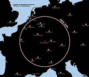
There are a range of European institutions in Strasbourg (France), the oldest of which dates back to 1815. In all, there are more than twenty different institutions based in the Alsatian city.
Council of Europe Archives
Distance: Approx. 1152 meters
Latitude and longitude: 48.595,7.772
The Council of Europe Archives are located at the headquarters of the Organisation at the Palace of Europe in Strasbourg, France. They were set up in 1949 soon after the Organisation was created. Open to the public, they constitute a unique research source for the early history of European integration.

European Court of Human Rights building
Civic in Strasbourg, France
Distance: Approx. 858 meters
Latitude and longitude: 48.59694444,7.77472222
The building of the European Court of Human Rights is located in the European Quarter of Strasbourg, France. It was designed by the Richard Rogers Partnership and Claude Buche and was completed in 1994. The building is located on the eastern corner of the water intersection, where the Ill river is crossed by the Canal de la Marne au Rhin.
Château de Pourtalès
Distance: Approx. 1403 meters
Latitude and longitude: 48.60833333,7.8
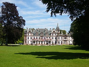
Château de Pourtalès (or Château de Robertsau) is a château situated in the Robertsau district of Strasbourg, France. It's dated to the 18th century and named after the Pourtalès family.

Villa Schutzenberger
Private housing in Strasbourg, France
Distance: Approx. 1512 meters
Latitude and longitude: 48.59177778,7.77
The Villa Schutzenberger, also known as Hôtel Schutzenberger (German: Schützenberger) is an Art Nouveau hôtel particulier on allée de la Robertsau in the Neustadt district of Strasbourg, in the French department of the Bas-Rhin. It has been classified as a Monument historique since 1975. The Villa is the seat of the European Audiovisual Observatory since 1992.
European School of Strasbourg
School in Strasbourg, France
Distance: Approx. 546 meters
Latitude and longitude: 48.600325,7.77655
The European School of Strasbourg (French: École Européenne de Strasbourg), or EES, is a public Accredited European School in Strasbourg, France. Founded in 2008, it is an all-through school, which offers a multicultural and multilingual education leading to the European Baccalaureate as its secondary leaving qualification.

United Earth
Public artwork by Tomasz Urbanowicz and Beata Urbanowicz
Distance: Approx. 1209 meters
Latitude and longitude: 48.597528,7.768556
United Earth (Polish: Zjednoczony Świat) is a public artwork by Tomasz Urbanowicz and Beata Urbanowicz in the Agora of the Seat of the European Parliament in Strasbourg. The glass sculpture has a diameter of 180 cm (71 in) and symbolizes the idea of openness to further expansion of the European Union in order to create a united world.
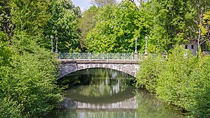
Aar (Ill)
River in Grand Est, France
Distance: Approx. 1346 meters
Latitude and longitude: 48.60277778,7.76527778
The Aar is a river in the administrative district of Bas-Rhin which crosses the municipalities of Strasbourg and Schiltigheim. It is an arm which separates from the Ill at the University bridge to rejoin it at lock no 51 in Schiltigheim. Together the Aar and the Ill form the island of Saint-Hélène.
Weather in this IP's area
overcast clouds
7 Celsius
6 Celsius
6 Celsius
7 Celsius
1026 hPa
100 %
1026 hPa
1009 hPa
6000 meters
2.06 m/s
160 degree
100 %
07:21:52
17:03:03
