193.38.32.37 - IP Lookup: Free IP Address Lookup, Postal Code Lookup, IP Location Lookup, IP ASN, Public IP
Country:
Region:
City:
Location:
Time Zone:
Postal Code:
IP information under different IP Channel
ip-api
Country
Region
City
ASN
Time Zone
ISP
Blacklist
Proxy
Latitude
Longitude
Postal
Route
Luminati
Country
Region
nw
City
huckeswagen
ASN
Time Zone
Europe/Berlin
ISP
BEW Bergische Energie- und Wasser GmbH
Latitude
Longitude
Postal
IPinfo
Country
Region
City
ASN
Time Zone
ISP
Blacklist
Proxy
Latitude
Longitude
Postal
Route
IP2Location
193.38.32.37Country
Region
bayern
City
schwarzenbach am wald
Time Zone
Europe/Berlin
ISP
Language
User-Agent
Latitude
Longitude
Postal
db-ip
Country
Region
City
ASN
Time Zone
ISP
Blacklist
Proxy
Latitude
Longitude
Postal
Route
ipdata
Country
Region
City
ASN
Time Zone
ISP
Blacklist
Proxy
Latitude
Longitude
Postal
Route
Popular places and events near this IP address

Naila
Town in Bavaria, Germany
Distance: Approx. 5478 meters
Latitude and longitude: 50.31666667,11.68333333
Naila is a town in the Hof district of Bavaria, Germany. It lies in the Franconian Forest. Naila is 18 km (11 mi) from the larger city of Hof, on both banks of the Selbitz river.
Helmbrechts concentration camp
Distance: Approx. 7822 meters
Latitude and longitude: 50.23329889,11.69999889
As a Nazi concentration camp for forced labor, Helmbrechts concentration camp was a women's subcamp of the Flossenbürg concentration camp founded near Helmbrechts near Hof, Germany in the summer of 1944. The first prisoners who came to the camp were political prisoners from the Ravensbrück camp in northern Germany. Later Jewish prisoners were brought.

Franconian Forest
Mountain range in Germany
Distance: Approx. 2465 meters
Latitude and longitude: 50.3,11.6
The Franconian Forest (German: Frankenwald, ), is a mid-altitude mountain range in Northern Bavaria, Germany. It is located in the district of Upper Franconia (Oberfranken) and forms the geological connection between the Fichtel Mountains and the Thuringian Forest. It is a broad well-wooded plateau, running for about 45 kilometres (28 mi) in a northwesterly direction, descending gently on the north and eastern sides towards the Saale river, but more precipitously to the Bavarian plain in the west, and attaining its highest elevation in the Döbraberg near Schwarzenbach am Wald (794 metres).

Geroldsgrün
Municipality in Hof, Bavaria, Germany
Distance: Approx. 6178 meters
Latitude and longitude: 50.33333333,11.58333333
Geroldsgrün is a municipality in the Hof district of Bavaria, Germany.
Schwarzenbach am Wald
Town in Bavaria, Germany
Distance: Approx. 322 meters
Latitude and longitude: 50.28333333,11.62083333
Schwarzenbach am Wald is a town in the district of Hof, in Bavaria, Germany. It is situated 21 km west of Hof, and 23 km northeast of Kulmbach.
Stammbach
Municipality in Bavaria, Germany
Distance: Approx. 4865 meters
Latitude and longitude: 50.25,11.66666667
Stammbach is a market town and municipality in the district of Hof in Bavaria in Germany.

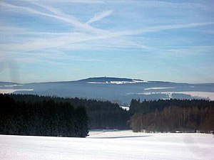
Döbraberg
Mountain in Germany
Distance: Approx. 2678 meters
Latitude and longitude: 50.26666667,11.65
Döbraberg () is a mountain of Bavaria, Germany.
Döbrabach
River in Germany
Distance: Approx. 8279 meters
Latitude and longitude: 50.29444444,11.74027778
Döbrabach (also Döbra) is a small river of Bavaria, Germany. The Döbrabach source is at the village of Döbra (district of the town Schwarzenbach am Wald) at the foot of the Döbraberg in the Franconian Forest. It passes through the village of Marlesreuth (district of Naila) and flows south of the village Weidesgrün (district of Selbitz) into the river Selbitz.

East Germany balloon escape
1979 crossing into West Germany
Distance: Approx. 6120 meters
Latitude and longitude: 50.33130556,11.67030556
On 16 September 1979, eight people from two families escaped from East Germany by crossing the border into West Germany at night in a homemade hot air balloon. The unique feat was the result of over a year and a half of preparations involving three different balloons, various modifications, and a first, unsuccessful attempt. The failed attempt alerted the East German authorities to the plot, but the police were unable to identify the escapees before their second, successful flight two months later.

Naila station
Railway station in Naila, Germany
Distance: Approx. 7965 meters
Latitude and longitude: 50.3296,11.712
Naila station is a railway station in the municipality of Naila, located in the Hof district in Bavaria, Germany.
Weavers' cottage (Kleinschwarzenbach, Zum Weberhaus 10)
Cultural heritage site in Helmbrechts, Germany
Distance: Approx. 7184 meters
Latitude and longitude: 50.24701,11.70697
The weavers' cottage is a heritage site in the village of Kleinschwarzenbach in Helmbrechts, Bavaria, Germany. It is an example of the cultural heritage and the way of life of the weavers in pre-industrial times in the Franconian Forest.
Kleinschwarzenbach
Bavarian village
Distance: Approx. 7123 meters
Latitude and longitude: 50.24694444,11.70583333
Kleinschwarzenbach is a village in the German city of Helmbrechts. Dr. Seuss visited members of the Seuss family there to rediscover his heritage.
Weather in this IP's area
broken clouds
2 Celsius
-3 Celsius
2 Celsius
3 Celsius
1003 hPa
68 %
1003 hPa
922 hPa
10000 meters
7.72 m/s
200 degree
75 %


