193.36.70.248 - IP Lookup: Free IP Address Lookup, Postal Code Lookup, IP Location Lookup, IP ASN, Public IP
Country:
Region:
City:
Location:
Time Zone:
Postal Code:
IP information under different IP Channel
ip-api
Country
Region
City
ASN
Time Zone
ISP
Blacklist
Proxy
Latitude
Longitude
Postal
Route
Luminati
Country
ASN
Time Zone
Europe/London
ISP
The Press Association Limited
Latitude
Longitude
Postal
IPinfo
Country
Region
City
ASN
Time Zone
ISP
Blacklist
Proxy
Latitude
Longitude
Postal
Route
IP2Location
193.36.70.248Country
Region
england
City
howden
Time Zone
Europe/London
ISP
Language
User-Agent
Latitude
Longitude
Postal
db-ip
Country
Region
City
ASN
Time Zone
ISP
Blacklist
Proxy
Latitude
Longitude
Postal
Route
ipdata
Country
Region
City
ASN
Time Zone
ISP
Blacklist
Proxy
Latitude
Longitude
Postal
Route
Popular places and events near this IP address

Boothferry
Village in the East Riding of Yorkshire, England
Distance: Approx. 1985 meters
Latitude and longitude: 53.729728,-0.887405
Boothferry is a village in the East Riding of Yorkshire in England. It is situated on the north bank of the River Ouse where the A614 road crosses the river. It is about 2 miles (3 km) north-west of Goole.

Ouse Bridge (M62)
Road bridge in the East Riding of Yorkshire, England
Distance: Approx. 1895 meters
Latitude and longitude: 53.727,-0.879
The Ouse Bridge is a reinforced concrete plate girder bridge that spans River Ouse between Goole and Howden in the East Riding of Yorkshire, England. It carries the M62 and is situated between junctions 36 and 37. It was built between 1973 and 1976 by Costain and was designed by Scott Wilson Kirkpatrick & Partners.

Howden
Town and civil parish in the East Riding of Yorkshire, England
Distance: Approx. 270 meters
Latitude and longitude: 53.744111,-0.863416
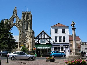
Howden () is a market town and civil parish in the East Riding of Yorkshire, England. It lies in the Vale of York to the north of the M62, on the A614 road about 16 miles (26 km) south-east of York and 3 miles (4.8 km) north of Goole, which lies across the River Ouse. It is known for Howden Minster, one of the largest churches in the East Riding.
Howden School
Academy in Howden, East Riding of Yorkshire, England
Distance: Approx. 863 meters
Latitude and longitude: 53.7491,-0.86005
Howden School is a coeducational secondary school located in Howden in the East Riding of Yorkshire, England. The school previously specialised in Technology and ICT. Pupils usually attend the school from Year Seven (aged 11 or 12) to Year Eleven (aged 16 or 17). The school sixth form department closed around 2010.

Knedlington
Hamlet in the East Riding of Yorkshire, England
Distance: Approx. 1585 meters
Latitude and longitude: 53.74377,-0.889612
Knedlington is a small hamlet and former civil parish, now in the parish of Asselby, in the East Riding of Yorkshire, England. It is situated approximately 1 mile (1.6 km) west of the market town of Howden and lies to the west of the B1228 road. The M62 motorway is just over 1 mile to the south-east.

Howden Minster
Church in Howden, East Riding of Yorkshire, England
Distance: Approx. 370 meters
Latitude and longitude: 53.7453,-0.8672
Howden Minster (also known as the Minster Church of St Peter and St Paul, Howden) is a large Grade I listed Church of England church in the Diocese of York. It is located in Howden, East Riding of Yorkshire, England and is one of the largest churches in the East Riding. It is dedicated to St Peter and St Paul and it is therefore properly known as 'the Minster Church of St Peter and St Paul'.
Howden (UK Parliament constituency)
Parliamentary constituency in the United Kingdom, 1955–1983
Distance: Approx. 547 meters
Latitude and longitude: 53.747,-0.865
Howden was a constituency in Yorkshire which returned one Member of Parliament (MP) to the House of Commons of the Parliament of the United Kingdom. It was created for the 1955 general election, made up largely of the constituency of Beverley (losing some territory in the south to Haltemprice, and taking some in the east from Bridlington). The Howden constituency was abolished for the 1983 general election.

Boothferry (UK Parliament constituency)
Parliamentary constituency in the United Kingdom, 1983–1997
Distance: Approx. 1326 meters
Latitude and longitude: 53.736,-0.883
Boothferry was a constituency in Humberside which returned one Member of Parliament (MP) to the House of Commons of the Parliament of the United Kingdom. It was created for the 1983 general election, and abolished for the 1997 general election.

Kilpin Pike
Village in the East Riding of Yorkshire, England
Distance: Approx. 1596 meters
Latitude and longitude: 53.732986,-0.846996
Kilpin Pike is a village in the East Riding of Yorkshire, England. It is situated approximately 2 miles (3.2 km) north of Goole town centre, about 1 mile (1.6 km) south of Howden, and lies on the north bank of the River Ouse. The village forms part of the civil parish of Kilpin.

Howdendyke
Hamlet in the East Riding of Yorkshire, England
Distance: Approx. 1104 meters
Latitude and longitude: 53.733446,-0.857519
Howdendyke is a hamlet in the East Riding of Yorkshire, England. It is situated approximately 2 miles (3.2 km) north of Goole town centre and about 1 mile (1.6 km) south of Howden. Howdendyke forms part of the civil parish of Kilpin.

Booth, East Riding of Yorkshire
Distance: Approx. 1945 meters
Latitude and longitude: 53.73,-0.887
Booth is a hamlet near Goole, in the East Riding of Yorkshire, England. Booth is also known as Boothferry or Boothferry Bridge.
South Howden railway station
Disused railway station in the East Riding of Yorkshire, England
Distance: Approx. 806 meters
Latitude and longitude: 53.749,-0.862
South Howden railway station was a station on the Hull and Barnsley Railway, and served the town of Howden in the East Riding of Yorkshire, England.
Weather in this IP's area
overcast clouds
8 Celsius
6 Celsius
7 Celsius
9 Celsius
1032 hPa
94 %
1032 hPa
1032 hPa
10000 meters
2.64 m/s
3.07 m/s
215 degree
100 %