193.36.151.232 - IP Lookup: Free IP Address Lookup, Postal Code Lookup, IP Location Lookup, IP ASN, Public IP
Country:
Region:
City:
Location:
Time Zone:
Postal Code:
IP information under different IP Channel
ip-api
Country
Region
City
ASN
Time Zone
ISP
Blacklist
Proxy
Latitude
Longitude
Postal
Route
Luminati
Country
ASN
Time Zone
Europe/Oslo
ISP
Globalconnect As
Latitude
Longitude
Postal
IPinfo
Country
Region
City
ASN
Time Zone
ISP
Blacklist
Proxy
Latitude
Longitude
Postal
Route
IP2Location
193.36.151.232Country
Region
rogaland
City
sandnes
Time Zone
Europe/Oslo
ISP
Language
User-Agent
Latitude
Longitude
Postal
db-ip
Country
Region
City
ASN
Time Zone
ISP
Blacklist
Proxy
Latitude
Longitude
Postal
Route
ipdata
Country
Region
City
ASN
Time Zone
ISP
Blacklist
Proxy
Latitude
Longitude
Postal
Route
Popular places and events near this IP address

Sandnes
Municipality in Rogaland County, Norway
Distance: Approx. 97 meters
Latitude and longitude: 58.85166667,5.73611111
Sandnes (pronounced [ˈsɑ̂nːeːs] ) is a city and municipality in Rogaland, Norway. It lies immediately south of Stavanger, the 4th largest city in Norway, and together the Stavanger/Sandnes area is the third-largest urban area in Norway. The urban city of Sandnes lies in the extreme western part of the vast municipality and it makes up about 5% of the total land area of the municipality.
Rogaland College
Distance: Approx. 266 meters
Latitude and longitude: 58.8535,5.7393
Rogaland College was a privately owned college situated about 40 kilometers (25 mi) south of Stavanger in Norway. In January 2006 the college moved to Sandnes 10 km south of Stavanger. Later the same year it merged with Diakonhjemmet University College in Oslo and became Diakonhjemmet University College Campus Rogaland, now it is part of the VID Specialized University.
Radio Narvik
Distance: Approx. 1582 meters
Latitude and longitude: 58.8656,5.7454
Radio Narvik was a local radio station which covered the whole Ofoten district, including Narvik, Ankenesstrand, Ballangen and Bjerkvik. The frequency was FM 103.5 and 105.5 in all areas. It was also possible to listen via internet radio.

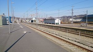
Sandnes Sentrum Station
Railway station in Sandnes, Norway
Distance: Approx. 54 meters
Latitude and longitude: 58.8525,5.73611111
Sandnes Sentrum Station (Norwegian: Sandnes sentrum stasjon) is a railway station in the city of Sandnes which lies in the western part of Sandnes Municipality in Rogaland county, Norway. The station is located in the downtown, harbour area of the city of Sandnes (in the borough of Trones og Sentrum). The station is served by regional trains to Kristiansand and Stavanger along the Sørlandet Line and by local trains on the Jæren Commuter Rail network from Stavanger Station to Egersund Station.
Skeiane Station
Railway station in Sandnes, Norway
Distance: Approx. 559 meters
Latitude and longitude: 58.8475,5.73305556
Skeiane Station (Norwegian: Skeiane stasjon) is a railway station in the city of Sandnes which is in the western part of Sandnes Municipality in Rogaland county, Norway. The station is located in the southern part of the city centre, a short distance south of the Sandnes Sentrum Station. The station is 15.36 kilometres (9.54 mi) south of the city of Stavanger.

Austrått, Rogaland
Borough in Western Norway, Norway
Distance: Approx. 1374 meters
Latitude and longitude: 58.84027778,5.73972222
Austrått is a borough of the city of Sandnes in the west part of the large municipality of Sandnes in Rogaland county, Norway. The 6-square-kilometre (2.3 sq mi) borough lies just southeast of the main city centre of Sandnes. The borough has a population (2016) of 8,251.

Trones og Sentrum
Borough in Western Norway, Norway
Distance: Approx. 166 meters
Latitude and longitude: 58.85222222,5.73805556
Trones og Sentrum is a borough of the city of Sandnes in the west part of the large municipality of Sandnes in Rogaland county, Norway. It encompasses the downtown part of the city, at the inner end of the Gandsfjorden. In 2016, this borough had a population of 8,250 and is 2.5 km2 (0.97 sq mi) in size.

Jæren District Court
District court in Rogaland county, Norway
Distance: Approx. 240 meters
Latitude and longitude: 58.85326,5.739018
Jæren District Court (Norwegian: Jæren tingrett) was a district court in Rogaland county, Norway. The court was based at the Sandnes Courthouse located on Olav V's plass in the town of Sandnes. The court existed until 2021.

Sandnes District Court
Court in Norway
Distance: Approx. 240 meters
Latitude and longitude: 58.85326,5.739018
Sandnes District Court (Norwegian: Sandnes tingrett) was a district court in Rogaland county, Norway. The court was based at the Sandnes Courthouse located on Olav V's plass in the town of Sandnes. The court existed from until 2021.

Sandnes Church (Rogaland)
Church in Rogaland, Norway
Distance: Approx. 107 meters
Latitude and longitude: 58.85285,5.73356
Sandnes Church (Norwegian: Sandnes kirke) is a parish church of the Church of Norway in the large Sandnes municipality in Rogaland county, Norway. It is located in the borough of Trones og Sentrum in the centre of the city of Sandnes in the far western part of the municipality. It is the church for the Sandnes parish and it is the seat of the Sandnes prosti (deanery) in the Diocese of Stavanger.
Øster Hus Arena
Football stadium in Sandnes, Norway
Distance: Approx. 1292 meters
Latitude and longitude: 58.8613693,5.7209634
Øster Hus Arena is a football stadium located in Sandnes, Rogaland, Norway. It is a part of Sandnes Idrettspark and is used for football matches as the home ground of Sandnes Ulf. Øster Hus Arena was opened in the beginning of the 2020 season.

Stangeland stone
Viking Age runestone in Norway
Distance: Approx. 1460 meters
Latitude and longitude: 58.85,5.71027778
The Stangeland stone or N 239 is a Viking Age runestone engraved in Old Norse with the Younger Futhark runic alphabet in Stangeland, Norway, and the style of the runestone is the runestone style RAK. It was found on Stangeland Farm, where it has been moved several times and for many years was used as a bridge over a river.
Weather in this IP's area
scattered clouds
3 Celsius
1 Celsius
2 Celsius
5 Celsius
1005 hPa
85 %
1005 hPa
994 hPa
10000 meters
2.06 m/s
240 degree
40 %
