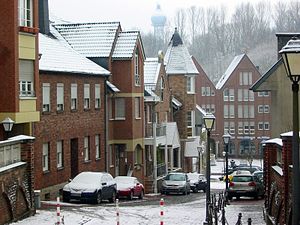
Country:
Region:
City:
Latitude and Longitude:
Time Zone:
Postal Code:
IP information under different IP Channel
ip-api
Country
Region
City
ASN
Time Zone
ISP
Blacklist
Proxy
Latitude
Longitude
Postal
Route
IPinfo
Country
Region
City
ASN
Time Zone
ISP
Blacklist
Proxy
Latitude
Longitude
Postal
Route
MaxMind
Country
Region
City
ASN
Time Zone
ISP
Blacklist
Proxy
Latitude
Longitude
Postal
Route
Luminati
Country
ASN
Time Zone
Europe/Berlin
ISP
SkyLink Data Center BV
Latitude
Longitude
Postal
db-ip
Country
Region
City
ASN
Time Zone
ISP
Blacklist
Proxy
Latitude
Longitude
Postal
Route
ipdata
Country
Region
City
ASN
Time Zone
ISP
Blacklist
Proxy
Latitude
Longitude
Postal
Route
Popular places and events near this IP address
Eygelshoven
Neighbourhood and former village in Kerkrade, Limburg, Netherlands
Distance: Approx. 5350 meters
Latitude and longitude: 50.9,6.05
Eygelshoven (Dutch pronunciation: [ˈɛiɣəlsɦoːvə(n)], Limburgish: Egelze [ˈeːɣəlzə], Ripuarian: Ejelze [ˈeːjəlzə]) is a village, since 1982 part of the town of Kerkrade, in the southeast of the Netherlands, close to the German and Belgian borders. It has two former coal mines, Laura and Julia, which were named after the wives of the two owners. Both pits closed in 1974.

Herzogenrath
Town in North Rhine-Westphalia, Germany
Distance: Approx. 6080 meters
Latitude and longitude: 50.86666667,6.1
Herzogenrath (Ripuarian: Herzeroa; Limburgish: Hertseraoj; Dutch: 's-Hertogenrade) is a municipality in the district of Aachen in the German state of North Rhine-Westphalia. It borders the Dutch town of Kerkrade, the national border in one section running along the middle of a main road and even directly through the centre of the cross-border Eurode office complex.
Ubach over Worms
Distance: Approx. 4882 meters
Latitude and longitude: 50.91666667,6.05
Ubach over Worms (Dutch pronunciation: [ˈybɑx oːvər ˈʋɔr(ə)ms]) is a former municipality located in the southeast of the Netherlands, in the province of Limburg. In 1982 it was incorporated into the new municipality of Landgraaf along with Schaesberg and Nieuwenhagen. The German name for this part of Landgraaf is "Waubach".

Übach-Palenberg
Town in North Rhine-Westphalia, Germany
Distance: Approx. 20 meters
Latitude and longitude: 50.91972222,6.11944444
Übach-Palenberg (Ripuarian: Übach-Pallebersch) is a town in the Heinsberg district of North Rhine-Westphalia, Germany. It was formed by the merger of two villages, Palenberg and Übach.

Alsdorf
Town in North Rhine-Westphalia, Germany
Distance: Approx. 5253 meters
Latitude and longitude: 50.88333333,6.16666667
Alsdorf (German pronunciation: [ˈalsdɔʁf] ) is a municipality in the district of Aachen, in North Rhine-Westphalia, Germany. Until the 21st century Alsdorf was a mining area, but now many service companies have established themselves in Alsdorf. Alsdorf has an indoor arena, a cinema, a mining museum and a zoo.

Geilenkirchen
Town in North Rhine-Westphalia, Germany
Distance: Approx. 5051 meters
Latitude and longitude: 50.96527778,6.11944444
Geilenkirchen (German pronunciation: [ˈɡaɪlənkɪʁçn̩] , Ripuarian: Jellekerke [ˈjæləˌkæʀ˦(ə)kə]) is a town in the district Heinsberg, in North Rhine-Westphalia, Germany. It is situated near the border with the Netherlands, on the river Wurm, approx. 15 km (9.3 mi) north-east of Heerlen and 20 km (12.4 mi) north of Aachen.

Baesweiler
Town in North Rhine-Westphalia, Germany
Distance: Approx. 5006 meters
Latitude and longitude: 50.9,6.18333333
Baesweiler (German pronunciation: [ˈbaːsvaɪlɐ] ) is a municipality in the district of Aachen, North Rhine-Westphalia, Germany.

Rimburg
Village in Limburg, Netherlands
Distance: Approx. 2319 meters
Latitude and longitude: 50.91694444,6.08666667
Rimburg (Dutch pronunciation: [ˈrɪmbʏr(ə)x]) is a village in the Dutch province of Limburg. It is located in the municipality of Landgraaf, on the German border. Rimburg was a separate municipality until 1887, when it was merged with Ubach over Worms.
Eygelshoven railway station
Railway station in the Netherlands
Distance: Approx. 6143 meters
Latitude and longitude: 50.89027778,6.04555556
Eygelshoven station is a railway station southwest of Eygelshoven, the Netherlands. It is located on the Schaesberg–Simpelveld railway, which is part of the Heuvellandlijn (Maastricht–Kerkrade). Train services are operated by Arriva.

Eygelshoven Markt railway station
Railway station in the Netherlands
Distance: Approx. 6143 meters
Latitude and longitude: 50.89027778,6.04555556
Eygelshoven Markt (Dutch pronunciation: [ˌɛiɣəlsɦoːvə ˈmɑr(ə)kt]) is a railway station located in Eygelshoven, Netherlands.
Übach-Palenberg station
Railway station in Übach-Palenberg, Germany
Distance: Approx. 1589 meters
Latitude and longitude: 50.92416667,6.09777778
Übach-Palenberg station is in Übach-Palenberg on the southern edge of Heinsberg in the German state of North Rhine-Westphalia. It is located on the Aachen–Mönchengladbach railway on the western outskirts of Palenberg near the Wurm and is served by the Wupper-Express and the Rhein-Niers-Bahn. Its current form reflects its reconstruction and modernisation in the 1990s and in 2008.

Geilenkirchen station
Railway station in Geilenkirchen, Germany
Distance: Approx. 4600 meters
Latitude and longitude: 50.96111111,6.12416667
Geilenkirchen station is in Geilenkirchen in the German state of North Rhine-Westphalia on the Aachen–Mönchengladbach railway. It is the only railway station in the town of Geilenkirchen. It provided an interchange between the mainline railway and the Geilenkirchen District Railway (Geilenkirchener Kreisbahn) until 1971 and was a stop for long-distance traffic until 2001.
Weather in this IP's area
moderate rain
13 Celsius
13 Celsius
12 Celsius
15 Celsius
980 hPa
95 %
980 hPa
968 hPa
8000 meters
4.12 m/s
330 degree
100 %
07:50:41
18:53:52

