Country:
Region:
City:
Latitude and Longitude:
Time Zone:
Postal Code:
IP information under different IP Channel
ip-api
Country
Region
City
ASN
Time Zone
ISP
Blacklist
Proxy
Latitude
Longitude
Postal
Route
Luminati
Country
Region
m
City
betdagan
ASN
Time Zone
Asia/Jerusalem
ISP
Radware Ltd
Latitude
Longitude
Postal
IPinfo
Country
Region
City
ASN
Time Zone
ISP
Blacklist
Proxy
Latitude
Longitude
Postal
Route
db-ip
Country
Region
City
ASN
Time Zone
ISP
Blacklist
Proxy
Latitude
Longitude
Postal
Route
ipdata
Country
Region
City
ASN
Time Zone
ISP
Blacklist
Proxy
Latitude
Longitude
Postal
Route
Popular places and events near this IP address

Beit Dagan
Local council in Israel
Distance: Approx. 547 meters
Latitude and longitude: 32.00268889,34.82924722
Beit Dagan (Hebrew: בֵּית דָּגָן, lit. 'House of Grain') is a local council (town) in the Central District of Israel. As of 2021, Beit Dagan had a population of 7,823.

Bayt Dajan
Place in Jaffa, Mandatory Palestine
Distance: Approx. 562 meters
Latitude and longitude: 32.00361111,34.82944444
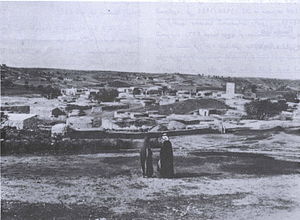
Bayt Dajan (Arabic: بيت دجن, romanized: Bayt Dajan; Hebrew: בית דג'ן), also known as Dajūn, was a Palestinian Arab village situated approximately 6 kilometers (3.7 mi) southeast of Jaffa. It is thought to have been the site of the biblical town of Beth Dagon, mentioned in the Book of Joshua and in ancient Assyrian and Ancient Egyptian texts. In the 10th century CE, it was inhabited mostly by Samaritans.
Ganot
Moshav in central Israel
Distance: Approx. 1658 meters
Latitude and longitude: 32.01638889,34.83277778
Ganot (Hebrew: גַּנּוֹת, lit. 'Gardens') is a moshav in the Central District of Israel. Located near Hiriya (now Ariel Sharon Park), it falls under the jurisdiction of Sdot Dan Regional Council. In 2022 it had a population of 591.

Hemed
Moshav in central Israel
Distance: Approx. 1961 meters
Latitude and longitude: 32.01833333,34.84138889
Hemed (Hebrew: חֶמֶ"ד, lit. 'Grace') is a national religious moshav in the Central District of Israel. Located near Or Yehuda, it falls under the jurisdiction of Sdot Dan Regional Council. In 2022 it had a population of 1,360.
Mishmar HaShiv'a
Moshav in central Israel
Distance: Approx. 1378 meters
Latitude and longitude: 32.00944444,34.82361111
Mishmar HaShiv'a (Hebrew: מִשְׁמַר הַשִּׁבְעָה, lit. 'Guard of the Seven') is a moshav in the Central District of Israel. Located near Beit Dagan, it falls under the jurisdiction of Sdot Dan Regional Council. In 2022 it had a population of 1,040.

Tzafria
Moshav in central Israel
Distance: Approx. 1986 meters
Latitude and longitude: 32.00333333,34.85583333
Tzafria (Hebrew: צַפְרִיָּה) is a religious moshav in the Central District of Israel. Located near Ben Gurion International Airport, it falls under the jurisdiction of Sdot Dan Regional Council. In 2022 it had a population of 1,013.

Al-Safiriyya
Place in Jaffa, Mandatory Palestine
Distance: Approx. 1786 meters
Latitude and longitude: 31.99333333,34.85111111
Al-Safiriyya was a Palestinian Arab village in the Jaffa Subdistrict. It was depopulated during Operation Hametz in the 1948 Palestine War on May 20, 1948. It was located 11 km east of Jaffa, 1.5 km west of Ben Gurion Airport.
Kfar Chabad railway station
Railway station in Israel
Distance: Approx. 1960 meters
Latitude and longitude: 31.99305556,34.85305556
The Kfar Chabad railway station is a railway station in the central Israeli village of Kfar Chabad. The station lies between Lod and Tel Aviv HaHagana. It is served by trains on the line between Binyamina and Ashkelon.

Shafrir synagogue shooting
1956 attack on Israeli civilians by Palestinian Arab fedayeen
Distance: Approx. 1890 meters
Latitude and longitude: 31.98694444,34.845
The Shafrir synagogue shooting was an attack which was carried out by Palestinian militants on 11 April 1956. Three Palestinian militants who crossed into Israel from Egypt attacked the study hall of a synagogue while it was full of children and teenagers, in the farming community of Kfar Chabad (Shafrir). Six people (five children and a youth worker) were killed.
Ulpana Tzfira
Distance: Approx. 1886 meters
Latitude and longitude: 32.00422222,34.85463889
Ulpana Tzfira is a religious institution for girls which is located in Tzafria, Israel. The Ulpana is related to Bnei-Akiva's yeshiva and was established in 1965.

Israel Meteorological Service
Distance: Approx. 1978 meters
Latitude and longitude: 32.00688418,34.814896
The Israel Meteorological Service (Hebrew: השירות המטאורולוגי הישראלי, HaSherut HaMete'orologi HaYisra'eli) is a unit of the Israeli Ministry of Transportation responsible for forecasting weather, meteorological data and climate research in Israel. It was founded in the 1930s as a meteorological unit during the British Mandate, mainly supporting the evolving aviation needs. After establishing the state of Israel, it was incorporated into the Ministry of Transportation.

Exhibition of Citriculture
Distance: Approx. 547 meters
Latitude and longitude: 32.00268889,34.82924722
The International Exhibition of Citriculture was a Specialised Expo recognised by the Bureau International des Expositions. The Expo took place from 21 May to 20 June 1956 in Beit Dagan, Israel and was organised within the framework of the fourth International Congress of Mediterranean Citrus Growers.
Weather in this IP's area
clear sky
23 Celsius
24 Celsius
23 Celsius
24 Celsius
1016 hPa
64 %
1016 hPa
1012 hPa
10000 meters
2.06 m/s
150 degree
06:03:25
16:45:29


