Country:
 Great Britain
Region:
City:
Latitude and Longitude:
Time Zone:
Postal Code:
IP information under different IP Channel
ip-api
Country
Region
City
ASN
Time Zone
ISP
Blacklist
Proxy
Latitude
Longitude
Postal
Route
IPinfo
Country
Region
City
ASN
Time Zone
ISP
Blacklist
Proxy
Latitude
Longitude
Postal
Route
MaxMind
Country
Region
City
ASN
Time Zone
ISP
Blacklist
Proxy
Latitude
Longitude
Postal
Route
Luminati
Country
GBASN
Time Zone
Europe/London
ISP
CW Vodafone Group PLC
Latitude
Longitude
Postal
db-ip
Country
Region
City
ASN
Time Zone
ISP
Blacklist
Proxy
Latitude
Longitude
Postal
Route
ipdata
Country
Region
City
ASN
Time Zone
ISP
Blacklist
Proxy
Latitude
Longitude
Postal
Route
Popular places and events near this IP address
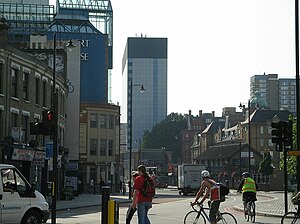
Old Street
Street in central and east London, England
Distance: Approx. 305 meters
Latitude and longitude: 51.52653,-0.08246
Old Street is a 1-mile (1.6 km) street in inner north-east Central London, England that runs west to east from Goswell Road in Clerkenwell, in the London Borough of Islington, via St Luke's and Old Street Roundabout, to the crossroads where it meets Shoreditch High Street (south), Kingsland Road (north) and Hackney Road (east) in Shoreditch in the London Borough of Hackney. It has London Underground station Old Street on the Northern line which has other platforms for National Rail's Northern City Line. Its west half is inside London's Congestion Charging Zone.

Old Street station
London Underground and railway station
Distance: Approx. 291 meters
Latitude and longitude: 51.52581,-0.08709
Old Street is an interchange station at the junction of Old Street and City Road in Central London for London Underground and National Rail services. The station is on the Bank branch of the Northern line between Angel and Moorgate stations and on the Northern City Line between Moorgate and Essex Road stations. The station is in the London Borough of Islington (straddling the Hackney border).

Old Street Roundabout
London interchange system
Distance: Approx. 312 meters
Latitude and longitude: 51.5257,-0.0875
Old Street Roundabout is a road junction in Central London, England. Historically a square roundabout, it is now a three-way junction. It is among access points of the Inner Ring Road for the adjoining St Luke's south part of Islington and the City of London beyond, west and south, respectively.

Sh! Women's Erotic Emporium
An erotic store in London
Distance: Approx. 283 meters
Latitude and longitude: 51.52727778,-0.08208333
Sh! Women's Erotic Emporium is a British sex shop with a retail store in the Hoxton, London and an online store. The business was established in 1992 by Kathryn Hoyle and Sophie Walters.

Courtyard Theatre, London
Distance: Approx. 167 meters
Latitude and longitude: 51.5279,-0.0835
The Courtyard is a theatre housed in the former public library (originally known as the Passmore Edwards Free Library) in Pitfield Street in Hoxton, London Borough of Hackney, England. It is a Grade II listed building. The Courtyard operates both a 150-seat main house and an 80-seat studio theatre.

Foundry (bar)
Distance: Approx. 288 meters
Latitude and longitude: 51.5262,-0.0834
The Foundry was a bar and venue on Great Eastern Street at the junction on Old Street, London. It was owned and run by Jonathan and Tracey Moberly. Bill Drummond, co-founder of The KLF, helped set up the Foundry.

St John the Baptist, Hoxton
Church in London , United Kingdom
Distance: Approx. 305 meters
Latitude and longitude: 51.53055556,-0.08333333
The Church of St John the Baptist, Hoxton, usually known as St John's Hoxton, is an Anglican parish church in the Hoxton area of Hackney, London N1. Nearby is Silicon Roundabout, and also Aske Gardens, named after the parish's major benefactor, City alderman and haberdasher Robert Aske.

Pulp Fiction (Banksy)
Work by stencil graffiti artist Banksy
Distance: Approx. 259 meters
Latitude and longitude: 51.526,-0.0864
Pulp Fiction is a type of work by stencil graffiti artist Banksy. Instances of it depict the characters played by Samuel L. Jackson and John Travolta in the 1994 film Pulp Fiction, with their guns replaced by bananas. A stencil graffiti work existed on a wall near the Old Street tube station in the City of London from 2002 to 2007.

Drake's (haberdashers)
Distance: Approx. 120 meters
Latitude and longitude: 51.5291,-0.087
Drake's is a British menswear haberdasher founded in 1977 by Michael Drake. Manufacturing in East London, Drake’s produces men’s accessories and shirting, and is predominantly known for its ties.

Fairchild House, Hoxton
Distance: Approx. 273 meters
Latitude and longitude: 51.5295,-0.0824
Fairchild House is a 1950 apartment block on the Pitfield Estate in Hoxton, London. When it was built it was the largest council council block that Hackney Council had built to date. It is a six-storey building of council housing.

Montcalm East
Hotel in London, England
Distance: Approx. 217 meters
Latitude and longitude: 51.5279,-0.0889
The Montcalm East is an 18-storey hotel in the Shoreditch area of Hackney, London. Opened in 2015, the 269-room hotel is part of The Montcalm group.

Pearce & Plenty
London restaurants
Distance: Approx. 211 meters
Latitude and longitude: 51.52704444,-0.08810556
Pearce & Plenty was a chain of working class restaurants in London, formed in the late 19th century. Its motto was "Quality, Economy, Despatch". The company was started by John Pearce as a coffee stall on the corner of East Road and City Road, which he operated from 1866 to 1879.
Weather in this IP's area
broken clouds
14 Celsius
14 Celsius
13 Celsius
16 Celsius
1004 hPa
93 %
1004 hPa
1001 hPa
10000 meters
2.06 m/s
90 degree
75 %
06:24:42
19:31:31