193.30.88.87 - IP Lookup: Free IP Address Lookup, Postal Code Lookup, IP Location Lookup, IP ASN, Public IP
Country:
Region:
City:
Location:
Time Zone:
Postal Code:
ISP:
ASN:
language:
User-Agent:
Proxy IP:
Blacklist:
IP information under different IP Channel
ip-api
Country
Region
City
ASN
Time Zone
ISP
Blacklist
Proxy
Latitude
Longitude
Postal
Route
db-ip
Country
Region
City
ASN
Time Zone
ISP
Blacklist
Proxy
Latitude
Longitude
Postal
Route
IPinfo
Country
Region
City
ASN
Time Zone
ISP
Blacklist
Proxy
Latitude
Longitude
Postal
Route
IP2Location
193.30.88.87Country
Region
illinois
City
roanoke
Time Zone
America/Chicago
ISP
Language
User-Agent
Latitude
Longitude
Postal
ipdata
Country
Region
City
ASN
Time Zone
ISP
Blacklist
Proxy
Latitude
Longitude
Postal
Route
Popular places and events near this IP address

Woodford County, Illinois
County in Illinois, United States
Distance: Approx. 1086 meters
Latitude and longitude: 40.79,-89.21
Woodford County is a county located in the state of Illinois. The 2020 United States Census listed its population at 38,467. Its county seat is Eureka.

Benson, Illinois
Village in Illinois, United States
Distance: Approx. 8919 meters
Latitude and longitude: 40.85,-89.12166667
Benson is a village in Woodford County, Illinois, United States. The population was 423 at the 2010 census, up from 408 in 2000. It is part of the Peoria, Illinois Metropolitan Statistical Area.

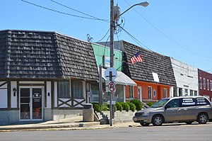
Roanoke, Illinois
Village in Illinois, United States
Distance: Approx. 137 meters
Latitude and longitude: 40.7975,-89.19972222
Roanoke is a village in Roanoke Township, Woodford County, Illinois, United States. The population was 1,960 at the 2020 census. It is part of the Peoria, Illinois Metropolitan Statistical Area.

Secor, Illinois
Village in Illinois, United States
Distance: Approx. 8334 meters
Latitude and longitude: 40.74111111,-89.13583333
Secor is a village in Clayton Township, Woodford County, Illinois, United States. The population was 373 at the 2010 census. It is part of the Peoria, Illinois Metropolitan Statistical Area.

Greene Township, Woodford County, Illinois
Township in Illinois, United States
Distance: Approx. 8542 meters
Latitude and longitude: 40.8,-89.1
Greene Township is located in Woodford County, Illinois at T27N, R1E. As of the 2010 census, its population was 483 and it contained 164 housing units.

Linn Township, Woodford County, Illinois
Township in Illinois, United States
Distance: Approx. 9675 meters
Latitude and longitude: 40.88333333,-89.21666667
Linn Township is located in Woodford County, Illinois at T28N, R1W. As of the 2010 census, its population was 287 and it contained 117 housing units. Linn Township was formed when it separated from its original township to create two new townships, the other being Clayton Township (T28N, R1E), on an unknown date.

Roanoke Township, Woodford County, Illinois
Township in Illinois, United States
Distance: Approx. 1332 meters
Latitude and longitude: 40.8,-89.21666667
Roanoke Township is located in Woodford County, Illinois at T27N, R1W. As of the 2010 census, its population was 2,558 and it contained 1,044 housing units. Roanoke Township includes within its boundaries the village of Roanoke, Illinois.

Benson Water Tower
United States historic place
Distance: Approx. 9069 meters
Latitude and longitude: 40.85097222,-89.12041667
The Benson Water Tower was a water tower located on Clayton Street in Benson, Illinois. The tower was built in 1891, in response to several serious fires in Benson; it supplied the village with water until 1985. The tall brick tower had a large wooden water tank on top.
Roanoke-Benson High School
Public school in the United States
Distance: Approx. 500 meters
Latitude and longitude: 40.80138889,-89.19916667
Roanoke-Benson High School is a comprehensive high school located at 208 West High Street, in Roanoke, Illinois. The school is a member of the Tri-County Conference, and compete under the name Rockets.
Weather in this IP's area
overcast clouds
-4 Celsius
-10 Celsius
-4 Celsius
-4 Celsius
1021 hPa
44 %
1021 hPa
992 hPa
10000 meters
5.51 m/s
8.69 m/s
353 degree
96 %