193.30.35.152 - IP Lookup: Free IP Address Lookup, Postal Code Lookup, IP Location Lookup, IP ASN, Public IP
Country:
Region:
City:
Location:
Time Zone:
Postal Code:
ISP:
ASN:
language:
User-Agent:
Proxy IP:
Blacklist:
IP information under different IP Channel
ip-api
Country
Region
City
ASN
Time Zone
ISP
Blacklist
Proxy
Latitude
Longitude
Postal
Route
db-ip
Country
Region
City
ASN
Time Zone
ISP
Blacklist
Proxy
Latitude
Longitude
Postal
Route
IPinfo
Country
Region
City
ASN
Time Zone
ISP
Blacklist
Proxy
Latitude
Longitude
Postal
Route
IP2Location
193.30.35.152Country
Region
oberosterreich
City
scharding
Time Zone
Europe/Vienna
ISP
Language
User-Agent
Latitude
Longitude
Postal
ipdata
Country
Region
City
ASN
Time Zone
ISP
Blacklist
Proxy
Latitude
Longitude
Postal
Route
Popular places and events near this IP address

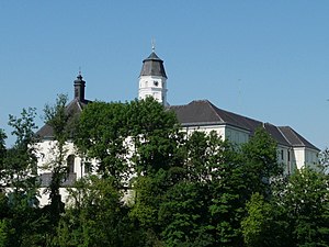
Vornbach Abbey
Distance: Approx. 1131 meters
Latitude and longitude: 48.46027778,13.42666667
Vornbach Abbey (German: Kloster Vornbach, sometimes spelt Formbach) was a Benedictine monastery in Neuhaus am Inn in Bavaria, Germany.
Suben Abbey
Prison in Austria
Distance: Approx. 4531 meters
Latitude and longitude: 48.4125,13.42972222
Suben Abbey (Stift Suben) was a monastery of the Augustinian Canons in Suben in Austria. In around 1050 the fortress that stood on the site, the property of the Counts of Formbach, was turned into a collegiate foundation by Tuta, daughter of Heinrich of Formbach, and wife of King Bela I of Hungary; it was established as a monastery in 1126. It had possessions in the Inn region, in Carinthia, Styria and the Wachau.

Rott (Inn, Neuhaus am Inn)
River in Bavaria, Germany
Distance: Approx. 861 meters
Latitude and longitude: 48.45333333,13.42555556
The Rott is a 111-kilometre-long (69 mi) river in Bavaria, Germany. It is a left tributary of the Inn. Its source is in the municipality Wurmsham in Lower Bavaria, between Landshut and Waldkraiburg.

Schärding
Municipality in Upper Austria, Austria
Distance: Approx. 608 meters
Latitude and longitude: 48.45694444,13.43166667
Schärding (German pronunciation: [ˈʃɛʁdɪŋ] | Bavarian name: Scharing) is a town in the northern Austrian state of Upper Austria, the capital of the district of the same name, and a major port on the Inn River. Historically, it was owned by the Wittelsbach family, which is reflected in the town's architecture. As of 1 January 2021, it had a population of 5,216.

Neuburg am Inn
Municipality in Bavaria, Germany
Distance: Approx. 5328 meters
Latitude and longitude: 48.5,13.45
Neuburg am Inn is a municipality in the district of Passau in Bavaria in Germany.
Neuhaus am Inn
Municipality in Bavaria, Germany
Distance: Approx. 1559 meters
Latitude and longitude: 48.46666667,13.43333333
Neuhaus is a municipality in the district of Passau in Bavaria in Germany.
Brunnenthal, Austria
Municipality in Upper Austria, Austria
Distance: Approx. 2661 meters
Latitude and longitude: 48.46666667,13.46666667
Brunnenthal is a municipality in the district of Schärding in the Austrian state of Upper Austria.
Sankt Florian am Inn
Municipality in Upper Austria, Austria
Distance: Approx. 2197 meters
Latitude and longitude: 48.43333333,13.44111111
Sankt Florian am Inn is a municipality in the district of Schärding in the Austrian state of Upper Austria.
Suben
Municipality in Upper Austria, Austria
Distance: Approx. 4044 meters
Latitude and longitude: 48.41666667,13.43333333
Suben is a municipality in the district of Schärding in the Austrian state of Upper Austria. It is not far from the Austrian-German border.

Schärding-Suben Airport
Airport in Austria
Distance: Approx. 5625 meters
Latitude and longitude: 48.40291667,13.44833333
Schärding-Suben Airport (German: Flugplatz Schärding-Suben, ICAO: LOLS) is a private use airport located 7 kilometres (4 mi) south of Schärding, Upper Austria, Austria.
Sulzbach (Rott)
River in Germany
Distance: Approx. 2252 meters
Latitude and longitude: 48.453,13.4067
Sulzbach is a river of Bavaria, Germany. It is a left tributary of the Rott near Neuhaus am Inn.
Battle of Schärding
1742 battle
Distance: Approx. 608 meters
Latitude and longitude: 48.45694444,13.43166667
The Battle of Schärding on 17 January 1742 took place during the War of the Austrian Succession near present German border. It ended with a victory for Khevenhüller's Austrian forces.
Weather in this IP's area
overcast clouds
1 Celsius
-3 Celsius
0 Celsius
1 Celsius
1016 hPa
98 %
1016 hPa
968 hPa
10000 meters
2.98 m/s
7.35 m/s
268 degree
100 %


