Country:
 Germany
Region:
City:
Latitude and Longitude:
Time Zone:
Postal Code:
IP information under different IP Channel
ip-api
Country
Region
City
ASN
Time Zone
ISP
Blacklist
Proxy
Latitude
Longitude
Postal
Route
IPinfo
Country
Region
City
ASN
Time Zone
ISP
Blacklist
Proxy
Latitude
Longitude
Postal
Route
MaxMind
Country
Region
City
ASN
Time Zone
ISP
Blacklist
Proxy
Latitude
Longitude
Postal
Route
Luminati
Country
DERegion
he
City
frankfurtammain
ASN
Time Zone
Europe/Berlin
ISP
Deutsche Boerse AG
Latitude
Longitude
Postal
db-ip
Country
Region
City
ASN
Time Zone
ISP
Blacklist
Proxy
Latitude
Longitude
Postal
Route
ipdata
Country
Region
City
ASN
Time Zone
ISP
Blacklist
Proxy
Latitude
Longitude
Postal
Route
Popular places and events near this IP address
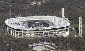
Waldstadion (Frankfurt)
Stadium in Frankfurt am Main, Germany
Distance: Approx. 1501 meters
Latitude and longitude: 50.068056,8.645806
The Waldstadion (German pronunciation: [ˈvalt.ʃtaːdi̯ɔn] , Forest Stadium), currently known as Deutsche Bank Park for sponsorship purposes, is a retractable roof sports stadium in Frankfurt, Hesse, Germany. The home stadium of the football club Eintracht Frankfurt, it was opened in 1925. The stadium has been upgraded several times since then; the most recent remodelling was its redevelopment as a football-only stadium in preparation for the 2005 FIFA Confederations Cup and 2006 FIFA World Cup.

Frankfurt City Forest
Forest district in the south of Frankfurt, Germany
Distance: Approx. 1687 meters
Latitude and longitude: 50.07083333,8.65833333
The Frankfurt City Forest or Frankfurter Stadtwald is a forest district in the south of Frankfurt am Main, Germany. There are also other forest areas spread out through the city.
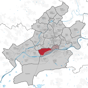
Gallus (Frankfurt am Main)
Quarter of Frankfurt am Main in Hesse, Germany
Distance: Approx. 2515 meters
Latitude and longitude: 50.10361111,8.64555556
Gallus (known as the Gallusviertel until 2007) is a quarter of Frankfurt am Main, Germany. It is part of the Ortsbezirk Innenstadt I and the location of the Frankfurt train station. The name Gallus originates from the German word "Galgen" (English: Gallows).

Max Planck Institute for Brain Research
Research institute in Frankfurt, Germany
Distance: Approx. 1511 meters
Latitude and longitude: 50.09305556,8.65138889
The Max Planck Institute for Brain Research is located in Frankfurt, Germany. It was founded as Kaiser Wilhelm Institute for Brain Research in Berlin 1914, moved to Frankfurt-Niederrad in 1962 and more recently in a new building in Frankfurt-Riedberg. It is one of 83 institutes in the Max Planck Society (Max Planck Gesellschaft).
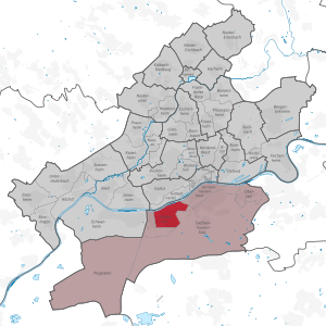
Niederrad
Quarter of Frankfurt am Main in Hesse, Germany
Distance: Approx. 814 meters
Latitude and longitude: 50.08833333,8.64361111
Niederrad is a quarter of Frankfurt am Main, Germany. It is part of the Ortsbezirk Süd and is subdivided into the Stadtbezirke Niederrad-Nord, Niederrad-Süd and the new Niederrad-West.
Tenovis
German telecommunications company
Distance: Approx. 1960 meters
Latitude and longitude: 50.09722222,8.62972222
Tenovis (formerly Deutsche Privat Telephon Gesellschaft, Telefonbau und Normalzeit, T&N, Telenorma and Bosch Telecom) was a large German telecommunications company first set up in 1899, who were acquired by Avaya in October 2004. The business has a staff force of more than 5,400 employees and maintains a presence in Austria, Belgium, France, Italy, Spain, Switzerland and the Netherlands. Tenovis announced its IPO in April 2004.

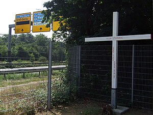
Frankfurt Stadion station
Railway station in Germany
Distance: Approx. 1572 meters
Latitude and longitude: 50.06805556,8.63305556
Frankfurt am Main Stadion station (German: Bahnhof Frankfurt am Main Stadion) is a junction railway station in Frankfurt, Germany. Stadion station is close to Frankfurt's main football stadium, the Deutsche Bank Park. Prior to 1937 it was called Frankfurt-Goldstein and from then until 24 December 2005 it was called Frankfurt-Sportfeld ("Sport field").

Frankfurt Galluswarte station
Railway station in Frankfurt, Germany
Distance: Approx. 2597 meters
Latitude and longitude: 50.10444444,8.64416667
Frankfurt (Main) Galluswarte station (German: Bahnhof Frankfurt (Main) Galluswarte) is a railway station located in the Gallus district of Frankfurt, Germany.

Luderbach
River in Germany
Distance: Approx. 1795 meters
Latitude and longitude: 50.095,8.6541
Luderbach (also: Königsbach) is a river of Hesse, Germany. It flows into the Main in Frankfurt.

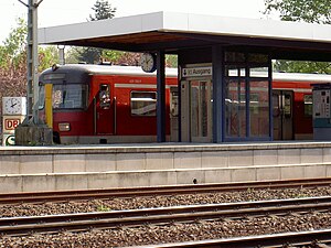
Frankfurt-Niederrad station
Railway halt in Niederrad, Germany
Distance: Approx. 305 meters
Latitude and longitude: 50.08055556,8.63694444
Frankfurt-Niederrad station is a station in the district of Niederrad in the southwest of Frankfurt am Main in the German state of Hesse.
Frankfurt-Louisa station
Railway station in Frankfurt, Germany
Distance: Approx. 2100 meters
Latitude and longitude: 50.083176,8.670337
Frankfurt-Louisa station is a station on the Rhine-Main S-Bahn in the city of Frankfurt in the German state of Hesse. It is also on the Main-Neckar Railway between Frankfurt and Heidelberg.The station is classified by Deutsche Bahn as a category 4 station.
1983 Rhein-Main Starfighter crash
Distance: Approx. 1511 meters
Latitude and longitude: 50.06958889,8.65204722
The 1983 Rhein-Main Starfighter crash happened on 22 May 1983, in connection with an air show at the Rhein-Main Air Base. A Canadian Armed Forces Canadair CF-104 Starfighter crashed on a nearby highway, killing six.
Weather in this IP's area
clear sky
19 Celsius
19 Celsius
18 Celsius
20 Celsius
1011 hPa
92 %
1011 hPa
999 hPa
10000 meters
2.24 m/s
190 degree
06:51:20
19:55:04