Country:
 Germany
Region:
City:
Latitude and Longitude:
Time Zone:
Postal Code:
IP information under different IP Channel
ip-api
Country
Region
City
ASN
Time Zone
ISP
Blacklist
Proxy
Latitude
Longitude
Postal
Route
IPinfo
Country
Region
City
ASN
Time Zone
ISP
Blacklist
Proxy
Latitude
Longitude
Postal
Route
MaxMind
Country
Region
City
ASN
Time Zone
ISP
Blacklist
Proxy
Latitude
Longitude
Postal
Route
Luminati
Country
DERegion
he
City
badvilbel
ASN
Time Zone
Europe/Berlin
ISP
Deutsche Boerse AG
Latitude
Longitude
Postal
db-ip
Country
Region
City
ASN
Time Zone
ISP
Blacklist
Proxy
Latitude
Longitude
Postal
Route
ipdata
Country
Region
City
ASN
Time Zone
ISP
Blacklist
Proxy
Latitude
Longitude
Postal
Route
Popular places and events near this IP address
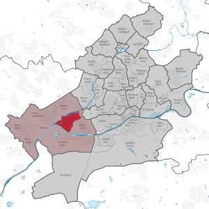
Nied (Frankfurt am Main)
Quarter of Frankfurt am Main in Hesse, Germany
Distance: Approx. 2344 meters
Latitude and longitude: 50.09972222,8.56472222
Nied is a quarter of Frankfurt am Main, Germany. It is part of the Ortsbezirk West and is subdivided into the Stadtbezirke Nied-Nord and Nied-Süd.

Sossenheim
Quarter of Frankfurt am Main in Hesse, Germany
Distance: Approx. 426 meters
Latitude and longitude: 50.11888889,8.56583333
Sossenheim is a quarter of Frankfurt am Main, Germany. It is part of the Ortsbezirk West and is subdivided into the Stadtbezirke Sossenheim-Ost and Sossenheim-West. Sossenheim has been a district of Frankfurt since 1928 and makes part of the northwest border of the city.

Unterliederbach
Quarter of Frankfurt am Main in Hesse, Germany
Distance: Approx. 2345 meters
Latitude and longitude: 50.11083333,8.53138889
Unterliederbach is a quarter of Frankfurt am Main, Germany. It is part of the Ortsbezirk West and is subdivided into the Stadtbezirke Unterliederbach-Ost, Unterliederbach-Mitte and Unterliederbach-West.

Nidda (river)
River in Germany
Distance: Approx. 2443 meters
Latitude and longitude: 50.09944444,8.55138889
The Nidda is a right-bank tributary of the river Main in Hesse, Germany. It springs from the Vogelsberg on the Taufstein mountain range near the town of Schotten. It flows through the Niddastausee dam, and then through the towns of Nidda, Niddatal, Karben, and Bad Vilbel.
1. FC Eschborn
German football club
Distance: Approx. 2160 meters
Latitude and longitude: 50.14,8.56055556
1. FC Eschborn was a German association football club which played in Eschborn, a town close to Frankfurt, Hesse.

Sulzbach, Hesse
Municipality in Hesse, Germany
Distance: Approx. 2402 meters
Latitude and longitude: 50.13333333,8.53333333
Sulzbach is a municipality in the Main-Taunus district, in Hesse, Germany and part of the Frankfurt Rhein-Main urban area.

Arboretum Main-Taunus
Distance: Approx. 1904 meters
Latitude and longitude: 50.135,8.54611111
The Arboretum Main-Taunus is an arboretum on an area of 76 hectares (190 acres) located southwest of Eschborn, Hesse, Germany. The arboretum lies close to Frankfurt am Main.

Frankfurt-Höchst station
Railway station in Frankfurt, Germany
Distance: Approx. 2390 meters
Latitude and longitude: 50.1025,8.5425
The Frankfurt-Höchst station is an important station in the Frankfurt district of Höchst and is the second largest station in the city with twelve tracks. It is currently mainly used by S-Bahn, suburban and regional services.

Schwalbach (Sulzbach)
River in Germany
Distance: Approx. 1680 meters
Latitude and longitude: 50.12888889,8.54083333
Schwalbach is a river of Hesse, Germany. It is formed in Schwalbach am Taunus at the confluence of the rivers Sauerbornsbach and Waldbach. It is a left tributary of the Sulzbach, into which it flows near Sulzbach.

Sulzbach (Nidda)
River in Hesse, Germany
Distance: Approx. 1394 meters
Latitude and longitude: 50.1087,8.5666
Sulzbach is a river of Hesse, Germany. It is a right tributary of the Nidda, into which it flows in the western part of Frankfurt, close to its discharge into the Main. It flows through Bad Soden and Sulzbach.

Frankfurt-Nied station
Railway station in Frankfurt, Germany
Distance: Approx. 2097 meters
Latitude and longitude: 50.10277778,8.57
Frankfurt-Nied station is a station in the district of Nied of the city of Frankfurt in the German state of Hesse on the Main-Lahn Railway. It is now served only by lines S1 and S 2 of the Rhine-Main S-Bahn. The station is classified by Deutsche Bahn as a category 5 station.
Helene-Lange-Schule (Frankfurt)
School in Germany
Distance: Approx. 1560 meters
Latitude and longitude: 50.1072,8.5541
Helene-Lange-Schule is a modern language gymnasium (another term for secondary school) in Frankfurt am Main, Hessen, Germany. The headmaster is Marc Peschke. In 2009 there were 567 students.
Weather in this IP's area
light rain
16 Celsius
15 Celsius
15 Celsius
16 Celsius
1014 hPa
81 %
1014 hPa
1001 hPa
10000 meters
1.54 m/s
150 degree
20 %
07:52:52
18:28:31