Country:
Region:
City:
Latitude and Longitude:
Time Zone:
Postal Code:
IP information under different IP Channel
ip-api
Country
Region
City
ASN
Time Zone
ISP
Blacklist
Proxy
Latitude
Longitude
Postal
Route
Luminati
Country
ASN
Time Zone
Europe/Berlin
ISP
CW Vodafone Group PLC
Latitude
Longitude
Postal
IPinfo
Country
Region
City
ASN
Time Zone
ISP
Blacklist
Proxy
Latitude
Longitude
Postal
Route
db-ip
Country
Region
City
ASN
Time Zone
ISP
Blacklist
Proxy
Latitude
Longitude
Postal
Route
ipdata
Country
Region
City
ASN
Time Zone
ISP
Blacklist
Proxy
Latitude
Longitude
Postal
Route
Popular places and events near this IP address

Hannover Messe
Trade fair
Distance: Approx. 1526 meters
Latitude and longitude: 52.3269,9.8092
The Hannover Messe (HM; "Hanover Fair") is one of the world's largest trade fairs, dedicated to the topic of industry development. It is organized by Deutsche Messe AG and held on the Hanover Fairground in Hanover, Germany. The fair attracts typically 100.000-200.000 visitors per year.

Mannesmann Tower (Hannover)
Distance: Approx. 1732 meters
Latitude and longitude: 52.32805556,9.80388889
The Mannesmann Tower was a tower on the Hanover fairground in Hanover, Germany. It was a free-standing lattice tower with a triangular cross-section, standing 120 metres (390 ft) high and carried the logo of the Hanover Fair, which erected the tower in 1954, at a height of 89.8 metres (295 ft). The Mannesmann Tower hosted aerials for mobile phone services.

ZAG-Arena
Arena in Hanover, Germany
Distance: Approx. 1657 meters
Latitude and longitude: 52.3225,9.81666667
ZAG-Arena (formerly Preussag Arena and TUI Arena) is an arena in Hanover, Germany. The arena opened in 2000 and holds 10,767, during hockey or handball matches and up to 14,000, during concerts. It is the biggest indoor-venue in the Hanover Region and most major concerts are held there.
Hanover Fairground
Exhibition area in Hanover
Distance: Approx. 2074 meters
Latitude and longitude: 52.32388889,9.80277778
The Hanover Fairground (in German: Messegelände Hannover) is an exhibition area in the Mittelfeld district of Hanover, Germany. Featuring 392,453 m² (4.2 million sq.ft.) of covered indoor space, 58,000 m² (624,306 sq ft) of open-air space, 24 halls and pavilions, and a convention center with 35 function rooms, it is the largest exhibition ground in the world.
Heil- und Giftpflanzengarten der Tierärztlichen Hochschule Hannover
Distance: Approx. 2261 meters
Latitude and longitude: 52.3539,9.8085
The Heil- und Giftpflanzengarten der Tierärztlichen Hochschule Hannover (5000 m2) is a botanical garden specializing in medicinal and poisonous plants. It is maintained by the Tierärztlichen Hochschule Hannover (University of Veterinary Medicine Hanover), and located on campus at Bünteweg 17D, Hanover, Lower Saxony, Germany. The garden contains over 300 taxa of medicinal and poisonous plants, with nearly 100 information displays describing their appearance, preparation, and effects.

CeBIT
Computer expo
Distance: Approx. 1524 meters
Latitude and longitude: 52.32694444,9.80916667
CeBIT was a computer expo which, at its peak, was the largest and most internationally representative. The trade fair was held each year on the Hanover fairground, the world's largest fairground, in Hanover, Germany. In its day, it was considered a barometer of current trends and a measure of the state of the art in information technology.

Kronsberg
Distance: Approx. 1165 meters
Latitude and longitude: 52.32722222,9.83361111
Kronsberg is a hill about six kilometres in length and dominates the surrounding areas up to 30 meters, just outside Hanover. The highest point on the Kronsberg is the scenic hill with 118 meters (387 ft). The only taller hill in the city is the "Monte Müllo" landfill site, standing at 122 metres (400 ft).

Kirchrode-Bemerode-Wülferode
Borough of Hanover in Lower Saxony, Germany
Distance: Approx. 1265 meters
Latitude and longitude: 52.34666667,9.83333333
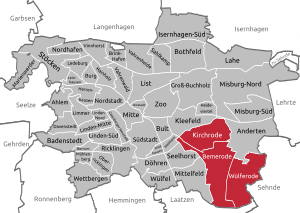
Kirchrode-Bemerode-Wülferode (Eastphalian: Kerkreoe-Beimeroe-Wülferoe) is the sixth borough of Hanover. As of 2020, it has 32,625 inhabitants and consists of the quarters Kirchrode (12,222 inhabitants), Bemerode (19,453 inhabitants) and Wülferode (950 inhabitants). Since 2011, the SPD politician Bernd Rödel is mayor of the borough.

ConventionCamp
Distance: Approx. 1804 meters
Latitude and longitude: 52.323314,9.809718
Convention Camp is a conference on digital future, social media and web culture. It takes place annually since 2008 at Hanover fairground and is the largest BarCamp in Germany.
Evangelical Church Centre Kronsberg
Distance: Approx. 770 meters
Latitude and longitude: 52.33901,9.83585
The Evangelical Kronsberg Church Centre (German: Evangelisches Kirchenzentrum Kronsberg) is a place of worship in the Kronsberg neighbourhood of Hanover, in Lower Saxony, Germany. The Church belongs to the St. Johannis-Kirchengemeinde Bemerode parish, within the Evangelical-Lutheran Church of Hanover.

St. Maria Angelica
Distance: Approx. 2376 meters
Latitude and longitude: 52.357721,9.826949
The Parish Church of St. Maria Angelica in Hanover, Germany, is the church of the Old Catholic Parish of Hanover/Southern Lower Saxony (Pfarrgemeinde Hannover/Niedersachsen-Süd). The church, which has been in use since 2010 and was consecrated on 3 September 2011, is located on a property that originally belonged to the neighbouring Lutheran parish of St.

Zu den heiligen Engeln
Church in Hanover-Kirchrode, Germany
Distance: Approx. 1989 meters
Latitude and longitude: 52.35416667,9.82222222
Zu den heiligen Engeln (To the Holy Angels) is a Catholic parish and church in Hanover-Kirchrode, Lower Saxony, Germany. The church was built in 1964 on a design by Josef Bieling, and was remodeled in 2014. It is now the parish church of a larger parish, serving the district Kirchrode-Bemerode-Wülferode.
Weather in this IP's area
broken clouds
9 Celsius
7 Celsius
8 Celsius
10 Celsius
1024 hPa
86 %
1024 hPa
1014 hPa
10000 meters
2.57 m/s
110 degree
75 %
07:24:16
16:44:19
