Country:
 Saint Martin (France)
Region:
City:
Latitude and Longitude:
Time Zone:
Postal Code:
IP information under different IP Channel
ip-api
Country
Region
City
ASN
Time Zone
ISP
Blacklist
Proxy
Latitude
Longitude
Postal
Route
IPinfo
Country
Region
City
ASN
Time Zone
ISP
Blacklist
Proxy
Latitude
Longitude
Postal
Route
MaxMind
Country
Region
City
ASN
Time Zone
ISP
Blacklist
Proxy
Latitude
Longitude
Postal
Route
Luminati
Country
 FR
FRASN
Time Zone
Europe/Paris
ISP
Orange
Latitude
Longitude
Postal
db-ip
Country
Region
City
ASN
Time Zone
ISP
Blacklist
Proxy
Latitude
Longitude
Postal
Route
ipdata
Country
Region
City
ASN
Time Zone
ISP
Blacklist
Proxy
Latitude
Longitude
Postal
Route
Popular places and events near this IP address

Saint Martin (island)
Small island in the Caribbean
Distance: Approx. 3539 meters
Latitude and longitude: 18.06,-63.05
Saint Martin (French: Saint-Martin; Dutch: Sint Maarten) is an island in the northeast Caribbean, approximately 300 km (190 mi) east of Puerto Rico. The 87 km2 (34 sq mi) island is divided roughly 60:40 between the French Republic (53 km2 or 20 sq mi) and the Kingdom of the Netherlands (34 km2 or 13 sq mi), but the Dutch part is more populated than the French part. The division dates to 1648.

Stade Alberic Richards
Distance: Approx. 1192 meters
Latitude and longitude: 18.06166667,-63.09194444
Stade Alberic Richards is a multi-use stadium in Sandy Ground, Saint Martin. It is currently used mostly for football matches. The stadium holds 2,600 people.

Marigot, Saint Martin
Largest city in the Collectivity of Saint Martin
Distance: Approx. 624 meters
Latitude and longitude: 18.0731,-63.0822
Marigot (French pronunciation: [maʁiɡo]) is the main town and capital in the French Collectivity of Saint Martin.

Collectivity of Saint Martin
French overseas collectivity, part of the island of Saint Martin in the Lesser Antilles
Distance: Approx. 2534 meters
Latitude and longitude: 18.07527778,-63.06
The Collectivity of Saint Martin (French: Collectivité de Saint-Martin), commonly known as simply Saint Martin (Saint-Martin, French pronunciation: [sɛ̃ maʁtɛ̃]), is an overseas collectivity of France in the West Indies in the Caribbean, on the northern half of the island of Saint Martin, as well as some smaller adjacent islands. Saint Martin is separated from the island of Anguilla by the Anguilla Channel. Its capital is Marigot.

Simpson Bay Lagoon
Lagoon on the island Saint Martin in the Caribbean
Distance: Approx. 3293 meters
Latitude and longitude: 18.052,-63.109
Simpson Bay Lagoon (also spelt Simson Bay Lagoon, or referred to simply as The Great Pond) is one of the largest inland lagoons in the West Indies of the Caribbean. It is located on the island of Saint Martin. The border between the French and Dutch halves of the island runs across the centre of the lagoon.
American University of Integrative Sciences
Offshore medical school in Barbados
Distance: Approx. 3666 meters
Latitude and longitude: 18.034668,-63.085218
The American University of Integrative Sciences (AUIS), is a private for-profit offshore medical school with a single campus located in Barbados. Founded in 1999, it was formerly known as the University of Sint Eustatius School of Medicine (USESOM). For a period, the school was based in Sint Maarten, where it was taken over by IEMR LLC, a US-based company.
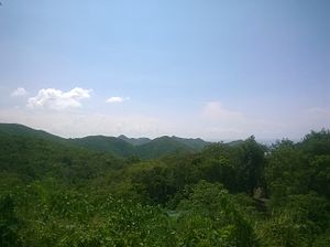
Pic Paradis
Mountain of Saint Martin in the Caribbean
Distance: Approx. 3615 meters
Latitude and longitude: 18.0775,-63.05
Pic Paradis or Pic du Paradis (Paradise Peak in English) is the highest point in a chain of hills in the Collectivity of Saint Martin, an overseas collectivity of France on the island of Saint Martin, located in the Caribbean, with an elevation of 424 m (1,391 ft), making it the highest point on the island.
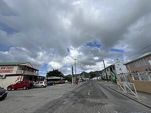
Sandy Ground, Saint Martin
Place in Saint Martin, France
Distance: Approx. 1804 meters
Latitude and longitude: 18.05888889,-63.09694444
Sandy Ground (French: Sol Sableux) is a coastal community on the French side of the Caribbean island of Saint Martin/Saint Maarten. Sandy Ground is known for its luxury hotels, nature, and beaches.

Mary Star of the Sea Church, Simpson Bay
Church in Sint Maarten, Netherlands
Distance: Approx. 3568 meters
Latitude and longitude: 18.0387,-63.0973
The Mary Star of the Sea Church (Dutch: Maria Sterre der Zee kerk) is a religious building of the Catholic Church located in the town of Simpson Bay in St. Maarten in the Dutch part of the Caribbean island of St. Martin in the Lesser Antilles, a constituent country of the Kingdom of the Netherlands.

St. Martin of Tours' Church, Marigot
Church in Saint Martin, France
Distance: Approx. 262 meters
Latitude and longitude: 18.0693,-63.0841
St. Martin of Tours Church (French: Église de Saint Martin de Tours) is a Roman Catholic parish of the Diocese of Basse-Terre located on rue du Fort Louis in the city of Marigot, St. Martin in the Lesser Antilles.

Concordia, Saint Martin
Place in Saint Martin, France
Distance: Approx. 958 meters
Latitude and longitude: 18.06,-63.07805556
Concordia is a small town on the French side of the island of Saint Martin in the Caribbean. It lies directly to the south of the French side's capital Marigot. The town has a population of 5,639 residents, as of 2016, making it the third most-populous town on the French side, behind Marigot and Grand Case.

Fort Louis (Saint Martin)
Distance: Approx. 477 meters
Latitude and longitude: 18.070774,-63.085404
Fort Louis (or Fort St. Louis) is a historic French military fort on the Caribbean island of Saint Martin. It is located in Marigot, the capital of the French side of the island, overlooking Marigot Bay.
Weather in this IP's area
light rain
28 Celsius
34 Celsius
27 Celsius
28 Celsius
1009 hPa
94 %
1009 hPa
1007 hPa
10000 meters
3.09 m/s
10 degree
20 %
06:03:28
17:57:29