Country:
Region:
City:
Latitude and Longitude:
Time Zone:
Postal Code:
IP information under different IP Channel
ip-api
Country
Region
City
ASN
Time Zone
ISP
Blacklist
Proxy
Latitude
Longitude
Postal
Route
Luminati
Country
Region
eng
City
wallington
ASN
Time Zone
Europe/London
ISP
Vodafone Limited
Latitude
Longitude
Postal
IPinfo
Country
Region
City
ASN
Time Zone
ISP
Blacklist
Proxy
Latitude
Longitude
Postal
Route
db-ip
Country
Region
City
ASN
Time Zone
ISP
Blacklist
Proxy
Latitude
Longitude
Postal
Route
ipdata
Country
Region
City
ASN
Time Zone
ISP
Blacklist
Proxy
Latitude
Longitude
Postal
Route
Popular places and events near this IP address

Normanton, Derby
Suburb of Derby, England
Distance: Approx. 1954 meters
Latitude and longitude: 52.899,-1.483
Normanton is an inner city suburb and ward of the city of Derby in Derbyshire, England, situated approximately 2 miles (3.2 km) south of the city centre. Neighbouring suburbs include Littleover, Pear Tree, Rose Hill and Sunny Hill. The original village of Normanton-by-Derby, which now forms the southern part of the suburb, dates back to the medieval period.

Peartree railway station
Railway station in Derbyshire, England
Distance: Approx. 1981 meters
Latitude and longitude: 52.89728,-1.47285
Peartree railway station is a railway station serving the areas of Pear Tree, Normanton and Osmaston in the city of Derby, England. It is one of three stations remaining open in the city (the others being the main Derby station and Spondon), and is situated about one mile south of Derby station on the main line to Birmingham New Street. For a short period, Derby - Birmingham local services called at Peartree, but it is now served by four trains each way on weekdays on the Crewe–Derby line, a community rail line also known as the North Staffordshire line.
Sunny Hill, Derby
Human settlement in England
Distance: Approx. 1159 meters
Latitude and longitude: 52.89,-1.497
Sunny Hill (or Sunnyhill) is a southern suburb of the city of Derby, England, situated mainly along the Stenson Road (which goes out to the hamlet of Stenson, on the Trent and Mersey Canal). It lies between the Derby City districts of Normanton and Littleover, and, to the south, Sinfin, and the parish of Stenson Fields in South Derbyshire district.

Stenson Fields
Human settlement in England
Distance: Approx. 1202 meters
Latitude and longitude: 52.875049,-1.5010393
Stenson Fields is a semi-rural suburban housing development and civil parish in the South Derbyshire district of Derbyshire, England. The parish is contiguous with Sinfin, a southern area of Derby, but is outside the city boundary. Stenson Fields is located approximately 3 miles (4.8 km) south-southwest of Derby city centre.

Sinfin
Human settlement in England
Distance: Approx. 156 meters
Latitude and longitude: 52.883,-1.487
Sinfin is a suburb of Derby, England, 3 miles (4.8 km) southwest of the city centre on its southern outskirts. The ward, which includes Osmaston as well as Sinfin itself, had a population of 15,128 in 2011. Historically, Sinfin and Osmaston were separate villages before being swallowed up by the expansion of Derby.
Arleston
Human settlement in England
Distance: Approx. 2252 meters
Latitude and longitude: 52.863,-1.5
Arleston is a hamlet in the South Derbyshire district of Derbyshire, England, about 4 miles (6.4 km) south of the centre of Derby. It is located 1.2 miles (1.9 km) northwest of Barrow upon Trent and is part of that village's civil parish. The Trent and Mersey Canal passes through Arleston.

Sinfin Central railway station
Former railway station in Derbyshire, England
Distance: Approx. 1327 meters
Latitude and longitude: 52.887473,-1.469616
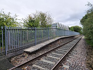
Sinfin Central railway station served the suburb of Sinfin in the city of Derby, Derbyshire, England.
Sinfin North railway station
Former railway station in Derby, England
Distance: Approx. 1444 meters
Latitude and longitude: 52.892755,-1.475828
Sinfin North Station was a railway station on the Sinfin branch in Derby, England. It opened on 4 October 1976 and closed on 17 May 1993. The station was built by British Rail.
2012 Derby arson attack
UK crime that resulted in the death of 6 children
Distance: Approx. 1869 meters
Latitude and longitude: 52.89525,-1.4706
The 2012 Derby arson attack occurred on 11 May 2012 at 18 Victory Road, a semi-detached house in a residential street in Osmaston (erroneously reported by the press as being in Allenton), Derby, Derbyshire, England. Five children died at the scene, while the oldest later died in hospital. The parents of the children, Mairead and Mick Philpott, along with their friend Paul Mosley, were later arrested and charged with murder.
City of Derby Academy
Academy in Derby, Derbyshire, England
Distance: Approx. 767 meters
Latitude and longitude: 52.8754,-1.4918
City of Derby Academy (formerly Sinfin Community School) is a mixed secondary school located in the Sinfin area of Derby in the English county of Derbyshire. Previously administered by Derby City Council, Sinfin Community School converted to academy status on 1 June 2013 and was renamed City of Derby Academy. The school is now part of QEGSMAT (Multi Academy Trust) City of Derby Academy offers GCSEs and vocational subjects as programmes of study for pupils.

Normanton Barracks
Distance: Approx. 1808 meters
Latitude and longitude: 52.89691,-1.47784
Normanton Barracks was a military installation in Normanton, Derby, England.

St Giles' Church, Normanton, Derby
Church in Derby, England
Distance: Approx. 1847 meters
Latitude and longitude: 52.89819167,-1.48635556
St Giles’ Church, Normantion, Derby is a locally listed parish church in the Church of England in Normanton, Derby.
Weather in this IP's area
broken clouds
8 Celsius
6 Celsius
7 Celsius
8 Celsius
1027 hPa
86 %
1027 hPa
1021 hPa
10000 meters
3.09 m/s
120 degree
75 %
07:16:54
16:22:35
