Country:
Region:
City:
Latitude and Longitude:
Time Zone:
Postal Code:
IP information under different IP Channel
ip-api
Country
Region
City
ASN
Time Zone
ISP
Blacklist
Proxy
Latitude
Longitude
Postal
Route
Luminati
Country
Region
eng
City
cityofwestminster
ASN
Time Zone
Europe/London
ISP
Vodafone Limited
Latitude
Longitude
Postal
IPinfo
Country
Region
City
ASN
Time Zone
ISP
Blacklist
Proxy
Latitude
Longitude
Postal
Route
db-ip
Country
Region
City
ASN
Time Zone
ISP
Blacklist
Proxy
Latitude
Longitude
Postal
Route
ipdata
Country
Region
City
ASN
Time Zone
ISP
Blacklist
Proxy
Latitude
Longitude
Postal
Route
Popular places and events near this IP address

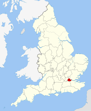
County of London
County of England between 1889 and 1965
Distance: Approx. 147 meters
Latitude and longitude: 51.5,-0.1
The County of London was a county of England from 1889 to 1965, corresponding to the area known today as Inner London. It was created as part of the general introduction of elected county government in England, by way of the Local Government Act 1888. The Act created an administrative County of London, which included within its territory the City of London.

London metropolitan area
Region of England
Distance: Approx. 147 meters
Latitude and longitude: 51.5,-0.1
The London metropolitan area is the metropolitan area of London, England. It has several definitions, including the London Travel to Work Area, and usually consists of the London urban area, settlements that share London's infrastructure, and places from which it is practicable to commute to work in London. It is also known as the London commuter belt, or Southeast metropolitan area.

London Fire Brigade
Fire and Rescue service in London
Distance: Approx. 238 meters
Latitude and longitude: 51.50335,-0.09862
The London Fire Brigade (LFB) is the fire and rescue service for London, the capital of the United Kingdom. It was formed by the Metropolitan Fire Brigade Act 1865 (28 & 29 Vict. c.

Southwark Bridge Road
Road in Southwark, London
Distance: Approx. 88 meters
Latitude and longitude: 51.50135,-0.09835
Southwark Bridge Road is a road in Southwark, London, England, between Newington Causeway near Elephant and Castle and Southwark Bridge across the River Thames, leading to the City of London, in a meandering route. The road was created by connecting a series of other streets to provide access from the south to Southwark Bridge in 1819, which as a private venture was not able to use the publicly financed road system which had been created to improve access from the south to the City and the Westminster areas by the building of Westminster Bridge and Blackfriars Bridge in the late 18th Century which junction of routes combine at St George's Circus. This connection did not come about until the creation of Southwark Street in the 1880s.
London Fire Brigade Museum
Firefighting museum in London, England
Distance: Approx. 130 meters
Latitude and longitude: 51.50194444,-0.09805556
The London Fire Brigade Museum (temporarily housed at The Workshop, Lambeth High Street) covers the history of firefighting since 1666 (the date of the Great Fire of London). The museum houses old fire appliances and other equipment.

King's Bench Prison
Former prison in Southwark, London
Distance: Approx. 205 meters
Latitude and longitude: 51.4998,-0.0979
The King's Bench Prison was a prison in Southwark, south London, England, from medieval times until it closed in 1880. It took its name from the King's Bench court of law in which cases of defamation, bankruptcy and other misdemeanours were heard; as such, the prison was often used as a debtor's prison until the practice was abolished in the 1860s. In 1842, it was renamed the Queen's Bench Prison, and became the Southwark Convict Prison in 1872.
Borough Road railway station
Disused railway station in Newington, London
Distance: Approx. 256 meters
Latitude and longitude: 51.499,-0.0997
Borough Road was a mainline railway station in Southwark, south London, located on Borough Road, close to the location Borough Underground station.

Blackwing Studios
Distance: Approx. 248 meters
Latitude and longitude: 51.503221,-0.097817
Blackwing Studios was an English recording studio, most notable for early Depeche Mode and Yazoo recordings in the early 1980s.

Lant Street
Street in Southwark, London
Distance: Approx. 240 meters
Latitude and longitude: 51.50119,-0.09616
Lant Street is a street south of Marshalsea Road in Southwark, south London, England.

Blackfriars Crown Court
Judicial building in London, England
Distance: Approx. 136 meters
Latitude and longitude: 51.50251,-0.09993
Blackfriars Crown Court was a Crown Court centre which dealt with criminal cases at 1–15 Pocock Street, London SE1. It is located in Southwark a short distance from Blackfriars Road, from which it takes its name.

Africa Centre, London
UK organization (founded 1964)
Distance: Approx. 229 meters
Latitude and longitude: 51.50298,-0.10153
The Africa Centre, London was founded in 1964 at 38 King Street, Covent Garden, where over the years it held many art exhibitions, conferences, lectures, and a variety of cultural events, as well as housing a gallery, meeting halls, restaurant, bar and bookshop. The Africa Centre closed its original venue in 2013, and now has a permanent home at 66 Great Suffolk Street, Southwark, south London. It is a registered charity.

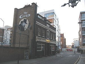
The Gladstone Arms
Distance: Approx. 218 meters
Latitude and longitude: 51.50086,-0.09656
The Gladstone Arms is a public house in Lant Street in the Borough – the Southwark district of London. It is also known as The Glad. Built on the site of a Victorian pub, the current building was constructed in the 1920s.
Weather in this IP's area
overcast clouds
9 Celsius
7 Celsius
7 Celsius
10 Celsius
1026 hPa
86 %
1026 hPa
1025 hPa
7000 meters
2.68 m/s
5.81 m/s
128 degree
100 %
07:06:49
16:21:35
