Country:
Region:
City:
Latitude and Longitude:
Time Zone:
Postal Code:
IP information under different IP Channel
ip-api
Country
Region
City
ASN
Time Zone
ISP
Blacklist
Proxy
Latitude
Longitude
Postal
Route
Luminati
Country
ASN
Time Zone
Europe/Moscow
ISP
DpkgSoft International Limited
Latitude
Longitude
Postal
IPinfo
Country
Region
City
ASN
Time Zone
ISP
Blacklist
Proxy
Latitude
Longitude
Postal
Route
db-ip
Country
Region
City
ASN
Time Zone
ISP
Blacklist
Proxy
Latitude
Longitude
Postal
Route
ipdata
Country
Region
City
ASN
Time Zone
ISP
Blacklist
Proxy
Latitude
Longitude
Postal
Route
Popular places and events near this IP address

St. Nicholas Church, Hamburg
Church in Hamburg
Distance: Approx. 267 meters
Latitude and longitude: 53.5475,9.99055556
The Church of St. Nicholas (German: St.-Nikolai-Kirche) was a Gothic Revival cathedral that was formerly one of the five Lutheran Hauptkirchen (main churches) in the city of Hamburg, Germany. The original chapel, a wooden building, was completed in 1195.

Siege of Hamburg
1813–1814 siege during the War of the Sixth Coalition
Distance: Approx. 287 meters
Latitude and longitude: 53.55,9.98333333
The siege of Hamburg was a military engagement of the War of the Sixth Coalition fought between French and Sixth Coalition forces in Hamburg. After being freed from Napoleonic rule by advancing Cossacks and other following Coalition troops it was once more occupied by Marshal Davout's French XIII Corps on 28 May 1813, at the height of the German Campaign during the War of the Sixth Coalition from French rule and occupation. Ordered to hold the city at all costs, Davout launched a characteristically energetic campaign against a similar numbered Army of the North made up of Prussian and other Coalition troops under the command of Count von Wallmoden-Gimborn, winning a number of minor engagements.

Stadthausbrücke station
Railway station in Hamburg, Germany
Distance: Approx. 66 meters
Latitude and longitude: 53.54916667,9.98638889
Stadthausbrücke is an underground railway station, on the City S-Bahn line of the Hamburg S-Bahn. The station is located in New Town quarter of the Hamburg borough of Mitte (centre), Germany. The station is managed by DB Station&Service.

Segelclub Rhe
Distance: Approx. 287 meters
Latitude and longitude: 53.55,9.98333333
Segelclub Rhe (Sailing Club Rhe) is the oldest yacht club in Germany. It was established in 1855 in Königsberg, East Prussia.

Norddeutscher Regatta Verein
Yacht club in Germany
Distance: Approx. 287 meters
Latitude and longitude: 53.55,9.98333333
Norddeutscher Regatta Verein (NRV), approx. meaning "North German Regatta Club", is a yacht club in Germany. This club is based in Uhlenhorst, Hamburg, Germany; the clubhouse is located at Hamburg's Lake Außenalster.

Hamburger Segel-Club
Yacht club in Hamburg, Germany
Distance: Approx. 287 meters
Latitude and longitude: 53.55,9.98333333
The Hamburger Segel-Club (Hamburg Sailing Club) (HSC), is one of the oldest and most active sailing clubs in Germany. The club is located by the shores of Lake Außenalster, in the heart of the Free and Hanseatic City of Hamburg. HSC is one of the organizers of the Kiel Week together with the Yacht Club of Kiel, the Verein Seglerhaus am Wannsee and the Norddeutscher Regattaverein.
Fleetstreet
Theatre in Hamburg
Distance: Approx. 200 meters
Latitude and longitude: 53.54861111,9.98416667
Fleetstreet is a theatre in Hamburg, Germany.

Hamburg Stock Exchange
Stock exchange in Hamburg, Germany
Distance: Approx. 279 meters
Latitude and longitude: 53.5497,9.9911
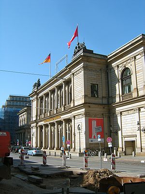
The Hamburg Stock Exchange (German: Hamburger Börse) is the oldest stock exchange in Germany. It was founded in 1558 in the Free and Hanseatic city of Hamburg. Four different individual exchanges now exist under its umbrella: the Insurance Exchange, Grain Exchange, Coffee Exchange, along with the General Exchange.
Hamburg Chamber of Commerce
Distance: Approx. 263 meters
Latitude and longitude: 53.54972222,9.99083333
The Hamburg Chamber of Commerce (Handelskammer Hamburg), originally named the Commercial Deputation (Commerz-Deputation), is the chamber of commerce for the city state of Hamburg, and was founded in 1665. Hamburg has for centuries been a commercial centre of Northern Europe, and the Hamburg Chamber of Commerce currently has 160,000 companies as its members. It was traditionally one of the three main political bodies of Hamburg.

Rödingsmarkt station
Railway station in Hamburg, Germany
Distance: Approx. 54 meters
Latitude and longitude: 53.54833333,9.98694444
Rödingsmarkt is an elevated metro station on the Hamburg U-Bahn line U3. It was opened in 1912 and is located in the borough of Hamburg-Mitte in Hamburg, Germany.

Neuer Wall
Distance: Approx. 200 meters
Latitude and longitude: 53.55055556,9.98777778
Neuer Wall (German pronunciation: [nɔʏɛʀ val]) is an upmarket shopping street in Hamburg, Germany. The 1,200 m of shop-fronts are almost entirely lined with luxury brands. According to international real estate and retail reports, Neuer Wall is among the most exclusive shopping streets in Europe.
Neue Burg (Hamburg)
One of the four famous castles in medieval Hamburg.
Distance: Approx. 268 meters
Latitude and longitude: 53.54777778,9.99083333
The New Castle (Hamburg) or Neue Burg was a medieval saxonian castle in the town of Hamburg and is the successor to the Hammaburg. In the 11th century it was the biggest castle in northern Germany and the last one built in the traditional saxonian style, only consisting of wood and earth.
Weather in this IP's area
overcast clouds
9 Celsius
6 Celsius
8 Celsius
9 Celsius
1022 hPa
92 %
1022 hPa
1021 hPa
10000 meters
5.14 m/s
240 degree
100 %
07:46:33
16:23:05
