193.23.154.12 - IP Lookup: Free IP Address Lookup, Postal Code Lookup, IP Location Lookup, IP ASN, Public IP
Country:
Region:
City:
Location:
Time Zone:
Postal Code:
IP information under different IP Channel
ip-api
Country
Region
City
ASN
Time Zone
ISP
Blacklist
Proxy
Latitude
Longitude
Postal
Route
Luminati
Country
ASN
Time Zone
Europe/Berlin
ISP
BASF Digital Solutions GmbH
Latitude
Longitude
Postal
IPinfo
Country
Region
City
ASN
Time Zone
ISP
Blacklist
Proxy
Latitude
Longitude
Postal
Route
IP2Location
193.23.154.12Country
Region
baden-wurttemberg
City
ludwigshafen
Time Zone
Europe/Berlin
ISP
Language
User-Agent
Latitude
Longitude
Postal
db-ip
Country
Region
City
ASN
Time Zone
ISP
Blacklist
Proxy
Latitude
Longitude
Postal
Route
ipdata
Country
Region
City
ASN
Time Zone
ISP
Blacklist
Proxy
Latitude
Longitude
Postal
Route
Popular places and events near this IP address

Billafingen
Distance: Approx. 6100 meters
Latitude and longitude: 47.83305556,9.13944444
Billafingen is a village that is part of Owingen in the Bodensee district, Germany, close to Überlingen. It was first mentioned in 970 and merged with Owingen in 1975. Its population is around 700.

Stockach
Town in Baden-Württemberg, Germany
Distance: Approx. 5371 meters
Latitude and longitude: 47.85138889,9.01138889
Stockach is a town in the district of Konstanz, in southern Baden-Württemberg, Germany.

Battle of Stockach (1799)
Battle in the War of the Second Coalition
Distance: Approx. 5897 meters
Latitude and longitude: 47.85,9
The Battle of Stockach occurred on 25 March 1799, when French and Austrian armies fought for control of the geographically strategic Hegau region in present-day Baden-Württemberg. In the broader military context, this battle constitutes a keystone in the first campaign in southwestern Germany during the Wars of the Second Coalition, part of the French Revolutionary Wars. It was the second battle between the French Army of the Danube, commanded by Jean-Baptiste Jourdan, and the Habsburg Army under Archduke Charles; the armies had met a few days earlier, 20–22 March, on the marshy fields southeast of Ostrach and the Pfullendorf heights.

Bodanrück
Peninsula in Germany
Distance: Approx. 7446 meters
Latitude and longitude: 47.75,9.06666667
Bodanrück (lit. 'Bodan rise') is the 112 km2 (43 sq mi) wide peninsula that divides Lake Constance (Bodensee) into Überlinger See (part of Obersee) and Gnadensee, which is part of Untersee. At its southern end, it reaches the Seerhein, which links Obersee with Untersee. It is bordered by the island of Mainau to the east and Triboldingerbohl and Reichenau Islands to the west.

Sipplingen
Municipality in Baden-Württemberg, Germany
Distance: Approx. 3469 meters
Latitude and longitude: 47.79583333,9.09583333
Sipplingen is a municipality in the district of Bodensee in Baden-Württemberg in Germany.

Bodman-Ludwigshafen
Municipality in Baden-Württemberg, Germany
Distance: Approx. 299 meters
Latitude and longitude: 47.81777778,9.05777778
Bodman-Ludwigshafen is a municipality in the district of Konstanz in Baden-Württemberg in Germany, located on the most western shore of Lake Überlingen, the north-western part of the Upper Lake of Lake Constance (German: Bodensee). The municipality consist of the two separate villages Bodman and Ludwigshafen on each side of Lake Überlingen. In 1975, the former municipalities Ludwigshafen am Bodensee and Bodman united to the current administrative situation.

Linzgau
Distance: Approx. 8082 meters
Latitude and longitude: 47.8,9.16666667
Linzgau is a historic region in Southern Germany, in the state of Baden-Württemberg. It is located north of Lake Constance and south of the Danube valley.

Lake Überlingen
Distance: Approx. 4708 meters
Latitude and longitude: 47.78333333,9.1
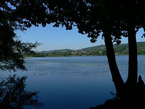
Lake Überlingen (Standard German of Germany: Überlinger See, Swiss Standard German: Überlingersee) is the northwestern "finger" of the Obersee, the lower part of Lake Constance. The boundary of lake is defined as the ferry link from Meersburg to Constance. It extends north to Bodman-Ludwigshafen.

Stockacher Aach
River in Germany
Distance: Approx. 2263 meters
Latitude and longitude: 47.8086,9.0338
Stockacher Aach is a river of Baden-Württemberg, Germany. It is a tributary to Lake Constance, which is drained by the Rhine. It passes through Stockach and flows into Lake Constance near Bodman-Ludwigshafen.

Mindelsee
Lake in Germany
Distance: Approx. 7537 meters
Latitude and longitude: 47.75444444,9.02222222
The Mindelsee is a Proglacial lake in Radolfzell, Baden-Württemberg Germany. Its current area is approximately 115 hectares (280 acres) with an average depth of 8 metres (26 ft). it extends approximately 2,200 metres (1.4 mi) in a northwest-southeast direction with a width of around 570 metres (1,870 ft).

Hohenfels Castle (Hohenfels)
Distance: Approx. 6446 meters
Latitude and longitude: 47.86417,9.11111
Hohenfels Castle (German: Burg Hohenfels), also called Schloss Hohenfels or New Hohenfels (Neu-Hohenfels) is a mediaeval spur castle in which a boarding school was housed until July 2017. The castle stands within the parish of Kalkofen, over a kilometre north of the village itself, which is part of the municipality of Hohenfels in the county of Konstanz in Germany. The castle gave its name to the municipality of Hohenfels which was created in 1973.
Hödingen (Überlingen)
Ortsteil of Überlingen in Baden-Württemberg, Germany
Distance: Approx. 6115 meters
Latitude and longitude: 47.78888889,9.13194444
Hödingen is a village in the municipality of Überlingen, in the west of the Bodenseekreis in southwest Baden-Württemberg, Germany. It is located about 3 kilometres (1.9 mi) northwest of Überlingen.
Weather in this IP's area
clear sky
-1 Celsius
-1 Celsius
-1 Celsius
0 Celsius
1032 hPa
92 %
1032 hPa
981 hPa
10000 meters
0.44 m/s
0.46 m/s
288 degree
10 %
