193.228.210.66 - IP Lookup: Free IP Address Lookup, Postal Code Lookup, IP Location Lookup, IP ASN, Public IP
Country:
Region:
City:
Location:
Time Zone:
Postal Code:
IP information under different IP Channel
ip-api
Country
Region
City
ASN
Time Zone
ISP
Blacklist
Proxy
Latitude
Longitude
Postal
Route
Luminati
Country
Region
3
City
schwechat
ASN
Time Zone
Europe/Vienna
ISP
VERBUND Services GmbH
Latitude
Longitude
Postal
IPinfo
Country
Region
City
ASN
Time Zone
ISP
Blacklist
Proxy
Latitude
Longitude
Postal
Route
IP2Location
193.228.210.66Country
Region
steiermark
City
grambach
Time Zone
Europe/Vienna
ISP
Language
User-Agent
Latitude
Longitude
Postal
db-ip
Country
Region
City
ASN
Time Zone
ISP
Blacklist
Proxy
Latitude
Longitude
Postal
Route
ipdata
Country
Region
City
ASN
Time Zone
ISP
Blacklist
Proxy
Latitude
Longitude
Postal
Route
Popular places and events near this IP address
Eisstadion Liebenau
Architectural structure
Distance: Approx. 4609 meters
Latitude and longitude: 47.04472222,15.45527778
Eisstadion Liebenau, currently named Merkur Eisstadion for sponsorship reasons, is an indoor sporting arena located in Graz, Austria. The arena was built in 1963 and can accommodate 4,126 spectators. It is home to the Graz 99ers of the ICE Hockey League.

Raaba
Former municipality in Styria, Austria
Distance: Approx. 1259 meters
Latitude and longitude: 47.02777778,15.49666667
Raaba, also known as Raaba bei Graz, was a village, merged into Raaba-Grambach in 2015, in the province of the Austrian state of Styria and a suburb of Graz. Due to its proximity to Graz an area with medium-rise office blocks has developed on the edge of Raaba.

ICE Hockey League
European sports league
Distance: Approx. 4599 meters
Latitude and longitude: 47.0446,15.4553
The ICE Hockey League (International Central European Hockey League, ICEHL), known as the win2day ICE Hockey League for sponsorship reasons, is a Central European hockey league that also serves as the top-tier ice hockey league in Austria. It currently features additional teams from Hungary, Italy, and Slovenia. The league was known as the Erste Bank Eishockey Liga (EBEL) from 2003 until 2020 and as the bet-at-home ICE Hockey League during the 2021–22 season.
Feldkirchen bei Graz
Municipality in Styria, Austria
Distance: Approx. 4389 meters
Latitude and longitude: 47.0125,15.4425
Feldkirchen bei Graz (German: [feltˈkɪʁçn̩ baɪ̯ gʁaːt͡s]) is a municipality in the district of Graz-Umgebung in the Austrian state of Styria.
Gössendorf
Municipality in Styria, Austria
Distance: Approx. 3924 meters
Latitude and longitude: 46.98333333,15.48333333
Gössendorf is a municipality in the district of Graz-Umgebung in the Austrian state of Styria with 3793 inhabitants (appointed date 31 October 2013 )
Grambach
Place in Styria, Austria
Distance: Approx. 377 meters
Latitude and longitude: 47.01388889,15.50277778
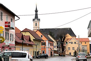
Grambach was a municipality, now merged into Raaba-Grambach in 2015, in the district of Graz-Umgebung in the Austrian state of Styria. The other town, Raaba, was also dissolved into the merger.

Hart bei Graz
Municipality in Styria, Austria
Distance: Approx. 3497 meters
Latitude and longitude: 47.045,15.52
Hart bei Graz is a municipality in the district of Graz-Umgebung in the Austrian state Styria.

Hausmannstätten
Municipality in Styria, Austria
Distance: Approx. 2953 meters
Latitude and longitude: 46.99083333,15.50861111
Hausmannstätten (German: [ˌhaʊ̯smanˈʃ͡tɛtn̩]) is a municipality in the district of Graz-Umgebung in the Austrian state of Styria.

Vasoldsberg
Municipality in Styria, Austria
Distance: Approx. 4296 meters
Latitude and longitude: 47.01333333,15.55638889
Vasoldsberg is a municipality in the district of Graz-Umgebung in the Austrian state of Styria.
Liebenau (Graz)
7th city district of Graz in Styria, Austria
Distance: Approx. 4562 meters
Latitude and longitude: 47.04055556,15.45111111
Liebenau (German: [ˈliːbεnaʊ̯]) is the 7th District of the Austrian city of Graz. The district is located in the southeastern part of the city. It is bordered to the north by the 6th District, Jakomini, and on the east by the 8th district, St.

St. Peter (Graz)
8th city district of Graz in Styria, Austria
Distance: Approx. 4666 meters
Latitude and longitude: 47.055,15.475
St. Peter (German: [saŋkt ˈpeːtɐ]) is the 8th District of Graz, in Styria, Austria. Its area is 8.86 km2.
Raaba-Grambach
Municipality in Styria, Austria
Distance: Approx. 1259 meters
Latitude and longitude: 47.02777778,15.49666667
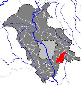
Raaba-Grambach is a market town in the district Graz-Umgebung in Styria, Austria since 2015. It was created as part of the Steiermärkische Gemeindestrukturreform of Styria at the end of 2014, dissolving the towns Raaba and Grambach. One complaint from both communities against merging was raised at the Constitutional Court but ended unsuccessfully.
Weather in this IP's area
scattered clouds
2 Celsius
-1 Celsius
1 Celsius
3 Celsius
1017 hPa
84 %
1017 hPa
968 hPa
10000 meters
2.06 m/s
150 degree
40 %


