193.218.216.142 - IP Lookup: Free IP Address Lookup, Postal Code Lookup, IP Location Lookup, IP ASN, Public IP
Country:
Region:
City:
Location:
Time Zone:
Postal Code:
ISP:
ASN:
language:
User-Agent:
Proxy IP:
Blacklist:
IP information under different IP Channel
ip-api
Country
Region
City
ASN
Time Zone
ISP
Blacklist
Proxy
Latitude
Longitude
Postal
Route
db-ip
Country
Region
City
ASN
Time Zone
ISP
Blacklist
Proxy
Latitude
Longitude
Postal
Route
IPinfo
Country
Region
City
ASN
Time Zone
ISP
Blacklist
Proxy
Latitude
Longitude
Postal
Route
IP2Location
193.218.216.142Country
Region
bayern
City
lauf
Time Zone
Europe/Berlin
ISP
Language
User-Agent
Latitude
Longitude
Postal
ipdata
Country
Region
City
ASN
Time Zone
ISP
Blacklist
Proxy
Latitude
Longitude
Postal
Route
Popular places and events near this IP address

Burglengenfeld
Town in Bavaria, Germany
Distance: Approx. 8887 meters
Latitude and longitude: 49.2,12.03333333
Burglengenfeld is a town in the district of Schwandorf, in Bavaria, Germany. It is situated on the river Naab, 22 km north of Regensburg.

Schmidmühlen
Municipality in Bavaria, Germany
Distance: Approx. 9036 meters
Latitude and longitude: 49.26666667,11.93333333
Schmidmühlen is a municipality in the district of Amberg-Sulzbach in Bavaria in Germany. It is situated at the junction of the Vils and Lauterach rivers.

Duggendorf
Municipality in Bavaria, Germany
Distance: Approx. 8754 meters
Latitude and longitude: 49.10916667,11.93388889
Duggendorf is a municipality located on the Naab River in the district of Regensburg in Bavaria in Germany.

Kallmünz
Municipality in Bavaria, Germany
Distance: Approx. 4497 meters
Latitude and longitude: 49.16111111,11.96083333
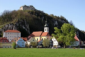
Kallmünz is a municipality in the district of Regensburg in Bavaria, Germany. Located on Naab River about 25 km north of Regensburg, Kallmünz has preserved a beautiful medieval center. The main attractions are the ruins of the Kallmünz Castle above the town on a cliff and the old stone bridge over the Naab River.

Hohenfels, Bavaria
Municipality in Bavaria, Germany
Distance: Approx. 4813 meters
Latitude and longitude: 49.2,11.85
Hohenfels (literally High Cliffs) is a municipality in the district of Neumarkt in the region of Upper Palatinate (German: Oberpfalz) in Bavaria, Germany. The town is host to the United States Army Garrison Hohenfels, which operates the Joint Multinational Readiness Center for training of North Atlantic Treaty Organization (NATO) armed forces.

Holzheim am Forst
Municipality in Bavaria, Germany
Distance: Approx. 7588 meters
Latitude and longitude: 49.14805556,11.99888889
Holzheim am Forst is a municipality in the district of Regensburg in Bavaria in Germany. The municipality, together with the community Duggendorf and the market town Kallmünz belong to the administrative community Kallmünz.
Vils (Naab)
River in Germany
Distance: Approx. 4362 meters
Latitude and longitude: 49.15888889,11.95527778
The Vils is a river in Bavaria, Germany. Its source is near Freihung. The 87 km (54 mi)-long Vils flows generally south through the towns of Vilseck, Amberg and Schmidmühlen.
Lauterach (river)
River in Germany
Distance: Approx. 8762 meters
Latitude and longitude: 49.2649,11.9252
The Lauterach is a river in Bavaria, Germany. It flows into the Vils in Schmidmühlen.

Forellenbach (Vils)
River in Germany
Distance: Approx. 1837 meters
Latitude and longitude: 49.1843,11.9379
Forellenbach is a river of Bavaria, Germany. It is a right tributary of the Vils in Rohrbach.

Waldkirchen (Petersberg)
Ortsteil of Seubersdorf i.d.OPf. in Bavaria, Germany
Distance: Approx. 3017 meters
Latitude and longitude: 49.21333333,11.91972222
Waldkirchen is a small village in the municipality of Seubersdorf in the German state of Bavaria. It is in the Upper Palatinate, in the Neumarkt district. It has a total population of about 25 people.
Stalag 383
Distance: Approx. 4813 meters
Latitude and longitude: 49.2,11.85
Stalag 383 was a German World War II Prisoner of War camp located in Hohenfels, Bavaria.

Hohenfels Army Airfield
Military airfield in Germany
Distance: Approx. 6498 meters
Latitude and longitude: 49.2165,11.83616667
Hohenfels Army Airfield (ICAO: ETIH) is a military airport near Hohenfels, a small town in Bavaria, Germany. It is part of the Hohenfels Training Area, which hosts the U.S. Army's Joint Multinational Readiness Center (JMRC). As part of JMRC, the airfield is used by helicopters in support of exercises held at the Hohenfels Training Area.
Weather in this IP's area
clear sky
-4 Celsius
-4 Celsius
-4 Celsius
-3 Celsius
1017 hPa
94 %
1017 hPa
961 hPa
10000 meters
1.26 m/s
1.31 m/s
102 degree
6 %


