Country:
 Great Britain
Region:
City:
Latitude and Longitude:
Time Zone:
Postal Code:
IP information under different IP Channel
ip-api
Country
Region
City
ASN
Time Zone
ISP
Blacklist
Proxy
Latitude
Longitude
Postal
Route
IPinfo
Country
Region
City
ASN
Time Zone
ISP
Blacklist
Proxy
Latitude
Longitude
Postal
Route
MaxMind
Country
Region
City
ASN
Time Zone
ISP
Blacklist
Proxy
Latitude
Longitude
Postal
Route
Luminati
Country
GBRegion
eng
City
wandsworth
ASN
Time Zone
Europe/London
ISP
euNetworks GmbH
Latitude
Longitude
Postal
db-ip
Country
Region
City
ASN
Time Zone
ISP
Blacklist
Proxy
Latitude
Longitude
Postal
Route
ipdata
Country
Region
City
ASN
Time Zone
ISP
Blacklist
Proxy
Latitude
Longitude
Postal
Route
Popular places and events near this IP address

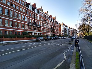
Battersea
District in London, England
Distance: Approx. 269 meters
Latitude and longitude: 51.47,-0.164
Battersea is a large district in southwest London, part of the London Borough of Wandsworth, England. It is centred 3.5 miles (5.6 km) southwest of Charing Cross it also extends along the south bank of the Thames Tideway. It includes the 200-acre (0.81 km2) Battersea Park.

Battersea railway station
Disused railway station in Battersea, London
Distance: Approx. 736 meters
Latitude and longitude: 51.47152,-0.17219
Battersea was a railway station on the West London Extension Railway located on Battersea High Street in Battersea, south-west London. Built at the request of the parishioners of Battersea, it opened on 2 March 1863. To prevent overloading the embankment, it was built of wood, with brick pillars under the platforms and structures, but was laid with broad gauge track, because the WLER carried GWR trains.

Theatre503
Theatre
Distance: Approx. 595 meters
Latitude and longitude: 51.4746,-0.1542
Theatre503 is a theatre based at 503 Battersea Park Road in Battersea in the London Borough of Wandsworth, above The Latchmere pub. The venue is known for promoting the work of new writers.

Brown Dog affair
British political controversy, 1903–1910
Distance: Approx. 7 meters
Latitude and longitude: 51.47194444,-0.16166667
The Brown Dog affair was a political controversy about vivisection that raged in Britain from 1903 until 1910. It involved the infiltration of University of London medical lectures by Swedish feminists, battles between medical students and the police, police protection for the statue of a dog, a libel trial at the Royal Courts of Justice, and the establishment of a Royal Commission to investigate the use of animals in experiments. The affair became a cause célèbre that divided the country.

Shaftesbury Park Estate
Housing estate in Battersea, London
Distance: Approx. 560 meters
Latitude and longitude: 51.469,-0.155
The Shaftesbury Park Estate, commonly known as The Shaftesbury Estate, is a residential estate in Battersea in South London, England. It lies north of Lavender Hill and Clapham Common and east of Clapham Junction railway station. The estate occupies a flat area of land at the edge of the River Thames flood plain, just north of the slope rising to Clapham Common.
Prince of Wales Drive, London
Distance: Approx. 606 meters
Latitude and longitude: 51.4758,-0.1555
Prince of Wales Drive is a street in Battersea, in the London borough of Wandsworth. It is situated on the southern perimeter of Battersea Park.
The Sanctuary (recording studio)
Distance: Approx. 591 meters
Latitude and longitude: 51.47416667,-0.15388889
The Sanctuary is a recording studio in Battersea, London founded by David McEwan and Eric Appapoulay in 2006. It is best known as the facility at which Plan B created his 2010 award winning album The Defamation of Strickland Banks. The Sanctuary is the home of the SMV writing and production team.

Battersea General Hospital
Hospital in England
Distance: Approx. 393 meters
Latitude and longitude: 51.4751,-0.164
Battersea General Hospital (founded as The National Anti-Vivisection Hospital) known locally as the "Antiviv" or the "Old Anti," was a hospital in Battersea, London.

Harris Academy Battersea
Academy in Battersea, London, England
Distance: Approx. 201 meters
Latitude and longitude: 51.47302,-0.15933
Harris Academy Battersea is a coeducational secondary school and sixth form with academy status, located near Battersea Park in the Battersea area of the London Borough of Wandsworth, England.

Riverside Radio
Distance: Approx. 706 meters
Latitude and longitude: 51.474,-0.152
Riverside Radio is a local digital radio station based in Battersea, London, which broadcasts local news, sports, music and specialist shows. It can be listened to via its website https://www.riversideradio.com/. Its main audience is based in South West London.

Latchmere Recreation Ground, Battersea
Park in Wandsworth, London
Distance: Approx. 30 meters
Latitude and longitude: 51.472,-0.162
Latchmere Recreation Ground or Latchmere Park is a public open space with a children's playground in Battersea in the London Borough of Wandsworth. It is located approximately 300 metres (330 yd) south of the far larger Battersea Park and the River Thames beyond. It is bounded by Burns Road to the south and Reform Street to the east and north.
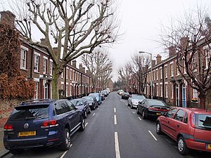
Latchmere Estate
Housing estate in Battersea, London
Distance: Approx. 33 meters
Latitude and longitude: 51.471604,-0.161623
Latchmere Estate is a housing estate in Battersea, Greater London, which was constructed in 1903. It is the first example of a housing estate built with labour directly employed by a local council authority. Between 1832 and the 1880s, Battersea's population increased from 5,500 to 107,000, meaning new housing needed to be constructed.
Weather in this IP's area
scattered clouds
20 Celsius
20 Celsius
17 Celsius
21 Celsius
1003 hPa
74 %
1003 hPa
1002 hPa
10000 meters
3.09 m/s
40 %
06:25:04
19:31:45