Country:
 Denmark
Region:
City:
Latitude and Longitude:
Time Zone:
Postal Code:
IP information under different IP Channel
ip-api
Country
Region
City
ASN
Time Zone
ISP
Blacklist
Proxy
Latitude
Longitude
Postal
Route
IPinfo
Country
Region
City
ASN
Time Zone
ISP
Blacklist
Proxy
Latitude
Longitude
Postal
Route
MaxMind
Country
Region
City
ASN
Time Zone
ISP
Blacklist
Proxy
Latitude
Longitude
Postal
Route
Luminati
Country
DKASN
Time Zone
Europe/Copenhagen
ISP
TDC Holding A/S
Latitude
Longitude
Postal
db-ip
Country
Region
City
ASN
Time Zone
ISP
Blacklist
Proxy
Latitude
Longitude
Postal
Route
ipdata
Country
Region
City
ASN
Time Zone
ISP
Blacklist
Proxy
Latitude
Longitude
Postal
Route
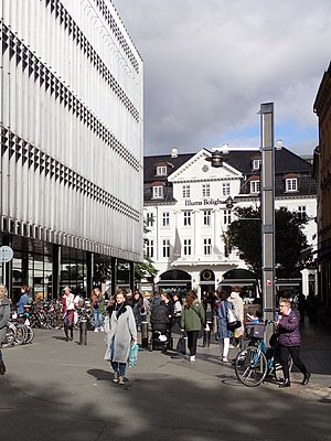
Popular places and events near this IP address

Church of Our Lady (Aarhus)
Church in Aarhus, Denmark
Distance: Approx. 191 meters
Latitude and longitude: 56.158,10.205
The Church of Our Lady (Danish: Vor Frue Kirke) is one of the larger church structures of Århus, Denmark. It is situated in the centre of the city not far from Aarhus Cathedral (Århus Domkirke). The church and associated structures were built in several stages in the course of the Middle Ages, from the late 1200s to 1500 AD. The original church at the site, stood finished as early as 1060 AD, but only the stone crypt remains today as evidence of its existence.
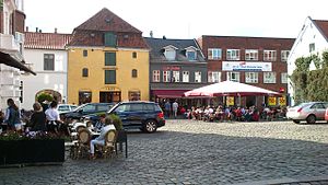
Latin Quarter, Aarhus
Neighborhood in Aarhus Municipality, Central Denmark Region, Kingdom of Denmark
Distance: Approx. 192 meters
Latitude and longitude: 56.159,10.209
The Latin Quarter (Danish: Latinerkvarteret) in Aarhus is the oldest part of the city and is itself part of the inner city. The quarter comprise the streets of Badstuegade, Klostergade, Volden, Studsgade, Borggade, Rosensgade, Mejlgade and Graven, with Pustervig Torv as the main square. The name Latinerkvarteret was officially adopted in the 1990s and reflects the areas similarities with the Latin Quarter of Paris by Rive Gauche.

Our Lady's Priory, Aarhus
Early Dominican foundation just outside the original walls of Aarhus, Denmark
Distance: Approx. 162 meters
Latitude and longitude: 56.15828,10.205011
Our Lady's Priory, Aarhus (Danish: Vor Frue Kloster) was an early Dominican foundation just outside the original walls of Aarhus, Denmark. The buildings are part of the Church of Our Lady (Vor Frue Kirke) complex, now part of the inner city of Aarhus, but they have been repurposed.
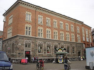
Business- and Agricultural Bank of Jutland
Building in Aarhus, Denmark
Distance: Approx. 207 meters
Latitude and longitude: 56.157793,10.206904
Business- and Agricultural Bank of Jutland (Danish: Jydsk Handels- og Landbrugsbank) is a listed building and a former Danish bank in Aarhus.

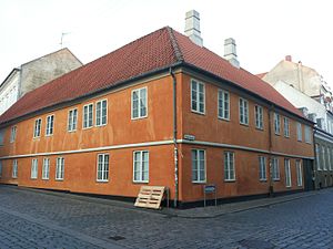
Badstuegade 1H
Listed building in Aarhus, Denmark
Distance: Approx. 192 meters
Latitude and longitude: 56.1582,10.2079
Badstuegade 1H is a house and a listed building in Aarhus, Denmark. The house was built in 1809 and was listed on the Danish registry of protected buildings and places by the Danish Heritage Agency on 7 October 1970. The house is situated in the historic and central Latin Quarter neighbourhood on Badstuegade by Pustervig square.

Mønsted's House
Building in Aarhus, Denmark
Distance: Approx. 244 meters
Latitude and longitude: 56.1575,10.205
Mønsted's House (Danish: Mønsteds Gård) is a house and a listed building in Aarhus, Denmark. The house was built in 1810 and was listed on the Danish registry of protected buildings and places by the Danish Heritage Agency on 24 March 1950. The building is situated in the historic Indre by neighborhood on Vestergade across from the Church of Our Lady.
Rosensgade 38
Building in Aarhus, Denmark
Distance: Approx. 236 meters
Latitude and longitude: 56.158,10.2086
Rosensgade 38 is a house and a listed building in Aarhus, Denmark. The house was built in approximately 1600 and was listed on the Danish registry of protected buildings and places by the Danish Heritage Agency on 21 March 2012. The building is situated in the historic Latin Quarter neighborhood on Pustervig square in the city center.

Klostergade
Street in Aarhus, Denmark
Distance: Approx. 91 meters
Latitude and longitude: 56.1588,10.2058
Klostergade (lit.: Priory-street) is a street in Aarhus which runs east from Grønnegade to Studsgade, intersecting a number of streets. Klostergade is an old street, situated in the Vesterbro neighborhood and its eastern section enters the smaller Latin Quarter. Klostergade is home to two listed buildings and the historic Our Lady's Priory.
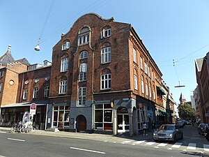
Elvirasminde (building)
Building in Aarhus, Denmark
Distance: Approx. 78 meters
Latitude and longitude: 56.15892,10.20637
Elvirasminde (Lit. Elvira's Memory) or Chokoladefabrikken (English: The Chocolate Factory) is a building complex and former factory in Aarhus, Denmark. Elvirasminde was built in 1912 by designs from the architect Christian Frühstück Nielsen.

Aarhus Fire Station
Building in Aarhus, Denmark
Distance: Approx. 282 meters
Latitude and longitude: 56.1615,10.2031
Aarhus Fire Station (Danish: Aarhus Brandstation) is a fire station in Aarhus, Denmark from 1904 situated on Ny Munkegade 15. The station is still in use (2016) and is the oldest fire station in Aarhus. In the end of the 1800s the Aarhus Fire Department consisted mostly of small pumping stations but the explosive population growth of the previous decades meant the city needed a modern fire station.
Immervad
Distance: Approx. 285 meters
Latitude and longitude: 56.1571,10.2071
Immervad, previously Emmervad, is a pedestrian street in Aarhus, Denmark, which runs north to south from Lille Torv to Åboulevarden and Frederiksgade. The alley Sankt Clemens Stræde leads to Immervad from the east. The street is situated in the historic Latin Quarter neighborhood and has existed as a road or street since the Viking Age when it was used as the eastern ford to cross the Aarhus River.

Øst for Paradis
Art cinema in Denmark
Distance: Approx. 219 meters
Latitude and longitude: 56.15989722,10.20959167
Øst for Paradis (East of Eden) is an art cinema in Aarhus, Denmark founded in 1978.
Weather in this IP's area
overcast clouds
12 Celsius
11 Celsius
12 Celsius
12 Celsius
1002 hPa
96 %
1002 hPa
1001 hPa
10000 meters
3.27 m/s
6.94 m/s
119 degree
100 %
07:36:43
18:36:16