Country:
Region:
City:
Latitude and Longitude:
Time Zone:
Postal Code:
IP information under different IP Channel
ip-api
Country
Region
City
ASN
Time Zone
ISP
Blacklist
Proxy
Latitude
Longitude
Postal
Route
Luminati
Country
ASN
Time Zone
Europe/Lisbon
ISP
Instituto Nacional de Estatistica, I.P.
Latitude
Longitude
Postal
IPinfo
Country
Region
City
ASN
Time Zone
ISP
Blacklist
Proxy
Latitude
Longitude
Postal
Route
db-ip
Country
Region
City
ASN
Time Zone
ISP
Blacklist
Proxy
Latitude
Longitude
Postal
Route
ipdata
Country
Region
City
ASN
Time Zone
ISP
Blacklist
Proxy
Latitude
Longitude
Postal
Route
Popular places and events near this IP address

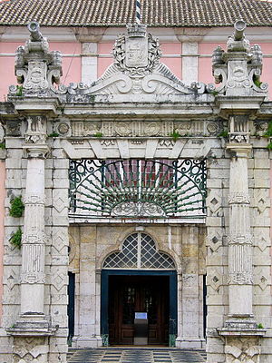
Instituto Nacional de Estatística (Portugal)
Portuguese government institution
Distance: Approx. 320 meters
Latitude and longitude: 38.73861111,-9.13777778
The Instituto Nacional de Estatística or INE (Portuguese for 'National Institute for Statistics') is the government office for national statistics of Portugal. In the English language it is also branded as Statistics Portugal. The INE is one of the components of the Portuguese National Statistical System (SEN), which also includes the Higher Council of Statistics, the Bank of Portugal and the regional statistical services the autonomous regions of the Azores and Madeira.
Instituto Superior Técnico
Public school of engineering and technology in Lisbon, Portugal
Distance: Approx. 245 meters
Latitude and longitude: 38.73666667,-9.13888889
The Instituto Superior Técnico (IST, also known as Técnico, and stylized TÉCNICO LISBOA; Higher Technical InstituteEnglish: Higher Technical Institute) is the school of engineering and technology of the University of Lisbon. It was founded as an autonomous school in 1911, and was integrated into the Technical University of Lisbon (now part of the University of Lisbon) in 1930. IST is the largest school of engineering in Portugal by number of enrolled students, faculty size, scientific production and patents.

Campo Pequeno Bullring
Building in Lisbon, Lisbon District, Portugal
Distance: Approx. 626 meters
Latitude and longitude: 38.7425,-9.14527778
The Campo Pequeno Bullring (Portuguese: Praça de Touros do Campo Pequeno) is the current Praça de Touros of the city of Lisbon, in Portugal. It is located in Avenida da República, in Lisbon. It is an enclosure for bull races, musical concerts, fairs, exhibitions and other events, with a capacity of around 10.000 people bearing 6.848 seats.
Institute for Nature Conservation and Forests
Distance: Approx. 555 meters
Latitude and longitude: 38.7358304,-9.1471787
The Institute for Nature Conservation and Forests (Portuguese: Instituto da Conservação da Natureza e das Florestas, I.P.), ICNF, is the responsible governmental body for the nature and forest policies, including the management of Protected Areas and State managed national, municipal and communal forests of mainland Portugal.
Instituto de Plasmas e Fusão Nuclear
Distance: Approx. 55 meters
Latitude and longitude: 38.7373501,-9.1410516
Instituto de Plasmas e Fusão Nuclear (IPFN) (Institute for Plasmas and Nuclear Fusion) is a research unit of Instituto Superior Técnico (IST), Lisbon, and a leading Portuguese institution in physics research. IPFN has the status of Associate Laboratory in the thematic areas of controlled nuclear fusion, plasma technologies and intense lasers, granted by the Portuguese Foundation for Science and Technology. IPFN was formally created in January 2008, as a result of the merging between the former research units Center for Nuclear Fusion and Center for Plasma Physics.

Galveias Palace
Historic site in Lisbon, Portugal
Distance: Approx. 454 meters
Latitude and longitude: 38.74144444,-9.14366667
Galveias Palace (Portuguese: Palácio das Galveias) is a Portuguese palace located in Lisbon, Portugal, in Avenidas Novas freguesia.
INESC-ID
Research institution in Lisbon, Portugal
Distance: Approx. 179 meters
Latitude and longitude: 38.7362113,-9.1410125
The Instituto de Engenharia de Sistemas e Computadores - Investigação e Desenvolvimento (INESC-ID, English: Institute of Systems and Computer Engineering - Research and Development) is a non-profit, privately owned institution of public interest, in Lisbon, Portugal, dedicated to advanced research and development in the domains of electronics, energy, telecommunications and information technologies. It was awarded the status of Associate Laboratory of the Portuguese Ministry for Science and Technology in 2005.
Caritas Portugal
Distance: Approx. 589 meters
Latitude and longitude: 38.74106,-9.13596
Caritas Portugal (Portuguese: Cáritas Portuguesa) is the official Catholic Church organization in Portugal for charity and social relief, instituted by the Portuguese Episcopal Conference. Caritas Portuguesa was founded in 1945, with its first statutes approved in 1956. From the 1950s to mid-1970s, its activities focused primarily on the distribution of food to the Portuguese population, donated by the United States, and the hosting of children from Central European countries in the aftermath of World War II and the beginning of Cold War tensions.

Alameda Station
Metro station in Lisbon, Portugal
Distance: Approx. 657 meters
Latitude and longitude: 38.73666667,-9.13388889
Alameda is a station on the Green and Red Lines of the Lisbon Metro. The station is located on Avenida Almirante Reis at Alameda Dom Afonso Henriques, east of the Instituto Superior Técnico.

Saldanha Station
Metro station in Lisbon, Portugal
Distance: Approx. 465 meters
Latitude and longitude: 38.735,-9.14527778
Saldanha is an interchange station in central Lisbon, where the Red and Yellow Lines of the Lisbon Metro connect.

Avenidas Novas
Civil parish in Lisbon, Portugal
Distance: Approx. 429 meters
Latitude and longitude: 38.739,-9.146
Avenidas Novas (Portuguese pronunciation: [ɐvɨˈniðɐʒ ˈnɔvɐʃ]) is a freguesia (civil parish) and district of Lisbon, the capital of Portugal. Located in central Lisbon, Avenidas Novas is to the south of Alvalade, west of Areeiro, east of Campolide, and north of Santo António.
Campo Pequeno Station
Metro station in Lisbon, Portugal
Distance: Approx. 634 meters
Latitude and longitude: 38.74166667,-9.14666667
Campo Pequeno station is part of the Yellow Line of the Lisbon Metro.
Weather in this IP's area
clear sky
15 Celsius
15 Celsius
14 Celsius
16 Celsius
1019 hPa
81 %
1019 hPa
1008 hPa
10000 meters
3.09 m/s
310 degree
07:22:39
17:21:16
