193.188.119.111 - IP Lookup: Free IP Address Lookup, Postal Code Lookup, IP Location Lookup, IP ASN, Public IP
Country:
Region:
City:
Location:
Time Zone:
Postal Code:
IP information under different IP Channel
ip-api
Country
Region
City
ASN
Time Zone
ISP
Blacklist
Proxy
Latitude
Longitude
Postal
Route
Luminati
Country
Region
13
City
manama
ASN
Time Zone
Asia/Bahrain
ISP
Beyon B.s.c.
Latitude
Longitude
Postal
IPinfo
Country
Region
City
ASN
Time Zone
ISP
Blacklist
Proxy
Latitude
Longitude
Postal
Route
IP2Location
193.188.119.111Country
Region
al janubiyah
City
umm ash sha'um
Time Zone
Asia/Bahrain
ISP
Language
User-Agent
Latitude
Longitude
Postal
db-ip
Country
Region
City
ASN
Time Zone
ISP
Blacklist
Proxy
Latitude
Longitude
Postal
Route
ipdata
Country
Region
City
ASN
Time Zone
ISP
Blacklist
Proxy
Latitude
Longitude
Postal
Route
Popular places and events near this IP address

Manama
Capital and largest city of Bahrain
Distance: Approx. 849 meters
Latitude and longitude: 26.22333333,50.5875
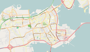
Manama (Arabic: الْمَنَامَة el-Menâme, Bahrani pronunciation: [elmɐˈnɑːmɐ]) is the capital and largest city of Bahrain, with an approximate population of 297,502 as of 2012. Long an important trading center in the Persian Gulf, Manama is home to a very diverse population. After periods of Portuguese and Persian control and a short invasion from the ruling dynasty of Saudi Arabia, followed by a longer invasion by Oman, Bahrain established itself as an independent nation in 1971 following a period of British hegemony.

Adliya
Neighbourhood in Capital Governorate, Bahrain
Distance: Approx. 815 meters
Latitude and longitude: 26.21,50.58
Adliya (Arabic: العدلية) is the bohemian neighborhood in Manama, Bahrain.
Zinj, Bahrain
Village in Capital Governorate, Bahrain
Distance: Approx. 1547 meters
Latitude and longitude: 26.22027778,50.56833333
Zinj (Arabic: الزنج) is a suburb in the city of Manama, the capital of Bahrain.

Al Fateh Grand Mosque
Mosque in Manama, Bahrain
Distance: Approx. 1494 meters
Latitude and longitude: 26.21888889,50.59805556
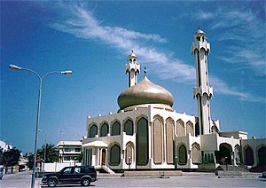
The Al-Fateh Mosque (also known as Al-Fateh Islamic Center & Al Fateh Grand Mosque) (Arabic: مسجد الفاتح; transliterated: Masjid al-Fatih) was one of the largest mosques in the world, encompassing 6,500 square meters and having the capacity to accommodate over 7,000 worshippers at a time. The mosque was built by the late Sheikh Isa Bin Salman Al Khalifa in 1987 and was named after Ahmed Al Fateh. In 2006, Al-Fateh became the site of the National Library of Bahrain.

Sacred Heart Church, Manama
Roman Catholic church in Bahrain
Distance: Approx. 1254 meters
Latitude and longitude: 26.2275,50.57972222
The Sacred Heart Church (Arabic: كنيسة القلب المقدس) is a Roman Catholic parish in Manama, Bahrain. The church is one of only two Roman Catholic churches in Bahrain (the other being the Cathedral of Our Lady of Arabia in Awali). The Sacred Heart Church serves an estimated 140,000 people.
Al Ahli Stadium (Bahrain)
Distance: Approx. 1482 meters
Latitude and longitude: 26.20583333,50.57472222
Al Ahli Stadium is a multi-use stadium in the Zinj district of the city of Manama, in Bahrain. It is currently used mostly for football matches and is the home ground of Al-Ahli. The stadium holds 10,000 people.

College of Health and Sport Sciences
Public college in Bahrain
Distance: Approx. 968 meters
Latitude and longitude: 26.21694444,50.57361111
The College of Health and Sport Sciences (Arabic: كلية العلوم الصحية والرياضية) is a public higher education institution situated in the Kingdom of Bahrain. Established in 1976, it is a constituent college of the University of Bahrain.

Mahooz
Neighborhood in Capital Governorate, Bahrain
Distance: Approx. 1360 meters
Latitude and longitude: 26.20466667,50.58566667
Mahooz is a neighborhood of Manama, Bahrain. The grave and shrine of the 13th century Shia theologian Maitham Al Bahrani is located in Mahooz.

Al-Qudaibiya Palace
Palace in Manama, Bahrain
Distance: Approx. 970 meters
Latitude and longitude: 26.21861111,50.59277778
Al-Qudaibiya Palace or Gudaibiya Palace is a palace in Gudaibiya, Manama, Bahrain. Located off Bani Otbah Avenue and Al Fatih Highway, it lies west of the Al Fateh Grand Mosque and southeast of the Old Palace of Manama and the Andalus Garden and Manama Cemetery. It is a light pink palace with a pearl-coloured, onion-shaped dome.

American Mission Hospital
Hospital in Manama, Bahrain
Distance: Approx. 1675 meters
Latitude and longitude: 26.231735,50.58267
The American Mission Hospital is a 120 year old private not-for-profit hospital located in Manama, Bahrain. Established in 1903, as the Mason Memorial Hospital, it was the first modern hospital in the country and, possibly, along the entire Persian Gulf region. The hospital offers specialist medical, dental, and wellness services from its main branch in Manama, and from its branches or satellite clinics in the country, located at Saar, Amwaj Islands and Riffa.
List of ambassadors of Iran to Bahrain
Distance: Approx. 988 meters
Latitude and longitude: 26.208379,50.579872
The Iranian ambassador in Manama is the official representative of the Government in Tehran to the Government of Bahrain. In 1972 a declaration on the establishment of political relations between the governments was issued at the embassy level in Tehran and Manama.

Embassy of the Philippines, Manama
Diplomatic mission of the Philippines in Bahrain
Distance: Approx. 253 meters
Latitude and longitude: 26.21722222,50.58083333
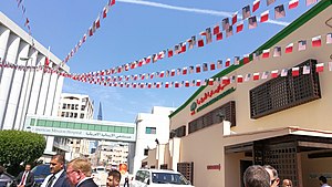
The Embassy of the Philippines in Manama is the diplomatic mission of the Republic of the Philippines to the Kingdom of Bahrain. Opened in 1992, it is located in the Adliya neighborhood of central Manama, near the Salmaniya Medical Complex.
Weather in this IP's area
haze
20 Celsius
20 Celsius
19 Celsius
20 Celsius
1022 hPa
81 %
1022 hPa
1022 hPa
5000 meters
2.06 m/s
300 degree