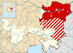
Country:
 Austria
Region:
City:
Latitude and Longitude:
Time Zone:
Postal Code:
IP information under different IP Channel
ip-api
Country
Region
City
ASN
Time Zone
ISP
Blacklist
Proxy
Latitude
Longitude
Postal
Route
IPinfo
Country
Region
City
ASN
Time Zone
ISP
Blacklist
Proxy
Latitude
Longitude
Postal
Route
MaxMind
Country
Region
City
ASN
Time Zone
ISP
Blacklist
Proxy
Latitude
Longitude
Postal
Route
Luminati
Country
ATASN
Time Zone
Europe/Vienna
ISP
Bundesministerium fuer Inneres, Sektion IV
Latitude
Longitude
Postal
db-ip
Country
Region
City
ASN
Time Zone
ISP
Blacklist
Proxy
Latitude
Longitude
Postal
Route
ipdata
Country
Region
City
ASN
Time Zone
ISP
Blacklist
Proxy
Latitude
Longitude
Postal
Route
Popular places and events near this IP address
Vienna Insurance Group
Austrian multinational company
Distance: Approx. 345 meters
Latitude and longitude: 48.21722222,16.37027778
Vienna Insurance Group AG Wiener Versicherung Gruppe (VIG) with its registered office in Vienna, Austria, is one of the largest international insurance groups in Central and Eastern Europe with approximately 25,000 employees.

Archduchy of Austria
Fief of the Holy Roman Empire
Distance: Approx. 330 meters
Latitude and longitude: 48.21666667,16.36666667
The Archduchy of Austria (Latin: Archiducatus Austriae; German: Erzherzogtum Österreich) was a major principality of the Holy Roman Empire and the nucleus of the Habsburg monarchy. With its capital at Vienna, the archduchy was centered at the Empire's southeastern periphery. Its present name originates from the Frankish term Oustrich – Eastern Kingdom (east of the Frankish kingdom).
Duchy of Austria
State of the Holy Roman Empire (1156–1453)
Distance: Approx. 330 meters
Latitude and longitude: 48.21666667,16.36666667
The Duchy of Austria (Austriae Ducatus (Latin); Herzogtum Österreich (German)) was a medieval principality of the Holy Roman Empire, established in 1156 by the Privilegium Minus, when the Margraviate of Austria (Ostarrîchi) was detached from Bavaria and elevated to a duchy in its own right. After the ruling dukes of the House of Babenberg became extinct in male line, there was as much as three decades of rivalry on inheritance and rulership, until the German king Rudolf I took over the dominion as the first monarch of the Habsburg dynasty in 1276. Thereafter, Austria became the patrimony and ancestral homeland of the dynasty and the nucleus of the Habsburg monarchy.

Margraviate of Austria
Southeastern frontier march of the Holy Roman Empire, c. 970–1156
Distance: Approx. 330 meters
Latitude and longitude: 48.21666667,16.36666667
The Margraviate of Austria (Latin: Marcha Austriae; German: Markgrafschaft Österreich) was a medieval frontier march, centered along the river Danube, between the river Enns and the Vienna Woods (Wienerwald), within the territory of modern Austrian provinces of Upper Austria and Lower Austria. It existed from c. 970 to 1156. It stemmed from the previous frontier structures, initially created for the defense of eastern Bavarian borders against the Avars, who were defeated and conquered during the reign of Charlemagne (d.

Flex (club)
Nightclub in Vienna
Distance: Approx. 296 meters
Latitude and longitude: 48.21805556,16.37055556
Flex is a nightclub in Vienna. It is located between underground station Schottenring and Augartenbrücke. Many international and Austrian music acts and DJs, such as Pete Doherty, Juliette and the Licks and Arcade Fire, have performed in Flex.

Servite Church, Vienna
Distance: Approx. 282 meters
Latitude and longitude: 48.2206,16.3638
The Servite Church (German: Servitenkirche) is a church in Vienna, Austria.

Rossauer Barracks
Distance: Approx. 134 meters
Latitude and longitude: 48.21861111,16.36833333
The Rossauer Barracks (German: Rossauer Kaserne) is a barracks in the 9th district of Vienna, in the Alsergrund quarter of the city. It serves as the headquarters of the Defense Ministry. In January 2020 the Rossauer Barracks were renamed the Bernardis-Schmid-Kaserne.

Sigmund Freud Museum (Vienna)
Museum in Vienna, Austria
Distance: Approx. 334 meters
Latitude and longitude: 48.21861111,16.36305556
The Sigmund Freud Museum in Vienna is a museum founded in 1971 covering Sigmund Freud's life story. It is located in the Alsergrund district, at Berggasse 19. In 2003, the museum was put in the hands of the newly established Sigmund Freud Foundation, which has since received the entire building as an endowment.

Roßauer Lände station
Vienna U-Bahn station
Distance: Approx. 290 meters
Latitude and longitude: 48.2222,16.3676
Roßauer Lände is a station on U4 of the Vienna U-Bahn. It is located in the Alsergrund District. It opened in 1978.

Museum der Johann-Strauss-Dynastie
Distance: Approx. 344 meters
Latitude and longitude: 48.22,16.3627
The Museum of the Johann Strauss Dynasty (Strauss Museum) in Vienna is a museum dedicated to the Strauss family: Johann I, Johann II, Josef, Eduard and Johann III.

Catholic Social Academy of Austria
Distance: Approx. 287 meters
Latitude and longitude: 48.21751389,16.369575
Catholic Social Academy of Austria (Katholische Sozialakademie Österreichs) was established by the Austrian Catholic Bishops' Conference in 1958 with its seat in Vienna, Austria. Its mission is to "research, mediate, and convey the use of Catholic social teaching in practice" and it does this mainly through social analysis, political adult education, and organizational development.

Augartenbrücke
Bridge in Vienna
Distance: Approx. 235 meters
Latitude and longitude: 48.21888889,16.37027778
The Augartenbrücke is a bridge that crosses the Donaukanal in Vienna, which connects the 9th district (Alsergrund) and the 1st district (Innere Stadt) on the southwest side of the canal with the 2nd district, Leopoldstadt, on the northeast side. There has been a bridge on the site since 1782.
Weather in this IP's area
clear sky
10 Celsius
8 Celsius
8 Celsius
11 Celsius
1025 hPa
79 %
1025 hPa
1004 hPa
10000 meters
3.6 m/s
150 degree
07:21:43
17:56:31