Country:
Region:
City:
Latitude and Longitude:
Time Zone:
Postal Code:
IP information under different IP Channel
ip-api
Country
Region
City
ASN
Time Zone
ISP
Blacklist
Proxy
Latitude
Longitude
Postal
Route
Luminati
Country
ASN
Time Zone
Europe/Amsterdam
ISP
KPN B.V.
Latitude
Longitude
Postal
IPinfo
Country
Region
City
ASN
Time Zone
ISP
Blacklist
Proxy
Latitude
Longitude
Postal
Route
db-ip
Country
Region
City
ASN
Time Zone
ISP
Blacklist
Proxy
Latitude
Longitude
Postal
Route
ipdata
Country
Region
City
ASN
Time Zone
ISP
Blacklist
Proxy
Latitude
Longitude
Postal
Route
Popular places and events near this IP address
Driehuis
Village in North Holland, Netherlands
Distance: Approx. 2101 meters
Latitude and longitude: 52.44722222,4.63666667
Driehuis is a village in the Dutch province of North Holland; part of the municipality of Velsen, it lies about 8 km north of Haarlem and 15 km west-northwest of Amsterdam.

Santpoort-Noord
Village in North Holland, Netherlands
Distance: Approx. 2368 meters
Latitude and longitude: 52.4225,4.62611111
Santpoort-Noord (Dutch pronunciation: [ˌsɑntpoːrt ˈnoːrt]; Santpoort North) is a village in the municipality of Velsen in the Dutch province of North Holland. It lies directly north of Haarlem. Santpoort developed in the dunes near the Brederode Castle (13th century).

Santpoort-Zuid
Village in North Holland, Netherlands
Distance: Approx. 2393 meters
Latitude and longitude: 52.41666667,4.63333333
Santpoort-Zuid (Dutch pronunciation: [ˌsɑntpoːrt ˈsœyt]; Santpoort South) is a village in the municipality of Velsen in the Dutch province of North Holland. It lies to the west of North Haarlem (Schoten). Santpoort-Zuid is bordered by the village of Bloemendaal to the south and the village of Santpoort-Noord to the north.

Hofgeest
Town in North Holland, Netherlands
Distance: Approx. 1967 meters
Latitude and longitude: 52.45,4.65
Hofgeest is a town in the Dutch province of North Holland. It is a part of the municipality of Velsen, and lies about 7 km north of Haarlem. The statistical area "Hofgeest", which also can include the surrounding countryside, has a population of around 110.

Velserbroek
Town in North Holland, Netherlands
Distance: Approx. 248 meters
Latitude and longitude: 52.435,4.65722222
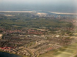
Velserbroek is a town in the Dutch province of North Holland. It is a part of the municipality of Velsen. Velserbroek is planned town for the Velsen region and was developed from 1985 onwards.
Driehuis railway station
Railway station in the Netherlands
Distance: Approx. 1624 meters
Latitude and longitude: 52.44277778,4.63916667
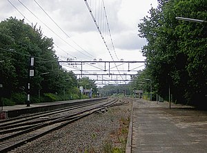
Driehuis railway station is located in Driehuis, the Netherlands. The station opened on 29 September 1957 on the Haarlem–Uitgeest railway. The station has 2 platforms.

Santpoort Noord railway station
Railway station in the Netherlands
Distance: Approx. 1624 meters
Latitude and longitude: 52.44277778,4.63916667
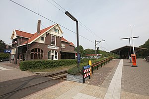
Santpoort Noord railway station is located in Santpoort-Noord, the Netherlands. The station opened 27 September 1957 on the Haarlem–Uitgeest railway. The station has 2 platforms.

Santpoort Zuid railway station
Railway station in the Netherlands
Distance: Approx. 2254 meters
Latitude and longitude: 52.41944444,4.63166667
Santpoort Zuid railway station is located in Santpoort-Zuid, the Netherlands. The station opened 1 May 1867 on the Haarlem–Uitgeest railway. The station has 2 platforms.
Brederode Castle
Castle ruins near Haarlem, NL
Distance: Approx. 2462 meters
Latitude and longitude: 52.4253,4.6225
Brederode Castle (Dutch: Kasteel Brederode), also called the Ruins of Brederode (Dutch: Ruïne van Brederode), is located near Santpoort-Zuid. The castle was founded in the second half of the 13th century by William I van Brederode (1215–1285). William was a descendant of the lords van Teylingen, who were related to the counts of Holland.

Beeckestijn
Distance: Approx. 2231 meters
Latitude and longitude: 52.4525,4.65055556
Beeckestijn is a historical buitenplaats (summer house) dating from the 18th century in a park by the same name in Velsen-Zuid, Netherlands.

De Vrienden van Jacob
Restaurant in Santpoort, Netherlands
Distance: Approx. 2102 meters
Latitude and longitude: 52.43408333,4.62573056
De Vrienden van Jacob is a restaurant in Santpoort, Netherlands. It is a fine dining restaurant that was awarded one Michelin star for the period 2006–present. GaultMillau awarded the restaurant 16 out of 20 points.

Duin en Kruidberg
Stately home in Santpoort, Haarlem, the Netherlands
Distance: Approx. 2111 meters
Latitude and longitude: 52.43423,4.62561
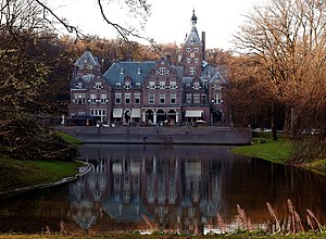
Duin en Kruidberg is a stately home in Santpoort, near Haarlem, the Netherlands. Kruidberg started as a summer house for rich merchants from Amsterdam, then it became a hunting lodge of the prince of Orange, the future king-stadholder, William III (1650–1702). The plans for the Dutch invasion of England were drawn up here, which culminated in the Glorious Revolution of 1688.
Weather in this IP's area
overcast clouds
8 Celsius
7 Celsius
8 Celsius
9 Celsius
1027 hPa
96 %
1027 hPa
1027 hPa
10000 meters
2.41 m/s
2.8 m/s
335 degree
99 %
08:03:30
16:48:47

