Country:
Region:
City:
Latitude and Longitude:
Time Zone:
Postal Code:
IP information under different IP Channel
ip-api
Country
Region
City
ASN
Time Zone
ISP
Blacklist
Proxy
Latitude
Longitude
Postal
Route
Luminati
Country
ASN
Time Zone
Europe/Berlin
ISP
Cerner Health Services Deutschland GmbH
Latitude
Longitude
Postal
IPinfo
Country
Region
City
ASN
Time Zone
ISP
Blacklist
Proxy
Latitude
Longitude
Postal
Route
db-ip
Country
Region
City
ASN
Time Zone
ISP
Blacklist
Proxy
Latitude
Longitude
Postal
Route
ipdata
Country
Region
City
ASN
Time Zone
ISP
Blacklist
Proxy
Latitude
Longitude
Postal
Route
Popular places and events near this IP address

Rohrdamm (Berlin U-Bahn)
Station of the Berlin U-Bahn
Distance: Approx. 823 meters
Latitude and longitude: 52.53722222,13.2625
Rohrdamm is a station on the Berlin U-Bahn line U7 in the Siemensstadt district. Designed by architect Rümmler, the station was opened on 1 October 1980, as part of the line's extension from Richard-Wagner-Platz to Rohrdamm. Until the second extension of the line from Rohrdamm to Rathaus Spandau in 1984, it was the western terminus of the U7.

Siemensdamm (Berlin U-Bahn)
Station of the Berlin U-Bahn
Distance: Approx. 199 meters
Latitude and longitude: 52.53666667,13.27305556
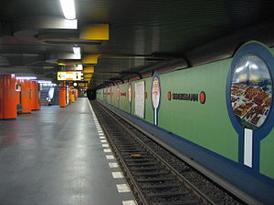
Siemensdamm is a station on the Berlin U-Bahn line U7, located in the Spandau district. It was opened on 1 October 1980 (designed by R.G.Rümmler) with the line's extension from Richard-Wagner-Platz to Rohrdamm. The station is named after an arterial street, which itself is named after Werner von Siemens.
Halemweg (Berlin U-Bahn)
Station of the Berlin U-Bahn
Distance: Approx. 853 meters
Latitude and longitude: 52.53666667,13.28638889
Halemweg is a station on the Berlin U-Bahn line U7, located in the Charlottenburg-Nord district. It was opened on 1 October 1980 (architect R.G.Rümmler) with the line's extension from Richard-Wagner-Platz to Rohrdamm. The eponymous neighborhood street is named after Resistance fighter Nikolaus von Halem, who was executed in Brandenburg-Görden Prison on 9 October 1944.

Jakob-Kaiser-Platz (Berlin U-Bahn)
Station of the Berlin U-Bahn
Distance: Approx. 1323 meters
Latitude and longitude: 52.53444444,13.29361111
Jakob-Kaiser-Platz is a metro station on the Berlin U-Bahn line U7, located in the Charlottenburg-Nord district. It was opened on 1 October 1980 (architect R.G.Rümmler) with the line's extension from Richard-Wagner-Platz to Rohrdamm. The eponymous traffic circle located above the station is named after politician and Resistance fighter Jakob Kaiser (1888–1961).

Jungfernheide
Distance: Approx. 1504 meters
Latitude and longitude: 52.54388889,13.29083333
Jungfernheide (German pronunciation: [ˌjʊŋfɐnˈhaɪ̯də] ) is an area of forest and heathland located in Berlin in the present-day district of Charlottenburg-Nord, a locality of the borough of Charlottenburg-Wilmersdorf. Formerly a large forested area, it was progressively reduced in size through development and military use. The recently closed Tegel Airport now divides the remainder, with Volkspark Jungfernheide (Jungfernheidepark) to the south, and a larger still-forested region between the airport and Lake Tegel.

Großsiedlung Siemensstadt
Distance: Approx. 545 meters
Latitude and longitude: 52.53833333,13.28
The Siemensstadt Settlement (German: Großsiedlung Siemensstadt; also known as Ring Settlement or Ringsiedlung) is a nonprofit residential community in the Charlottenburg-Wilmersdorf district of Berlin. It is one of the six Modernist Housing Estates in Berlin recognized in July 2008 by UNESCO as a World Heritage Site because of their outstanding modernist architecture and contribution to the progressive housing reform movement during the Weimar Republic.

Siemensstadt
Quarter of Berlin in Germany
Distance: Approx. 970 meters
Latitude and longitude: 52.54055556,13.26305556
Siemensstadt (German: [ˈziːmənsˌʃtat] ) is a locality (Ortsteil) of Berlin in the district (Bezirk) of Spandau.

Charlottenburg-Nord
Quarter of Berlin in Germany
Distance: Approx. 1355 meters
Latitude and longitude: 52.53888889,13.29305556
Charlottenburg-Nord (German pronunciation: [ʃaʁˈlɔtn̩bʊʁk nɔʁt], literally "Charlottenburg North") is a locality (Ortsteil) in the northern part of the Charlottenburg-Wilmersdorf borough of Berlin, Germany. It is chiefly composed of after-war housing estates, allotment gardens and commercial zones. The locality comprises the Großsiedlung Siemensstadt, part of the Berlin Modernism Housing Estates UNESCO World Heritage Site, as well as Plötzensee Prison.

Kaiser Wilhelm Memorial Cemetery
Distance: Approx. 1050 meters
Latitude and longitude: 52.52583333,13.27777778
The Protestant Kaiser Wilhelm Memorial Cemetery (German: Der evangelische Kaiser-Wilhelm-Gedächtnis-Friedhof) is a burial ground in the Westend district of Berlin with a size of 3.7 hectares. The cemetery is under monument and cultural heritage protection. The cemetery is located on Fürstenbrunner way, adjacent to the cemetery Luisenfriedhof III and is connected by two paths.

Luisenfriedhof III
Historic cemetery in Berlin, Germany
Distance: Approx. 1163 meters
Latitude and longitude: 52.52472222,13.27722222
The Protestant Luisenfriedhof III (German: Der evangelische Luisenfriedhof III) is a cemetery in the Westend district of Berlin. The cemetery is under monument protection.

Nikolaus von Halem
German Resistance member
Distance: Approx. 853 meters
Latitude and longitude: 52.53666667,13.28638889
Nikolaus Christoph von Halem (15 March 1905 – 9 October 1944) was a German lawyer, businessman, and resistance fighter against Nazism.

Siemensstadt-Fürstenbrunn station
Railway station in Charlottenburg-Wilmersdorf, Germany
Distance: Approx. 835 meters
Latitude and longitude: 52.52805556,13.26944444
Siemensstadt-Fürstenbrunn station was a suburban station on the Berlin–Hamburg railway in Westend, a locality of the Charlottenburg-Wilmersdorf borough in Berlin. It was primarily built for workers at its nearby Siemens Works in the neighbouring quarter of Siemensstadt.
Weather in this IP's area
overcast clouds
5 Celsius
4 Celsius
4 Celsius
6 Celsius
1034 hPa
92 %
1034 hPa
1030 hPa
10000 meters
1.79 m/s
3.13 m/s
68 degree
100 %
07:16:37
16:24:47
