Country:
 Italy
ItalyRegion:
City:
Latitude and Longitude:
Time Zone:
Postal Code:
IP information under different IP Channel
ip-api
Country
Region
City
ASN
Time Zone
ISP
Blacklist
Proxy
Latitude
Longitude
Postal
Route
IPinfo
Country
Region
City
ASN
Time Zone
ISP
Blacklist
Proxy
Latitude
Longitude
Postal
Route
MaxMind
Country
Region
City
ASN
Time Zone
ISP
Blacklist
Proxy
Latitude
Longitude
Postal
Route
Luminati
Country
ITASN
Time Zone
Europe/Rome
ISP
SEEWEB s.r.l.
Latitude
Longitude
Postal
db-ip
Country
Region
City
ASN
Time Zone
ISP
Blacklist
Proxy
Latitude
Longitude
Postal
Route
ipdata
Country
Region
City
ASN
Time Zone
ISP
Blacklist
Proxy
Latitude
Longitude
Postal
Route
Popular places and events near this IP address

Rho, Lombardy
Comune in Lombardy, Italy
Distance: Approx. 5374 meters
Latitude and longitude: 45.53111111,9.04055556
Rho (Italian: [ˈrɔ]; Lombard: Rò; Latin: Rhaudum) is a town and comune (municipality) in the Metropolitan City of Milan in the Italian region of Lombardy, located about 14 kilometres (9 miles) northwest of Milan. The language spoken in Rho is Italian.

Parabiago
Comune in Lombardy, Italy
Distance: Approx. 5730 meters
Latitude and longitude: 45.55,8.95
Parabiago (Milanese: Parabiagh; Latin: Parabiacum) is a town located in the north-western part of the Metropolitan City of Milan, Lombardy, northern Italy. The town is crossed by the road to Sempione (S.S.33) and Milan – Gallarate Railway; nearby flow the Olona river and the Canale Villoresi.

Origgio
Comune in Lombardy, Italy
Distance: Approx. 2725 meters
Latitude and longitude: 45.6,9.01666667
Origgio (Lombard: Origg [uˈritʃ]) is a comune (municipality) in the Province of Varese in the Italian region Lombardy, located about 20 kilometres (12 mi) northwest of Milan and about 30 kilometres (19 mi) southeast of Varese. As of 31 December 2004, it had a population of 6,777 and an area of 8.1 square kilometres (3.1 sq mi). The municipality of Origgio contains the frazioni (subdivisions, mainly villages and hamlets) Cascina Muschiona and Cascina Broggio.

Pogliano Milanese
Comune in Lombardy, Italy
Distance: Approx. 4826 meters
Latitude and longitude: 45.53333333,9
Pogliano Milanese (Lombard: Pojan [puˈjãː]) is a comune (municipality) in the Province of Milan in the Italian region Lombardy, located about 15 kilometres (9 mi) northwest of Milan. Pogliano Milanese borders the following municipalities: Lainate, Nerviano, Rho, Vanzago, Pregnana Milanese, Arluno.
Vanzago
Comune in Lombardy, Italy
Distance: Approx. 4826 meters
Latitude and longitude: 45.53333333,9
Vanzago (Lombard: Vanzagh [ʋãˈsaːk]) is a comune (municipality) in the Province of Milan in the Italian region Lombardy, located about 15 kilometres (9 mi) northwest of Milan. As of 31 December 2004, it had a population of 7,615 and an area of 6.2 square kilometres (2.4 sq mi). The municipality of Vanzago contains the frazioni (subdivisions, mainly villages and hamlets) Mantegazza, Valdarenne, and Tre Campane.

Museo Alfa Romeo
Automobile museum in Milan, Italy
Distance: Approx. 3233 meters
Latitude and longitude: 45.5574,9.04612
Museo Storico Alfa Romeo (Alfa Romeo Historical Museum; subsequently called Museo Alfa Romeo - La macchina del tempo, literally Alfa Romeo Museum - The time machine) is Alfa Romeo's official museum, located in Arese (Milan), and displaying a permanent collection of Alfa Romeo cars and engines. After being closed down in 2011, the museum reopened in June 2015.

Alfa Romeo Arese Plant
Distance: Approx. 3309 meters
Latitude and longitude: 45.56638889,9.05416667
The Alfa Romeo Arese Plant was a plant area where Alfa Romeo had its head office for more than two decades prior to 1986. After Fiat Group purchased Alfa Romeo in 1986, Arese became one of the assembly plants of Fiat Group. The factory is in the Province of Milan in the Italian region of Lombardy, located about 12 kilometres (7.5 mi) northwest of Milan.
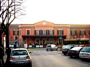
Saronno railway station
Distance: Approx. 5691 meters
Latitude and longitude: 45.62530889,9.03083889
Saronno railway station is a railway station in Italy. It serves the town of Saronno.

Saronno Sud railway station
Distance: Approx. 4728 meters
Latitude and longitude: 45.61166667,9.04583333
Saronno Sud railway station is a railway station in Italy. It serves the southern suburbs of the town of Saronno.
Caronno Pertusella railway station
Railway station in Italy
Distance: Approx. 4259 meters
Latitude and longitude: 45.59805556,9.05805556
Caronno Pertusella railway station is a railway station in Italy. It serves the town of Caronno Pertusella.
Garbagnate Milanese railway station
Railway station in Italy
Distance: Approx. 5207 meters
Latitude and longitude: 45.58027778,9.08027778
Garbagnate Milanese railway station is a railway station in Italy. It serves the town of Garbagnate Milanese.

Cesate railway station
Railway station in Italy
Distance: Approx. 4435 meters
Latitude and longitude: 45.59083333,9.06638889
Cesate railway station is a railway station in Italy. It serves the town of Cesate.
Weather in this IP's area
moderate rain
15 Celsius
15 Celsius
14 Celsius
16 Celsius
1018 hPa
90 %
1018 hPa
996 hPa
8357 meters
1.34 m/s
3.13 m/s
8 degree
100 %
07:45:47
18:31:36