Country:
Region:
City:
Latitude and Longitude:
Time Zone:
Postal Code:
IP information under different IP Channel
ip-api
Country
Region
City
ASN
Time Zone
ISP
Blacklist
Proxy
Latitude
Longitude
Postal
Route
Luminati
Country
ASN
Time Zone
Europe/Luxembourg
ISP
Fondation RESTENA
Latitude
Longitude
Postal
IPinfo
Country
Region
City
ASN
Time Zone
ISP
Blacklist
Proxy
Latitude
Longitude
Postal
Route
db-ip
Country
Region
City
ASN
Time Zone
ISP
Blacklist
Proxy
Latitude
Longitude
Postal
Route
ipdata
Country
Region
City
ASN
Time Zone
ISP
Blacklist
Proxy
Latitude
Longitude
Postal
Route
Popular places and events near this IP address
Pétrusse
River in Luxembourg
Distance: Approx. 748 meters
Latitude and longitude: 49.6074,6.1373
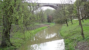
The Pétrusse (French pronunciation: [petʁys]; Luxembourgish: Péitruss pronounced [ˈpɜɪ.tʀus] , German: Petruss) is a river flowing through Luxembourg, joining the Alzette at Luxembourg City. It flows through the town of Hollerich.
Stade Achille Hammerel
Football stadium in Luxembourg
Distance: Approx. 639 meters
Latitude and longitude: 49.60472222,6.14027778
Stade Achille Hammerel is a football stadium in Verlorenkost, a quarter of Luxembourg City, in southern Luxembourg. It is currently the home stadium of Racing FC Union Luxembourg. Until 2005, it was the home of Union Luxembourg.

Gare, Luxembourg
Quarter in Luxembourg City, Luxembourg
Distance: Approx. 130 meters
Latitude and longitude: 49.6016,6.1316
Gare (Luxembourgish: Garer Quartier) is a quarter in central Luxembourg City, in southern Luxembourg. The quarter has, since 1859, been the location of Luxembourg's principal railway station and terminus, Luxembourg station, around which it subsequently developed. The quarter's name translates into English, from the French Gare, to "station".

Passerelle (Luxembourg)
Viaduct in Luxembourg
Distance: Approx. 516 meters
Latitude and longitude: 49.60583333,6.13333333
The Passerelle, also known as the Luxembourg Viaduct, is a viaduct in Luxembourg City, in southern Luxembourg. Nowadays it runs from the south into the city centre, Ville Haute, carrying road traffic across the Pétrusse valley and connecting Avenue de la Gare to Boulevard Franklin Delano Roosevelt. It is 290 m long, with 24 arches, and 45 m above the valley floor.

René Konen Tunnel
Distance: Approx. 775 meters
Latitude and longitude: 49.60816,6.13294
The René Konen Tunnel (French: Tunnel René Konen), colloquially known as the Saint Esprit Tunnel (French: Tunnel du St-Esprit, Luxembourgish: Helleg-Geescht-Tunnel), is a 655 m (2,149 ft) road tunnel in Luxembourg City in southern Luxembourg. It carries two lanes of one-way traffic northwards, under Ville Haute, bypassing the narrow streets and pedestrian zone in the heart of the city. At the southern end (49°36′29″N 6°07′59″E), the tunnel is fed by the Passerelle, which carries traffic from Gare, on the southern side of the Pétrusse valley.

Place des Martyrs, Luxembourg
Garden square in Luxembourg City, Luxembourg
Distance: Approx. 554 meters
Latitude and longitude: 49.60527778,6.12888889
The Place des Martyrs is a garden square in Luxembourg City, in southern Luxembourg. The square lies to the south of the Pétrusse valley, in the quarter of Gare. It is colloquially known as the Rose Garden (Luxembourgish: Rousegäertchen), on account of the red roses that dominate the garden's floriculture.
Am Tunnel
Distance: Approx. 679 meters
Latitude and longitude: 49.60638889,6.12833333
Am Tunnel is a contemporary art gallery, situated in a tunnel in Luxembourg City, in southern Luxembourg. The gallery is located in part of the underground casemates of the city's ancient fortress, under the Bourbon plateau, in the northern part of Gare quarter. It is connected to the former headquarters of Banque et Caisse d'Épargne de l'État (BCEE), the third-largest bank based in Luxembourg.

Judiciary City
Distance: Approx. 757 meters
Latitude and longitude: 49.608,6.1335
The Judiciary City (French: Cité judiciaire) is a site in Luxembourg City, in southern Luxembourg, that houses a number of courts and legal offices. It consolidates all of Luxembourg City's judicial buildings, except those related to the institutions of the European Union, on one site, and greatly expands their capacity. The City sits on the Saint-Esprit plateau, sandwiched between the Alzette and the Pétrusse, in the southern part of the central Ville Haute quarter.
Le Juste Milieu Mosque
Mosque in Luxembourg City, Luxembourg
Distance: Approx. 512 meters
Latitude and longitude: 49.59672222,6.13491667
Le Juste Milieu (from Arabic: الوسط, romanized: al-waṣaṭ, "the middle") is the name of an Islamic association and the first Islamic center in Luxembourg City. Luxembourg. The center's construction was largely funded by Qatar Charity.
Villa Pauly
Building in Luxembourg
Distance: Approx. 809 meters
Latitude and longitude: 49.6061,6.125
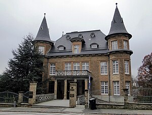
The Villa Pauly was built in 1923 at No. 57, Boulevard de la Pétrusse, in the center of Luxembourg, for the surgeon Dr. Norbert Pauly; the architect was Mathias Martin.

Bourbon Plateau
Plateau and neighbourhood of Luxembourg City, Luxembourg
Distance: Approx. 554 meters
Latitude and longitude: 49.605,6.12833333
The Bourbon Plateau is a plateau and neighbourhood of Luxembourg City that was named after the Fort Bourbon, part of the Fortress of Luxembourg.

Spuerkeess Building
Building in Luxembourg City, Luxembourg
Distance: Approx. 763 meters
Latitude and longitude: 49.60731389,6.12851944
The Spuerkeeess Building (French: Palais de la Banque et caisse d'épargne de l'État, Luxembourgish: Spuerkeessgebai) is a historic building located in Luxembourg City, Luxembourg.
Weather in this IP's area
light rain
9 Celsius
5 Celsius
8 Celsius
10 Celsius
1002 hPa
94 %
1002 hPa
968 hPa
8000 meters
8.75 m/s
220 degree
75 %
07:53:48
16:48:22


