193.163.186.138 - IP Lookup: Free IP Address Lookup, Postal Code Lookup, IP Location Lookup, IP ASN, Public IP
Country:
Region:
City:
Location:
Time Zone:
Postal Code:
IP information under different IP Channel
ip-api
Country
Region
City
ASN
Time Zone
ISP
Blacklist
Proxy
Latitude
Longitude
Postal
Route
Luminati
Country
ASN
Time Zone
Europe/Zurich
ISP
Quickline AG
Latitude
Longitude
Postal
IPinfo
Country
Region
City
ASN
Time Zone
ISP
Blacklist
Proxy
Latitude
Longitude
Postal
Route
IP2Location
193.163.186.138Country
Region
basel-landschaft
City
oberdorf
Time Zone
Europe/Zurich
ISP
Language
User-Agent
Latitude
Longitude
Postal
db-ip
Country
Region
City
ASN
Time Zone
ISP
Blacklist
Proxy
Latitude
Longitude
Postal
Route
ipdata
Country
Region
City
ASN
Time Zone
ISP
Blacklist
Proxy
Latitude
Longitude
Postal
Route
Popular places and events near this IP address

Waldenburg, Switzerland
Municipality in Basel-Landschaft, Switzerland
Distance: Approx. 1091 meters
Latitude and longitude: 47.38333333,7.75
Waldenburg is a municipality in the canton of Basel-Country in Switzerland, and the capital of the district of the same name.
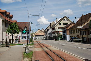
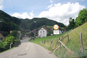
Oberdorf, Basel-Landschaft
Municipality in Basel-Landschaft, Switzerland
Distance: Approx. 1091 meters
Latitude and longitude: 47.38333333,7.75
Oberdorf is a municipality in the district of Waldenburg in the canton of Basel-Landschaft in Switzerland.
Titterten
Municipality in Basel-Landschaft, Switzerland
Distance: Approx. 2713 meters
Latitude and longitude: 47.4,7.71666667
Titterten is a municipality in the district of Waldenburg in the canton of Basel-Country in Switzerland.
Arboldswil
Municipality in Basel-Landschaft, Switzerland
Distance: Approx. 3695 meters
Latitude and longitude: 47.41666667,7.71666667
Arboldswil is a municipality in the district of Waldenburg in the canton of Basel-Country in Switzerland.
Bennwil
Municipality in Basel-Landschaft, Switzerland
Distance: Approx. 2540 meters
Latitude and longitude: 47.4,7.78333333
Bennwil is a municipality in the district of Waldenburg in the canton of Basel-Country in Switzerland.
Hölstein
Municipality in Basel-Landschaft, Switzerland
Distance: Approx. 4628 meters
Latitude and longitude: 47.43333333,7.76666667
Hölstein is a municipality in the district of Waldenburg in the canton of Basel-Country in Switzerland.
Liedertswil
Municipality in Basel-Landschaft, Switzerland
Distance: Approx. 2713 meters
Latitude and longitude: 47.4,7.71666667
Liedertswil (Swiss German: Tschoppehof) is a municipality in the district of Waldenburg in the canton of Basel-Country in Switzerland.
Niederdorf, Basel-Landschaft
Municipality in Basel-Landschaft, Switzerland
Distance: Approx. 773 meters
Latitude and longitude: 47.4,7.75
Niederdorf is a municipality in the district of Waldenburg in the canton of Basel-Landschaft in Switzerland.
Waldenburg District
District in Switzerland
Distance: Approx. 1091 meters
Latitude and longitude: 47.38333333,7.75
Waldenburg District is one of the five districts of the largely German-speaking canton of Basel-Country in Switzerland. The district lies to the south of Basel-Country, bordering the canton of Solothurn. Its capital is the town of Waldenburg.

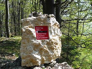
Hinteri Egg
Highest point of the Swiss canton of Basel-Country
Distance: Approx. 3814 meters
Latitude and longitude: 47.37258333,7.71066667
The Hinteri Egg is a mountain of the Jura, located south of Reigoldswil in the Swiss canton of Basel-Landschaft, close to the border with the canton of Solothurn. The Hinteri Egg reaches a height of 1,169 metres above sea level and is the highest point of the canton of Basel-Landschaft.

Sculpture at Schoenthal
Distance: Approx. 4096 meters
Latitude and longitude: 47.3594,7.773
Sculpture at Schoenthal is an art foundation in Switzerland. It is named after the Schönthal Monastery, a former church near the village of Langenbruck, Basel-Landschaft, which is now used for temporary art exhibitions. An array of sculptures, including some by well-known artists, is dotted around the monastery area and the surrounding countryside.

Wildenstein Castle (Bubendorf)
Castle in Bubendorf, Switzerland
Distance: Approx. 4447 meters
Latitude and longitude: 47.43166667,7.73583333
Wildenstein Castle (German: Schloss Wildenstein) is a castle in the municipality of Bubendorf in the canton of Basel-Land in Switzerland. It is a Swiss heritage site of national significance. The castle was acquired by the local council in 1995 and is now regularly used for cultural events.
Weather in this IP's area
clear sky
-3 Celsius
-5 Celsius
-3 Celsius
-0 Celsius
1036 hPa
75 %
1036 hPa
973 hPa
10000 meters
1.5 m/s
4.07 m/s
105 degree
6 %


