Country:
 Norway
Region:
City:
Latitude and Longitude:
Time Zone:
Postal Code:
IP information under different IP Channel
ip-api
Country
Region
City
ASN
Time Zone
ISP
Blacklist
Proxy
Latitude
Longitude
Postal
Route
IPinfo
Country
Region
City
ASN
Time Zone
ISP
Blacklist
Proxy
Latitude
Longitude
Postal
Route
MaxMind
Country
Region
City
ASN
Time Zone
ISP
Blacklist
Proxy
Latitude
Longitude
Postal
Route
Luminati
Country
NORegion
02
City
nittedal
ASN
Time Zone
Europe/Oslo
ISP
Telenor Norge AS
Latitude
Longitude
Postal
db-ip
Country
Region
City
ASN
Time Zone
ISP
Blacklist
Proxy
Latitude
Longitude
Postal
Route
ipdata
Country
Region
City
ASN
Time Zone
ISP
Blacklist
Proxy
Latitude
Longitude
Postal
Route
Popular places and events near this IP address
Nittedal
Municipality in Akershus, Norway
Distance: Approx. 3289 meters
Latitude and longitude: 60.07305556,10.87222222
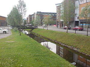
Nittedal is a municipality and city in Akershus county, Norway. It is part of the traditional region of Romerike. The administrative centre of the municipality is the village of Rotnes.
Rotnes
Village in Østlandet, Norway
Distance: Approx. 653 meters
Latitude and longitude: 60.05,10.88333333
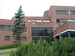
Rotnes is the administrative centre of Nittedal municipality, Norway. Its population (2010) is 20 939. It is located by the Norwegian National Road 4.
Åneby
Village in Østlandet, Norway
Distance: Approx. 4474 meters
Latitude and longitude: 60.08333333,10.86666667
Åneby is a village in the municipality of Nittedal, Norway.
Movatn
Place in Oslo, Norway
Distance: Approx. 4516 meters
Latitude and longitude: 60.04,10.80666667
Movann is a lake at the northern end of the village of Sørbråten in Maridalen valley in Nordmarka, a forested part of Oslo, Norway. It has a train station on the Gjøvik Line. The population of Sørbråten is 317.

Nedre Romerike
Distance: Approx. 369 meters
Latitude and longitude: 60.0428,10.8817
Nedre Romerike is the lower (southern) part of the Romerike traditional district in Akershus, Norway. It consists of the municipalities Lillestrøm, Lørenskog, Nittedal, Rælingen and Aurskog-Høland. It make up the area served by Nedre Romerike District Court, based in Lillestrøm.
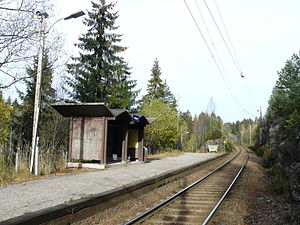
Snippen Station
Distance: Approx. 4863 meters
Latitude and longitude: 60.02416667,10.81
Snippen Station (Norwegian: Snippen stasjon) is an unmanned stop on the Gjøvik Line with the address Greveveien in Maridalen, Oslo, Norway. The station is located a little over 17.5 km from Oslo Central Station between Sandermosen Station and Movatn Station and was opened in 1934. There is no car parking area in connection with the station.

Movatn Station
Railway station in Norway
Distance: Approx. 4221 meters
Latitude and longitude: 60.0375,10.81277778
Movatn Station (Norwegian: Movatn stasjon) is an unstaffed railway station on the Gjøvik Line at Movatn in Maridalen, Oslo, Norway. The station is located about 19 km (12 mi) from Oslo S between Snippen Station and Nittedal Station and was first opened in 1900 as a crossing track, two years ahead of the opening of Gjøvikbanen. In 1927 the station was upgraded with a station building and converted to a staffed station reserved for passengers and freight.
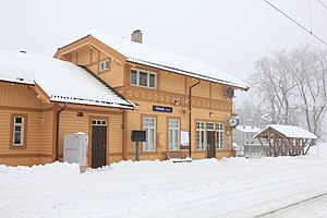
Nittedal Station
Railway station in Nittedal, Norway
Distance: Approx. 1946 meters
Latitude and longitude: 60.05805556,10.86527778
Nittedal Station (Norwegian: Nittedal stasjon) is a railway station on the Gjøvik Line at Rotnes in Akershus county, Norway. The station was opened in 1900 as a stop for passengers and freight two years ahead of the opening of the Gjøvik Line in 1902. In 1907 Nittedal was upgraded from a stop to a station staffed to expedite trains, passengers and freight.

Åneby Station
Distance: Approx. 4800 meters
Latitude and longitude: 60.08583333,10.86277778
Åneby Station is a railway station on the Gjøvik Line at Nittedal in Akershus, Norway. The station was opened in 1905 as a stop, three years after the line's opening in 1902. In 1945, the stop was upgraded to a station, but since 1972 the station has been unmanned and remote controlled.
Askkroken
Village in Østlandet, Norway
Distance: Approx. 2607 meters
Latitude and longitude: 60.0648,10.9108
Askkroken is a village in Nittedal, Akershus, Norway.
Kjul
Village in Østlandet, Norway
Distance: Approx. 1999 meters
Latitude and longitude: 60.02694444,10.895
Kjul is a small village in Nittedal, Akershus, Norway.
Slattum
Village in Østlandet, Norway
Distance: Approx. 4317 meters
Latitude and longitude: 60.0094,10.9204
Slattum is a village in Nittedal, Akershus, Norway.
Weather in this IP's area
broken clouds
14 Celsius
14 Celsius
14 Celsius
16 Celsius
1017 hPa
97 %
1017 hPa
1003 hPa
10000 meters
1.48 m/s
1.54 m/s
34 degree
59 %
06:28:40
19:59:47