Country:
 Norway
Region:
City:
Latitude and Longitude:
Time Zone:
Postal Code:
IP information under different IP Channel
ip-api
Country
Region
City
ASN
Time Zone
ISP
Blacklist
Proxy
Latitude
Longitude
Postal
Route
IPinfo
Country
Region
City
ASN
Time Zone
ISP
Blacklist
Proxy
Latitude
Longitude
Postal
Route
MaxMind
Country
Region
City
ASN
Time Zone
ISP
Blacklist
Proxy
Latitude
Longitude
Postal
Route
Luminati
Country
NORegion
03
City
oslo
ASN
Time Zone
Europe/Oslo
ISP
Telenor Norge AS
Latitude
Longitude
Postal
db-ip
Country
Region
City
ASN
Time Zone
ISP
Blacklist
Proxy
Latitude
Longitude
Postal
Route
ipdata
Country
Region
City
ASN
Time Zone
ISP
Blacklist
Proxy
Latitude
Longitude
Postal
Route
Popular places and events near this IP address

Akershus Fortress
Medieval castle in Oslo, Norway
Distance: Approx. 573 meters
Latitude and longitude: 59.90666667,10.73611111
Akershus Fortress (Norwegian: Akershus Festning, pronounced [ɑkəʂˈhʉːs ˈfɛ̂sːtnɪŋ]) or Akershus Castle (Norwegian: Akershus slott [ɑkəʂˈhʉːs ˈslɔtː]) is a medieval castle in the Norwegian capital Oslo that was built to protect and provide a royal residence for the city. Since the Middle Ages the fortress has been the namesake and centre of the main fief and later main county of Akershus, which was originally one of Norway's four main regions and which included most of Eastern Norway. The fortress itself was located within the Akershus main county until 1919, and also within the smaller Akershus sub county until 1842.

Fortification Upgrades
Re-organization of military forces in Norway
Distance: Approx. 682 meters
Latitude and longitude: 59.9076,10.7368
Fortification Upgrades (1673–1675) was a re-organization of military forces and strengthening of the defenses of Norway. The Norwegian army in this period became much better prepared for conflict with Sweden than in any previous period. It numbered 12,000 men in five regiments of infantry, 6 companies of cavalry, and an artillery division with 76 field pieces.

Hovedøya
Distance: Approx. 186 meters
Latitude and longitude: 59.9,10.73333333
Hovedøya is one of several small islands off the coast of Oslo, Norway in the Oslofjord. The island is quite small, no more than 800 metres across in any direction, the total area is 0,4 square kilometre. It is well known for its lush and green nature, with a wide variety of trees, bushes and flowers.

Hovedøya Abbey
Distance: Approx. 192 meters
Latitude and longitude: 59.9,10.733
Hovedøya Abbey (Hovedøya kloster) was a medieval era Cistercian monastery on the island of Hovedøya in Oslofjord outside of Oslo, Norway.

Vippetangen
Distance: Approx. 446 meters
Latitude and longitude: 59.902885,10.74186111
Vippetangen is the southern tip of the Akersnes peninsula in central Oslo, Norway, located southeast of Akershus Fortress and bounded on three sides by the Oslofjord. It has in the past served as an important part of the port of Oslo. The area is currently undergoing urban renewal as part of the Fjord City development.
Vippetangen Line
Former line of the Oslo Tramway, Norway
Distance: Approx. 448 meters
Latitude and longitude: 59.9029,10.7419
The Vippetangen Line or the Grain Tram (Norwegian: Korntrikken) is a former line of the Oslo Tramway, Norway, that ran from Tollbugata in the city center to Vippetangen between 1900 and 1967. It was built by Kristiania Kommunale Sporveie (KKS).
Norwegian Military College
Distance: Approx. 722 meters
Latitude and longitude: 59.9078,10.7381
The Norwegian Military College (Norwegian: Den militære høyskole) was a military educational institution in Norway. It was established on 16 February 1817, with headquarters at Akershus Fortress. It was originally meant for artillery and engineer officers, and in 1826 it was expanded to include naval officers; however, not many naval officers actually attended.

Norway's Resistance Museum
World War II museum in Akershus Fortress, Oslo
Distance: Approx. 706 meters
Latitude and longitude: 59.9079,10.7358
Norway's Resistance Museum also known as the Norwegian Home Front Museum (Norwegian: Norges Hjemmefrontmuseum) is a museum located at the Akershus Fortress in Oslo. The museum collection focuses on Norwegian resistance during the occupation of Norway by Nazi Germany from 1940 to 1945. The museum displays equipment, photos and documents from the war years.

Anatomigården
Distance: Approx. 537 meters
Latitude and longitude: 59.90615,10.73749167
Anatomigården is a historic house located on the north side of Christiania Torv in Oslo, Norway.

Armed Forces Museum (Norway)
Military museum in Oslo, Norway
Distance: Approx. 483 meters
Latitude and longitude: 59.90444444,10.74083333
The Armed Forces Museum of Norway (Norwegian: Forsvarsmuseet - The Defence Museum) is a museum located at Akershus Fortress in Oslo, Norway. Previously it was named Hærmuseet, The Army Museum (even earlier the Artillery Museum). The museum consists of mostly army materiel.
Gamle Logen
Distance: Approx. 715 meters
Latitude and longitude: 59.90694444,10.74138889
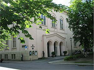
Gamle Logen is a concert hall and music venue located at Grev Wedels plass 2 in Oslo, Norway. The hall also hosts artistic performances, conferences, banquets and private parties.

Oslo Port Authority
Port in Norway
Distance: Approx. 681 meters
Latitude and longitude: 59.9017,10.7465
Oslo Port Authority (Norwegian: Oslo Havn KF) is a kommunalt foretak (municipal enterprise), and accountable to the Municipality of Oslo. For many years, Oslo Havn KF was known as Oslo havnevesen (OHV) but was renamed on June 8, 2004, to its current name. As of 2021, the enterprise has around 100 employees and is managed by an elected board and a Port Director.
Weather in this IP's area
light rain
18 Celsius
18 Celsius
17 Celsius
19 Celsius
1014 hPa
89 %
1014 hPa
1014 hPa
10000 meters
1.41 m/s
2.87 m/s
38 degree
100 %
06:29:32
20:00:09