Country:
Region:
City:
Latitude and Longitude:
Time Zone:
Postal Code:
IP information under different IP Channel
ip-api
Country
Region
City
ASN
Time Zone
ISP
Blacklist
Proxy
Latitude
Longitude
Postal
Route
Luminati
Country
Region
ut
City
utrecht
ASN
Time Zone
Europe/Amsterdam
ISP
Voiped Wholesale BV
Latitude
Longitude
Postal
IPinfo
Country
Region
City
ASN
Time Zone
ISP
Blacklist
Proxy
Latitude
Longitude
Postal
Route
db-ip
Country
Region
City
ASN
Time Zone
ISP
Blacklist
Proxy
Latitude
Longitude
Postal
Route
ipdata
Country
Region
City
ASN
Time Zone
ISP
Blacklist
Proxy
Latitude
Longitude
Postal
Route
Popular places and events near this IP address

Vleuten
Neighbourhood of Utrecht, Netherlands
Distance: Approx. 2165 meters
Latitude and longitude: 52.10805556,5.015
Vleuten is a former village in the Dutch province of Utrecht. Today, it is a neighbourhood of the city of Utrecht, and lies about 6 km west from the city centre. Vleuten has a railway station on the line between Utrecht and Woerden.

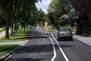
Leidsche Rijn
Neighborhood in Utrecht
Distance: Approx. 976 meters
Latitude and longitude: 52.0964879,5.0522518
Leidsche Rijn (Dutch pronunciation: [ˈlɛitsə ˈrɛin], Utrecht dialect: [ˈlaitsə ˈʁain]) is a new construction site and neighborhood in Utrecht, the capital of the Dutch province of Utrecht. The area is located west of the Amsterdam–Rhine Canal and its name is derived from the Leidse Rijn canal, which runs through it. At the time of its inception in the 1990s and in the decades that followed, Leidsche Rijn was the largest Vinex location in the Netherlands.
Vleuten-De Meern
Distance: Approx. 1973 meters
Latitude and longitude: 52.09583333,5.02083333
Vleuten-De Meern is a former municipality in the Dutch province of Utrecht. It was created in a merger of Haarzuilens, Veldhuizen, Vleuten and a part of Oudenrijn in 1954, and existed until 2001, when it was merged with Utrecht to become a city part of it.

Themaat
Hamlet in Utrecht, Netherlands
Distance: Approx. 2777 meters
Latitude and longitude: 52.11583333,5.01
Themaat is a hamlet in the Dutch province of Utrecht. It is a part of the municipality of Utrecht, and lies about 7 km west of Utrecht. The hamlet has about 100 inhabitants.
Oudenrijn
Distance: Approx. 2735 meters
Latitude and longitude: 52.08333333,5.06666667
Oudenrijn is a hamlet in the Dutch province of Utrecht. It is located in the municipality of Utrecht, in the western part of the city, surrounded by the new neighbourhoods of Leidsche Rijn. Oudenrijn was a separate municipality from 1818 to 1954, when it was divided between the municipalities of Utrecht and Vleuten-De Meern.

Het Zand, Utrecht
Utrecht
Distance: Approx. 1232 meters
Latitude and longitude: 52.09333333,5.04583333
Het Zand (Dutch pronunciation: [ət ˈsɑnt]) is a hamlet in the Dutch province of Utrecht, in the municipality of Utrecht.
Utrecht Leidsche Rijn railway station
Railway station in the Netherlands
Distance: Approx. 1716 meters
Latitude and longitude: 52.09833333,5.06916667
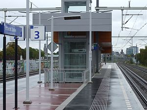
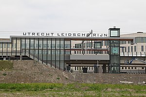
Utrecht Leidsche Rijn is a railway station in west Utrecht, Netherlands. The station opened on 9 June 2013 and is located on the Utrecht–Rotterdam railway. The station is primarily for the housing areas, Parkwijk and Terwijde Oost.

Utrecht Terwijde railway station
Railway station in the Netherlands
Distance: Approx. 448 meters
Latitude and longitude: 52.10083333,5.04305556
Utrecht Terwijde is a railway station on the Utrecht–Rotterdam railway. It is located between Vleuten and Utrecht Leidsche Rijn stations. The Terwijde neighbourhood is part of the Leidsche Rijn area under construction, west of Utrecht.

Utrecht Zuilen railway station
Railway station in the Netherlands
Distance: Approx. 2949 meters
Latitude and longitude: 52.10305556,5.08916667
Utrecht Zuilen is a railway station located in Utrecht, Netherlands. The station opened on 10 June 2007 and is located on the Amsterdam–Arnhem railway. The services are currently operated by Nederlandse Spoorwegen.

Vleuten railway station
Railway station in the Netherlands
Distance: Approx. 2340 meters
Latitude and longitude: 52.10305556,5.01194444
Vleuten is a railway station located in Vleuten, Utrecht, Netherlands. The station was opened in 1881, and is located on the Utrecht–Rotterdam railway. The train services are operated by Nederlandse Spoorwegen.

FC Utrecht (women)
Dutch women's football (soccer) club
Distance: Approx. 2269 meters
Latitude and longitude: 52.12041667,5.06663889
FC Utrecht Vrouwen is the women's football section of Dutch club FC Utrecht based in Utrecht. Established in 2007, as one of the founding members of the professional Dutch women's Eredivisie. The team competed in the Eredivisie from its inaugural season of 2007–08 until 2011–12 and then in the BeNe League, made of up Belgian and Dutch teams, from 2012–13 until the team's dissolution in January 2014.
Academie Tien
School
Distance: Approx. 1982 meters
Latitude and longitude: 52.0956,5.0713
Academie Tien (stylized as ACADEMİE TİEN) is a Dutch secondary school located in the city of Utrecht. The school officially opened in 2015 as Mavo Tien, which only offered education to students in the MAVO level. On August 1, 2018, the school changed its name to Academie Tien and started enrolling students in the HAVO and VWO levels.
Weather in this IP's area
overcast clouds
8 Celsius
8 Celsius
6 Celsius
9 Celsius
1010 hPa
84 %
1010 hPa
1010 hPa
10000 meters
0.45 m/s
0.89 m/s
222 degree
100 %
08:05:55
16:44:29
