193.141.71.227 - IP Lookup: Free IP Address Lookup, Postal Code Lookup, IP Location Lookup, IP ASN, Public IP
Country:
Region:
City:
Location:
Time Zone:
Postal Code:
IP information under different IP Channel
ip-api
Country
Region
City
ASN
Time Zone
ISP
Blacklist
Proxy
Latitude
Longitude
Postal
Route
Luminati
Country
ASN
Time Zone
Europe/Amsterdam
ISP
KPN B.V.
Latitude
Longitude
Postal
IPinfo
Country
Region
City
ASN
Time Zone
ISP
Blacklist
Proxy
Latitude
Longitude
Postal
Route
IP2Location
193.141.71.227Country
Region
overijssel
City
vroomshoop
Time Zone
Europe/Amsterdam
ISP
Language
User-Agent
Latitude
Longitude
Postal
db-ip
Country
Region
City
ASN
Time Zone
ISP
Blacklist
Proxy
Latitude
Longitude
Postal
Route
ipdata
Country
Region
City
ASN
Time Zone
ISP
Blacklist
Proxy
Latitude
Longitude
Postal
Route
Popular places and events near this IP address

Mariënberg
Village in Overijssel, Netherlands
Distance: Approx. 5381 meters
Latitude and longitude: 52.50888889,6.57333333
Mariënberg (Dutch Low Saxon: Mainbarg or Mainbarrug) is a village in the Dutch province of Overijssel. It is located in the municipality of Hardenberg, and lies on the westside of the Vecht river, between Hardenberg and Ommen.

Daarlerveen
Village in Overijssel, Netherlands
Distance: Approx. 2236 meters
Latitude and longitude: 52.44194444,6.57666667
Daarlerveen is a village in the Dutch province of Overijssel. It is located in the municipality of Hellendoorn, about 2 km south of the town of Vroomshoop.

Geerdijk
Village in Overijssel, Netherlands
Distance: Approx. 1676 meters
Latitude and longitude: 52.4756,6.5698
Geerdijk is a village in the Dutch province of Overijssel. It is located in the municipality of Twenterand. It became a village in 2009.

Vroomshoop
Town in Overijssel, Netherlands
Distance: Approx. 68 meters
Latitude and longitude: 52.46027778,6.56583333
Vroomshoop is a town located at the center of the municipality Twenterand in the Dutch province of Overijssel and was founded around 1859. The earliest inhabitants lived from the peat that was found in the nearby area. Farmers from the Groningen area played an important role by the excavated peat into farmland here.

Den Ham
Village in Overijssel, Netherlands
Distance: Approx. 4847 meters
Latitude and longitude: 52.465,6.49416667
Den Ham [dɛn ɦɑm] is a village in the Dutch province of Overijssel. It is located in the municipality of Twenterand, about 15 km northwest of Almelo. Den Ham was a separate municipality until 2001, when it became a part of Vriezenveen.

Beerzerveld
Village in Overijssel, Netherlands
Distance: Approx. 3763 meters
Latitude and longitude: 52.49388889,6.57666667
Beerzerveld is a village in the Dutch province of Overijssel. It is a part of the municipality of Ommen, and lies about 16 km north of Almelo. It was first mentioned in 1860 as Beerzerveld, and means "heath near Beerze".

Geerdijk railway station
Former railway station in Twenterand, the Netherlands
Distance: Approx. 1738 meters
Latitude and longitude: 52.47638889,6.56666667
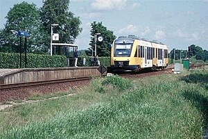
Geerdijk was a railway station in Geerdijk, The Netherlands. The station was opened on 1 October 1906 and is on the Mariënberg–Almelo railway. The station was on a single track line but had 2 platforms.

Daarlerveen railway station
Railway station in the Netherlands
Distance: Approx. 2305 meters
Latitude and longitude: 52.44111111,6.57583333
Daarlerveen is a railway station in Daarlerveen, The Netherlands. The station was opened on 1 October 1906 and is on the single track Mariënberg–Almelo railway. The line is primarily used by school children in the morning and afternoon.

Vroomshoop railway station
Railway station in the Netherlands
Distance: Approx. 2305 meters
Latitude and longitude: 52.44111111,6.57583333
Vroomshoop is a railway station in Vroomshoop, The Netherlands. The station was opened on 1 October 1906 and is on the single track Mariënberg–Almelo railway. The line is primarily used by school children in the morning and afternoon.

Mariënberg railway station
Railway station in the Netherlands
Distance: Approx. 5389 meters
Latitude and longitude: 52.50888889,6.57444444
Mariënberg is a railway station located in Mariënberg, Netherlands. The station was opened on 1 February 1905 and is located on the Zwolle–Emmen railway and the Mariënberg–Almelo railway. The services are operated by Arriva.
Sibculo Abbey
Cistercian abbey in Overijssel, Netherlands
Distance: Approx. 5594 meters
Latitude and longitude: 52.48138889,6.64055556
Sibculo Abbey (Dutch: Klooster Sibculo), also called Groot Galilea (Galilea Major), was a Cistercian abbey founded in 1403 by followers of the Modern Devotion movement and dissolved in 1579 during the Protestant Reformation of the Netherlands. Its remains are near the village of Sibculo in the municipality of Hardenberg in Overijssel.

Daarle
Village in Overijssel, Netherlands
Distance: Approx. 3723 meters
Latitude and longitude: 52.4328,6.5353
Daarle (Dutch Low Saxon: Doarle) is a village in the Dutch province of Overijssel in the Salland region. It is part of the municipality of Hellendoorn.
Weather in this IP's area
overcast clouds
3 Celsius
1 Celsius
3 Celsius
3 Celsius
1017 hPa
41 %
1017 hPa
1015 hPa
10000 meters
2.68 m/s
3.58 m/s
239 degree
98 %