193.141.69.129 - IP Lookup: Free IP Address Lookup, Postal Code Lookup, IP Location Lookup, IP ASN, Public IP
Country:
Region:
City:
Location:
Time Zone:
Postal Code:
IP information under different IP Channel
ip-api
Country
Region
City
ASN
Time Zone
ISP
Blacklist
Proxy
Latitude
Longitude
Postal
Route
Luminati
Country
ASN
Time Zone
Europe/Amsterdam
ISP
KPN B.V.
Latitude
Longitude
Postal
IPinfo
Country
Region
City
ASN
Time Zone
ISP
Blacklist
Proxy
Latitude
Longitude
Postal
Route
IP2Location
193.141.69.129Country
Region
gelderland
City
wijchen
Time Zone
Europe/Amsterdam
ISP
Language
User-Agent
Latitude
Longitude
Postal
db-ip
Country
Region
City
ASN
Time Zone
ISP
Blacklist
Proxy
Latitude
Longitude
Postal
Route
ipdata
Country
Region
City
ASN
Time Zone
ISP
Blacklist
Proxy
Latitude
Longitude
Postal
Route
Popular places and events near this IP address

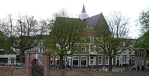
Wijchen
City and Municipality in Gelderland, Netherlands
Distance: Approx. 1174 meters
Latitude and longitude: 51.8,5.73333333
Wijchen (Dutch pronunciation: [ˈʋixə(n)] ) is a municipality and a town in the province of Gelderland, in the eastern part of the Netherlands.

Grave, Netherlands
City and former municipality in North Brabant, Netherlands
Distance: Approx. 4769 meters
Latitude and longitude: 51.76666667,5.73333333
Grave (Dutch: [ˈɣraːvə] ; formerly De Graaf) is a city and former municipality in the Dutch province of North Brabant. The former municipality had a population of 12,486 in 2021. Grave is a member of the Dutch Association of Fortified Cities.

Hernen
Village in Gelderland, Netherlands
Distance: Approx. 4050 meters
Latitude and longitude: 51.83305556,5.68055556
Hernen is a village in the Dutch province of Gelderland. It is located in the municipality of Wijchen, about 13 km west of Nijmegen.

Niftrik
Village in Gelderland, Netherlands
Distance: Approx. 4032 meters
Latitude and longitude: 51.79583333,5.67055556
Niftrik is a village in the Dutch province of Gelderland. It is located in the municipality of Wijchen, about 4 km southwest of that town. The village was first mentioned in 1117 as Nifterka.

Raam (river)
River in Netherlands
Distance: Approx. 4219 meters
Latitude and longitude: 51.7715,5.7313
The Raam is a small river in the eastern part of North Brabant, Netherlands. It flows into the Meuse (Dutch: Maas) at the old town Grave.
John S. Thompsonbrug
Bridge
Distance: Approx. 4522 meters
Latitude and longitude: 51.76916667,5.73611111
The John S. Thompsonbrug is a bridge over the Maas River between Grave and Nederasselt in the Netherlands.

Wijchen railway station
Railway station in the Netherlands
Distance: Approx. 373 meters
Latitude and longitude: 51.81111111,5.72944444
Wijchen is a railway station located in Wijchen, Netherlands. The station was opened in 1881 and is located on the Tilburg–Nijmegen railway. The train services are operated by Nederlandse Spoorwegen.
Schoonoord, Alverna
Windmill in Gelderland, Netherlands
Distance: Approx. 2146 meters
Latitude and longitude: 51.80194444,5.75388889
Schoonoord is a tower mill in Alverna, Gelderland, Netherlands, which was built in 1887 and is in working order. The mill is listed as a Rijksmonument.
Nederasselt
Village in Gelderland, Netherlands
Distance: Approx. 4359 meters
Latitude and longitude: 51.77222222,5.74583333
Nederasselt is a village in the municipality of Heumen in the province of Gelderland, the Netherlands.

Lancaster Memorial (Netherlands)
Monument in Beuningen, Netherlands
Distance: Approx. 4584 meters
Latitude and longitude: 51.846278,5.753972
The Lancaster Memorial in Beuningen, Netherlands is a memorial that commemorates the crew of the British Avro Lancaster LM325 SR-J that crashed on the spot during the night of 22 to 23 June 1943 in World War II. The bomber belonged to the No. 101 Squadron of the RAF. Six of the seven crew lost their lives.

Hernen Castle
Dutch castle from the 14th century
Distance: Approx. 4384 meters
Latitude and longitude: 51.8346,5.6763
Hernen Castle is a Dutch castle from the 14th century. It is a well-preserved medieval castle in the province of Gelderland in the Netherlands. It is situated in the village of Hernen (municipality of Wijchen), in the far west of the Rijk van Nijmegen.

Alverna, Netherlands
Village in Gelderland, Netherlands
Distance: Approx. 3045 meters
Latitude and longitude: 51.8,5.76666667
Alverna (Dutch pronunciation: [ɑlˈvɛr.naː]) is a village in the municipality of Wijchen in the province of Gelderland in the Netherlands. As of 2021, it had a population of 2,525. The village is named after the Alverna monastery founded there in 1887, which in turn is named after La Verna, the mountain in Tuscany where Francis of Assisi is said to have received the stigmata on 17 September 1224.
Weather in this IP's area
overcast clouds
4 Celsius
2 Celsius
3 Celsius
4 Celsius
1019 hPa
89 %
1019 hPa
1018 hPa
10000 meters
2.57 m/s
250 degree
100 %


