193.141.60.140 - IP Lookup: Free IP Address Lookup, Postal Code Lookup, IP Location Lookup, IP ASN, Public IP
Country:
Region:
City:
Location:
Time Zone:
Postal Code:
IP information under different IP Channel
ip-api
Country
Region
City
ASN
Time Zone
ISP
Blacklist
Proxy
Latitude
Longitude
Postal
Route
Luminati
Country
ASN
Time Zone
Europe/Berlin
ISP
Tube-Hosting
Latitude
Longitude
Postal
IPinfo
Country
Region
City
ASN
Time Zone
ISP
Blacklist
Proxy
Latitude
Longitude
Postal
Route
IP2Location
193.141.60.140Country
Region
baden-wurttemberg
City
staffort
Time Zone
Europe/Berlin
ISP
Language
User-Agent
Latitude
Longitude
Postal
db-ip
Country
Region
City
ASN
Time Zone
ISP
Blacklist
Proxy
Latitude
Longitude
Postal
Route
ipdata
Country
Region
City
ASN
Time Zone
ISP
Blacklist
Proxy
Latitude
Longitude
Postal
Route
Popular places and events near this IP address

Weingarten (Baden)
Municipality in Baden-Württemberg, Germany
Distance: Approx. 4715 meters
Latitude and longitude: 49.05138889,8.53055556
Weingarten (Baden) (German: [ˈvaɪnɡaʁtn̩] ) is a municipality in the district of Karlsruhe in southwestern Germany, situated at the transition from the Kraichgau to the Rhine valley. Its name means wine garden in German. Weingarten is located on the Bertha Benz Memorial Route.
LOPES (telescope)
Cosmic ray detector array, located in Karlsruhe, Germany
Distance: Approx. 5288 meters
Latitude and longitude: 49.09938889,8.43741667
The LOPES project (LOFAR PrototypE Station) was a cosmic ray detector array, located in Karlsruhe, Germany, and is operated in coincidence with an existing, well calibrated air shower experiment called KASCADE. In 2013, after approximately 10 years of measurements, LOPES was finally switched off and dismantled. There are different ways to observe cosmic rays, or, more accurately, the air showers that cosmic rays produce when they enter our atmosphere. Traditionally, one directly measures the shower products that make it all the way to the surface.

Stutensee
Town in Baden-Württemberg, Germany
Distance: Approx. 4016 meters
Latitude and longitude: 49.06472222,8.47166667
Stutensee is a town in northern Karlsruhe district in Baden-Württemberg, Germany. It was founded in 1975 by the voluntary connection of the four villages of Blankenloch (with Büchig), Friedrichstal, Spöck and Staffort. In the meantime it has become a lively city with more than 23,000 inhabitants.

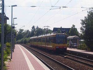
Staffort
Distance: Approx. 195 meters
Latitude and longitude: 49.09194444,8.51138889
Staffort is an old German village between Karlsruhe and Bruchsal - since 1975 the village is part of the town Stutensee which was created by joining together with Blankenloch, Friedrichstal and Spöck. Stutensee-Staffort has roughly 2000 inhabitants (2011).
KASCADE
Distance: Approx. 5288 meters
Latitude and longitude: 49.09938889,8.43741667
KASCADE was a European physics experiment started in 1996 at Forschungszentrum Karlsruhe, Germany (now Karlsruher Institut für Technologie), an extensive air shower experiment array to study the cosmic ray primary composition and the hadronic interactions, measuring simultaneously the electronic, muonic and hadronic components. KASCADE-Grande was a further extension of the previous project by reassembling 37 detectors of the former EAS-TOP experiment running between 1987 and 2000 at Campo Imperatore, Gran Sasso Laboratories, Italy. By this Grande extension of KASCADE the energy range was extended to 1014–1018 eV. The experiment contributed significantly to the development of the CORSIKA simulation program which is use heavily in astroparticle physics.

Michelsberg culture
Central European Neolithic culture
Distance: Approx. 3867 meters
Latitude and longitude: 49.08777778,8.56166667
The Michelsberg culture (German: Michelsberger Kultur (MK)) is an important Neolithic culture in Central Europe. Its dates are c. 4400–3500 BC. Its conventional name is derived from that of an important excavated site on Michelsberg (short for Michaelsberg) hill near Untergrombach, between Karlsruhe and Heidelberg (Baden-Württemberg), Germany.
Michaelsberg (Untergrombach)
Distance: Approx. 3867 meters
Latitude and longitude: 49.08777778,8.56166667
The Michaelsberg is a hill at Untergrombach near Bruchsal in Baden-Württemberg, Germany. A Neolithic settlement has been excavated at the top. It is the type site for the Michelsberg culture.
Accident on the Bundesautobahn 5
Distance: Approx. 1945 meters
Latitude and longitude: 49.07388889,8.51111111
The accident on the Bundesautobahn 5 occurred on 14 July 2003 close to Karlsruhe, Germany, when a young mother lost control of her car on Bundesautobahn 5 and collided with a tree. The 21-year-old woman and her two-year-old daughter died at the scene. The accident and the following judicial proceeding received nationwide attention after eyewitnesses stated that another vehicle had closed the gap to her from behind with excessive speed and caused the accident.
Untergrombach station
Railway station in Bruchsal, Germany
Distance: Approx. 2898 meters
Latitude and longitude: 49.087605,8.548248
Untergrombach station is a "halt" (Haltepunkt) in the Bruchsal district of Untergrombach in the German state of Baden-Württemberg. It is located on the Rhine Valley Railway between Heidelberg and Karlsruhe and is served by lines S31 and S32 of the Karlsruhe Stadtbahn. In the peak hour several services on line S3 of the Rhine-Neckar S-Bahn stop in Untergrombach.
Friedrichstal (Baden) station
Railway station in Stutensee, Germany
Distance: Approx. 2746 meters
Latitude and longitude: 49.1009,8.4742
Friedrichstal (Baden) station is a railway station in the municipality of Stutensee-Friedrichstal, located in the Karlsruhe district in Baden-Württemberg, Germany.

Staffort Castle
Distance: Approx. 359 meters
Latitude and longitude: 49.0945,8.5083
The Staffort Castle (also moated castle, water castle or deep castle) was the building in Staffort, a district of the town of Stutensee, where the Staffort Book was printed in 1599. Schmalkalder's plan from 1689, which shows the dimensions of the foundation walls, is the only surviving document relating to the castle plan. The depiction by Leon & Manfred Raupp is based on this plan and other contemporary documents.

Thomas Mann Gymnasium (Stutensee)
Distance: Approx. 3806 meters
Latitude and longitude: 49.0645,8.4765
Thomas-Mann-Gymnasium Stutensee (TMG) is part of the school center of the large district town of Stutensee, north of Karlsruhe in Baden-Württemberg, Germany. It is located in Stutensee's district Blankenloch. Together with the Erich-Kästner-Realschule, the grammar school forms a two-storey complex with a new building.
Weather in this IP's area
overcast clouds
7 Celsius
6 Celsius
6 Celsius
8 Celsius
1036 hPa
71 %
1036 hPa
1022 hPa
10000 meters
1.93 m/s
3.26 m/s
77 degree
91 %


