193.141.37.200 - IP Lookup: Free IP Address Lookup, Postal Code Lookup, IP Location Lookup, IP ASN, Public IP
Country:
 Netherlands
Region:
City:
Location:
Time Zone:
Postal Code:
ISP:
ASN:
language:
User-Agent:
Proxy IP:
Blacklist:
IP information under different IP Channel
ip-api
Country
Region
City
ASN
Time Zone
ISP
Blacklist
Proxy
Latitude
Longitude
Postal
Route
db-ip
Country
Region
City
ASN
Time Zone
ISP
Blacklist
Proxy
Latitude
Longitude
Postal
Route
IPinfo
Country
Region
City
ASN
Time Zone
ISP
Blacklist
Proxy
Latitude
Longitude
Postal
Route
IP2Location
193.141.37.200Country
nlRegion
gelderland
City
druten
Time Zone
Europe/Amsterdam
ISP
Language
User-Agent
Latitude
Longitude
Postal
ipdata
Country
Region
City
ASN
Time Zone
ISP
Blacklist
Proxy
Latitude
Longitude
Postal
Route
Popular places and events near this IP address

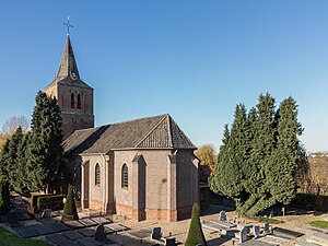
Druten
Municipality in Gelderland, Netherlands
Distance: Approx. 674 meters
Latitude and longitude: 51.88333333,5.6
Druten (Dutch pronunciation: [ˈdrytə(n)] ) is a municipality and a town in the eastern Netherlands. The municipality covers the eastern part of the Land van Maas en Waal region of the province of Gelderland. One of its key features is the town's church, designed by architect Pierre Cuypers.

Horssen
Village in Gelderland, Netherlands
Distance: Approx. 3653 meters
Latitude and longitude: 51.8555,5.6072
Horssen is a village in the Dutch province of Gelderland. It is a part of the municipality of Druten, and lies about 10 km northwest of Wijchen. Horssen was a separate municipality until 1984, when it was merged with Druten.

Ochten
Village in Gelderland, Netherlands
Distance: Approx. 3384 meters
Latitude and longitude: 51.90777778,5.56777778
Ochten is a village in the Dutch province of Gelderland. It is a part of the municipality of Neder-Betuwe, and lies about 10 km southwest of Wageningen. Ochten was a separate municipality until 1818, when it was divided into two parts, Echteld and IJzendoorn.

Dodewaard
Village in Gelderland, Netherlands
Distance: Approx. 4390 meters
Latitude and longitude: 51.91666667,5.65
Dodewaard is a village in the Dutch province of Gelderland. It is a part of the municipality of Neder-Betuwe, and lies about 7 km south of Wageningen. Dodewaard extends south from national highway A15(exit 36 Dodewaard-Opheusden) and sits along the river Waal.

Boven-Leeuwen
Village in Gelderland, Netherlands
Distance: Approx. 3867 meters
Latitude and longitude: 51.88555,5.5495
Boven-Leeuwen is a village in the Dutch province of Gelderland. It is a part of the municipality of West Maas en Waal, and lies about 9 km east of Tiel. It is the protestant part of the former village of Leeuwen.

Afferden, Gelderland
Village in Gelderland, Netherlands
Distance: Approx. 2204 meters
Latitude and longitude: 51.88,5.63472222
Afferden is a village in the Dutch province of Gelderland. It is a part of the municipality of Druten, and lies about 10 km northwest of Wijchen. Afferden was a separate municipality until 1818, when it became a part of Druten.

Deest
Village in Gelderland, Netherlands
Distance: Approx. 4232 meters
Latitude and longitude: 51.88333333,5.66666667
Deest is a village in the Dutch province of Gelderland. It is a part of the municipality of Druten, and lies about 9 km south of Wageningen.

Puiflijk
Village in Gelderland, Netherlands
Distance: Approx. 1627 meters
Latitude and longitude: 51.88333333,5.58333333
Puiflijk is a village in the Dutch province of Gelderland. It is a part of the municipality of Druten, and lies about 12 km south of Wageningen. Puiflijk was a separate municipality until 1818, when it was merged with Druten.

Molenhoek, Druten
Hamlet in Gelderland, Netherlands
Distance: Approx. 2653 meters
Latitude and longitude: 51.86527778,5.61555556
Molenhoek (Dutch pronunciation: [ˈmoːlə(n)ˌɦuk]) is a hamlet in the Dutch province of Gelderland. It is a part of the municipality of Druten, and lies about 11 km northwest of Wijchen. It was first mentioned in 1899 as Molenhoek, and means "wind mill corner" after a wind mill which was demolished in 1922.
Hien, Netherlands
Hamlet and neighbourhood in Montferland, Gelderland, Netherlands
Distance: Approx. 4711 meters
Latitude and longitude: 51.90816,5.66616
Hien is a neighbourhood of Dodewaard and a hamlet in the Dutch province of Gelderland. It is located in the municipality of Neder-Betuwe, about 1 km east of Dodewaard. It was first mentioned in the late 9th century as Hehun.

Opheusden railway station
Railway station in the Netherlands
Distance: Approx. 4728 meters
Latitude and longitude: 51.92611111,5.63694444
Opheusden is a railway station located in Opheusden, Netherlands. The station opened on 1 November 1882 and is on the Elst–Dordrecht railway. Train services are operated by Arriva.
De Drie Waaien, Afferden
Dutch windmill
Distance: Approx. 2755 meters
Latitude and longitude: 51.88472222,5.64527778
De Drie Waaien (English: The Three Breaches) is a tower mill in Afferden, Gelderland, Netherlands which was built in 1869 and is in working order. The mill is listed as a Rijksmonument.
Weather in this IP's area
light rain
3 Celsius
-2 Celsius
3 Celsius
3 Celsius
1023 hPa
75 %
1023 hPa
1022 hPa
10000 meters
6.86 m/s
12.98 m/s
91 degree
98 %