193.141.111.52 - IP Lookup: Free IP Address Lookup, Postal Code Lookup, IP Location Lookup, IP ASN, Public IP
Country:
Region:
City:
Location:
Time Zone:
Postal Code:
IP information under different IP Channel
ip-api
Country
Region
City
ASN
Time Zone
ISP
Blacklist
Proxy
Latitude
Longitude
Postal
Route
Luminati
Country
Region
04
City
aleksandrowkujawski
ASN
Time Zone
Europe/Warsaw
ISP
KPN B.V.
Latitude
Longitude
Postal
IPinfo
Country
Region
City
ASN
Time Zone
ISP
Blacklist
Proxy
Latitude
Longitude
Postal
Route
IP2Location
193.141.111.52Country
Region
gelderland
City
gorssel
Time Zone
Europe/Amsterdam
ISP
Language
User-Agent
Latitude
Longitude
Postal
db-ip
Country
Region
City
ASN
Time Zone
ISP
Blacklist
Proxy
Latitude
Longitude
Postal
Route
ipdata
Country
Region
City
ASN
Time Zone
ISP
Blacklist
Proxy
Latitude
Longitude
Postal
Route
Popular places and events near this IP address

Gorssel
Village in Gelderland, Netherlands
Distance: Approx. 212 meters
Latitude and longitude: 52.2,6.2
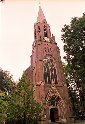
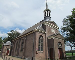
Gorssel is a village in the municipality of Lochem, province of Gelderland, Netherlands. It is located about 9 km (5.6 mi) southeast of the city centre of Deventer, Overijssel. In 2015, it had a population of 4,043.

Eefde
Village in Gelderland, Netherlands
Distance: Approx. 4468 meters
Latitude and longitude: 52.16666667,6.23333333
Eefde is a village in the Dutch province of Gelderland. It is located in the municipality of Lochem, about 3 km northeast of the city of Zutphen.

Battle of Zutphen
16th-century European battle
Distance: Approx. 6039 meters
Latitude and longitude: 52.1475,6.205
The Battle of Zutphen was fought on 22 September 1586, near the village of Warnsveld and the town of Zutphen, the Netherlands, during the Eighty Years' War. It was fought between the forces of the United Provinces of the Netherlands, aided by the English, against the Spanish. In 1585, England signed the Treaty of Nonsuch with the States-General of the Netherlands and formally entered the war against Spain.

Schipbeek
Watercourse in the Netherlands
Distance: Approx. 4245 meters
Latitude and longitude: 52.2325,6.1647
The Schipbeek is a tributary of the IJssel in the Netherlands and a continuation of the Buurserbeek. It flows into the IJssel near Deventer. The real source of the Schipbeek is in Germany - in western Northrhine-Westphalia - in the Ahauser Aa, to which the Alstätter Aa, the Buurserbeek and finally the Schipbeek are connected.
Twentekanaal
Canal in Netherlands
Distance: Approx. 3806 meters
Latitude and longitude: 52.168,6.192
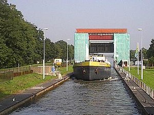
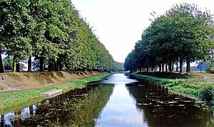
The Twentekanaal (Dutch pronunciation: [ˈtʋɛntəkaːˌnaːl]) is a canal running through the Dutch provinces of Gelderland and Overijssel, connecting the three largest cities of the Twente region, Almelo, Hengelo and Enschede to the national network of rivers and canals. Because the canal forks to reach Almelo, the canal is officially plural, which is Twentekanalen. The Twentekanaal starts at the IJssel North of Zutphen at the village of Eefde and runs through Almen, Lochem, Goor, Delden and Hengelo to Enschede.
Appen, Netherlands
Hamlet in Gelderland, Netherlands
Distance: Approx. 5410 meters
Latitude and longitude: 52.18166667,6.12916667
Appen is a hamlet in the Dutch province of Gelderland. It is located in the municipality of Voorst, about 0.5 km southwest of Gietelo, to which it belongs. It was first mentioned in 1299 as Appenses.

Joppe, Netherlands
Village in Gelderland, Netherlands
Distance: Approx. 2154 meters
Latitude and longitude: 52.2086,6.2309
Joppe is a village in the municipality of Lochem in the province of Gelderland, Netherlands. It was first mentioned in 1608 as Jobstede, and means "the city of Job (person)". The village started as a Catholic enclave near Huis 't Joppe which is an estate dating from 1736.

Deventer Colmschate railway station
Railway station in the Netherlands
Distance: Approx. 5490 meters
Latitude and longitude: 52.25027778,6.21527778
Deventer Colmschate is a railway station located in Deventer, Netherlands. The station was opened in 1888 and is located on the Deventer–Almelo railway. The train services are operated by Nederlandse Spoorwegen.
Sportpark Het Schootsveld
Distance: Approx. 5902 meters
Latitude and longitude: 52.25252778,6.22602778
Sportpark Het Schootsveld (Salland Cricket Club Ground) is a cricket ground in Deventer, the Netherlands. The first recorded match held on the ground came in 1975 when Dansk XL Club played The Forty Club. The ground later held four ICC Trophy matches in the 1990.

Bussloo
Village in the Netherlands
Distance: Approx. 4793 meters
Latitude and longitude: 52.1981,6.1314
Bussloo is a village in the municipality of Voorst in the province of Gelderland, the Netherlands. On the beach De Kuiter, on the South Western side of the lake, nudist recreation is permitted. It was first mentioned in 1390 as ten Loe, and means forest.

Epse
Village in Gelderland, Netherlands
Distance: Approx. 2583 meters
Latitude and longitude: 52.22487,6.19949
Epse is a village in the municipality of Lochem, province of Gelderland, Netherlands. It lies south of the A1 motorway and north of Gorssel, which was a separate municipality encompassing Epse until 2005, when it was merged with Lochem. In 2021, the village had a population of 2,069.

Museum MORE
Art museum in Gorssel, Netherlands
Distance: Approx. 236 meters
Latitude and longitude: 52.19961667,6.20079444
Museum MORE is a Dutch museum in Gorssel, Netherlands. Museum MORE is dedicated to Dutch Neorealism (art) (the name is an abbreviation of MOdern REalism). It is located in the former town hall of Gorssel, which was expanded for that purpose with seven exhibition spaces.
Weather in this IP's area
overcast clouds
8 Celsius
6 Celsius
7 Celsius
9 Celsius
1033 hPa
96 %
1033 hPa
1032 hPa
10000 meters
2.9 m/s
6.13 m/s
206 degree
99 %
