193.133.23.197 - IP Lookup: Free IP Address Lookup, Postal Code Lookup, IP Location Lookup, IP ASN, Public IP
Country:
Region:
City:
Location:
Time Zone:
Postal Code:
IP information under different IP Channel
ip-api
Country
Region
City
ASN
Time Zone
ISP
Blacklist
Proxy
Latitude
Longitude
Postal
Route
Luminati
Country
Region
eng
City
littlehampton
ASN
Time Zone
Europe/London
ISP
UUNET
Latitude
Longitude
Postal
IPinfo
Country
Region
City
ASN
Time Zone
ISP
Blacklist
Proxy
Latitude
Longitude
Postal
Route
IP2Location
193.133.23.197Country
Region
england
City
crediton
Time Zone
Europe/London
ISP
Language
User-Agent
Latitude
Longitude
Postal
db-ip
Country
Region
City
ASN
Time Zone
ISP
Blacklist
Proxy
Latitude
Longitude
Postal
Route
ipdata
Country
Region
City
ASN
Time Zone
ISP
Blacklist
Proxy
Latitude
Longitude
Postal
Route
Popular places and events near this IP address

Crediton
Town in Devon, England
Distance: Approx. 970 meters
Latitude and longitude: 50.79111111,-3.65611111
Crediton is a town and civil parish in the Mid Devon district of Devon, England. It stands on the A377 Exeter to Barnstaple road at the junction with the A3072 road to Tiverton, 7 miles (11 km) north west of Exeter and 14 miles (23 km) from the M5 motorway. It has a population of 21,990.
Crediton railway station
Railway station in Devon, England
Distance: Approx. 207 meters
Latitude and longitude: 50.78318,-3.64707
Crediton railway station is a railway station serving the town of Crediton in Devon, England. It is 7 miles 76 chains (12.8 km) from Exeter Central at milepost 179.25 from London Waterloo. It is the junction of the Tarka and Dartmoor lines, though the two lines run parallel until Coleford Junction (where the junction of the Barnstaple and Okehampton lines used to be) at Penstone near Coleford (west of Yeoford).
Crediton United A.F.C.
Association football club in England
Distance: Approx. 1139 meters
Latitude and longitude: 50.79214722,-3.64187778
Crediton United Association Football Club is a football club based in Crediton, Devon, England. They are currently members of the South West Peninsula League Premier Division East and play at Lords Meadow.
Sandford, Devon
Village in Devon, England
Distance: Approx. 3162 meters
Latitude and longitude: 50.810522,-3.662816
Sandford is a village and civil parish in the Mid Devon district, within Devon, England. Sandford is part of the electoral ward named Sandford and Creedy. The ward population at the 2011 Census was 3,429.

Church of the Holy Cross, Crediton
Church in Devon, England
Distance: Approx. 724 meters
Latitude and longitude: 50.78963889,-3.65228056
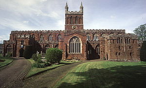
Church of the Holy Cross, Crediton, formally the Collegiate Church of the Holy Cross and the Mother of Him Who Hung Thereon, is the parish church of the town of Crediton in Devon, England. The church is built on the site of what was the cathedral of the Bishop of Crediton in the former diocese until 1050 when the see was transferred to Exeter. A college of canons remained at Crediton, administering the buildings and life of the "collegiate" church.

Queen Elizabeth's Grammar School, Crediton
Distance: Approx. 1483 meters
Latitude and longitude: 50.7919,-3.6661
The former Queen Elizabeth's Grammar School in Crediton, Devon, England was founded (as The Kyng's Newe Gramer Scole of Credyton) in 1547 by Edward VI and re-endowed and renamed in 1559 by Elizabeth I.

Queen Elizabeth's School, Crediton
Academy in Crediton, Devon, England
Distance: Approx. 1485 meters
Latitude and longitude: 50.79192,-3.6661
Queen Elizabeth's School is an academy school, with a sixth-form, in Crediton, Devon. It has 1300 students. It was formed as a comprehensive school in the early 1970s by a merger of The Shelley Secondary Modern with the Queen Elizabeth's Grammar School.
Downes, Crediton
Country house in Devon, England
Distance: Approx. 1398 meters
Latitude and longitude: 50.786,-3.6306
Downes House is situated about one mile east of Crediton in Devon. The house is an 18th-century Palladian re-modelling of an earlier house. It was classed Grade II* listed on 20 May 1985.

Little Fulford
Historic estate in Devon, England
Distance: Approx. 2465 meters
Latitude and longitude: 50.8,-3.627
Little Fulford was a historic estate in the parishes of Shobrooke and Crediton, Devon. It briefly share ownership before 1700 with Great Fulford, in Dunsford, about 9 miles (14 km) to the south-west. The Elizabethan mansion house originally called Fulford House was first built by Sir William Peryam (1534–1604), a judge and Lord Chief Baron of the Exchequer.

Shobrooke
Village in Devon, England
Distance: Approx. 3633 meters
Latitude and longitude: 50.800381,-3.606
Shobrooke is a village, parish and former manor in Devon, England. The village is situated about 1 1/2 miles north-east of Crediton. It is located close to Shobrooke park.
Creedy, Sandford
Historic estate in Devon, England
Distance: Approx. 2218 meters
Latitude and longitude: 50.8025,-3.6584
Creedy is an historic estate in the parish of Sandford, near Crediton in Devon. It is named from its location on the west side of the River Creedy. It was the seat of the Davie family (created Davie baronets in 1641) from about 1600 until the late 20th century.

Old Town Hall, Crediton
Municipal building in Crediton, Devon, England
Distance: Approx. 1119 meters
Latitude and longitude: 50.7909,-3.6604
The Old Town Hall is a historic building in the High Street in Crediton, a town in Devon in England. The structure, which was previously used as public events venue and currently accommodates the Crediton Museum, is a Grade II listed building.
Weather in this IP's area
clear sky
-4 Celsius
-7 Celsius
-4 Celsius
-4 Celsius
1027 hPa
100 %
1027 hPa
1009 hPa
10000 meters
1.54 m/s
30 degree


